After fairly quiet weather this weekend (again), northerly winds will arrive to bring an Autumnal chill into the start of next week - thanks in part to the influence of Hurricane Fiona.
The weekend is set to be another quiet one over the British Isles with high pressure close to the west. However, it will turn cool and unsettled next week following a cold northerly outbreak. Unusually warm weather in the western North Atlantic, assisted by the intensity of Hurricane Fiona, which is currently making landfall around Nova Scotia, will help to create a blocking high over Greenland that will contribute to Britain getting a few days of predominantly northerly winds.
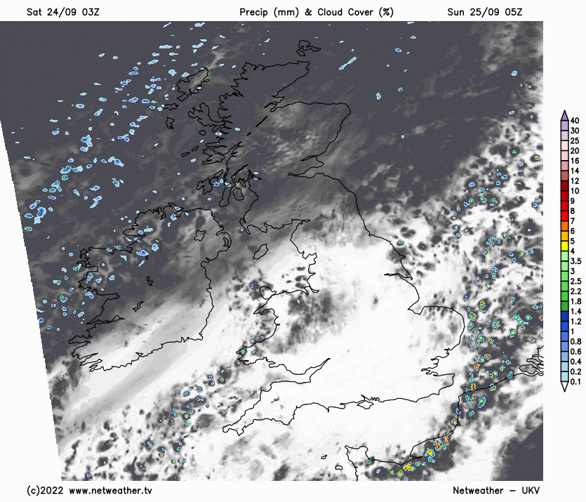
Most places will be dry today with some broken cloud and sunny spells, but there will be a scattering of light showers. Most of the showers will be near North Sea coasts to begin with, but during the day we can expect some well-scattered showers to develop across most parts of England and Wales. With a ridge of high pressure covering north-western Britain, any showers in Scotland and Northern Ireland will be very isolated.
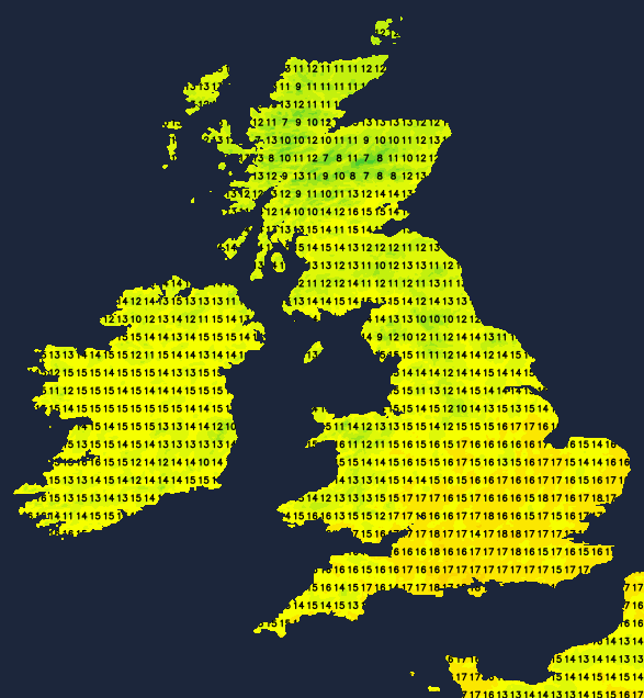
Temperatures will generally be close to the seasonal average in central and southern England and in east Wales, reaching 16 to 18C in most places and reaching 19 or 20C in the south and south-east of England. Much of Northern Ireland and the Scottish Lowlands will also reach between 16 and 18C, but it will be cooler in the northern half of Scotland and in north-east England.
Tonight, the weather will be dry and clear for most, but high cloud will increase from the north in Scotland and Northern Ireland. It will be a cold night for much of the UK with many inland parts of Scotland, Wales and northern England falling to between 3 and 5C, with some prone frost hollows seeing temperatures closer to freezing and a frost. Northern Scotland and East Anglia will be warmer with many places not getting below 8C.
Sunday will be dry and sunny over central and southern parts of England and south Wales, but elsewhere it will tend to cloud over from the north-west as the day progresses. A band of rain, some of which will be heavy, will spread southwards through Scotland during the afternoon and head into northern England and Northern Ireland in the evening. Following behind will be the aforementioned northerlies, with brighter showery weather spreading into the north of Scotland.
Temperatures will generally be down on today's, with highs of 17 or 18C in most central and southern parts of England.
The northerlies will spread through the whole country on Monday.
After rain clears the south early on, it will be a cold bright day with some showers mainly affecting north and east-facing coasts and through the Cheshire Gap. The showers will turn wintry on high ground in the north, especially in the Scottish Highlands.
It will remain cold, bright and showery for most through to the middle of next week, but with the potential for some more persistent rain to affect south-western areas on Tuesday. On Monday and Tuesday, temperatures will be somewhat below average for the time of year, with southern England only reaching 14 to 16C, and highs of around 10C in much of Scotland. Temperatures will generally drop to between 3 and 7C overnight, resulting in some slight frost in places. It will turn less cold towards the end of next week, and there are signs that we could see a flip to much warmer south-westerlies afterwards, though this is a long way off and subject to change.
Hurricane Fiona is currently the biggest talking point, and as noted earlier, it is set to have some indirect effects on Britain's weather. It made landfall as a hurricane in Guadeloupe, Puerto Rico and the Dominican Republic. In Puerto Rico, it has triggered widespread power cuts and flooding and reports of up to eight deaths. It is currently making landfall around Nova Scotia as an extratropical depression, but, after weakening slightly over the past two days, it has been intensifying again in recent hours. Strong winds, storm surges and intense rainfall are forecast for parts of eastern Canada. It has the potential to be the most intense storm to affect the region in about 50 years.