One large low pressure is throwing a lot of showers across the UK this week. The risk of a heavy downpour or a thunderstorm continues until the end of Friday. Midlothian even saw a tornado.
Early September has brought some cracking thunderstorms, incredible night-time lightning shows and torrential downpours. Even a tornado on Tuesday not too far from Edinburgh. One large low pressure has enabled the hefty showers which have rotated around the low, feeding northwards and bringing welcome rain. Plenty more rain is still needed but the dry, brown grass has rallied a little and it was lovely to hear the sound of proper rain yesterday.
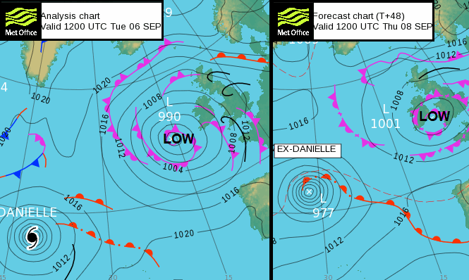
On the surface pressure analysis from Tuesday, you can see the thin black lines showing troughs. On the rainfall radar, these would be the distinct lines and bands of heavy downpours. There were also frontal bands, again bringing spells of heavy rain as this one low dominates our UK weather this week. It has been drawing up warm, moist air from the south, so it didn’t feel cold although often damp.
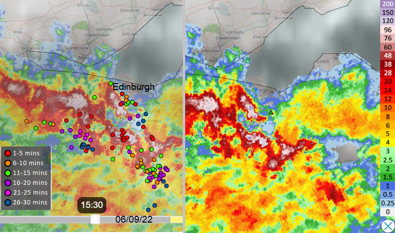
Radar imagery from Tuesday afternoon around the time of the Midlothian tornado
Areas of wind convergence added lift, where two streams of airflow drift too close together and as there is not enough room, so the only way is up. The Central Belt saw this late afternoon on Tuesday and the resulting energetic storms trundled northwards. In Midlothian, there was a tornado near Rosewell and Bonnyrigg with numerous social media posts showing the rotation in the dark clouds as parents collected their children from school. Many pupils will have got soaked on their way home yesterday and for evening commuters, conditions were tricky on the roads where the thundery showers developed and localised flooding occurred.
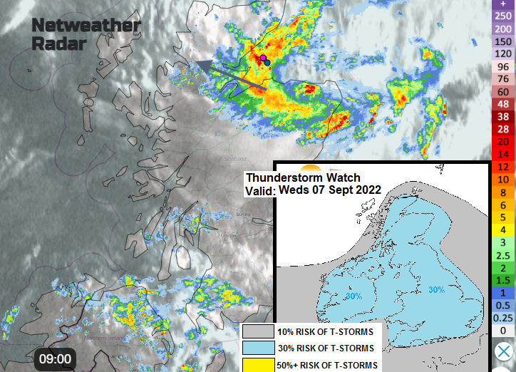
Overnight the showers slowly eased from eastern England, more fed into SW Britain and up the Irish Sea. The intense band over Scotland has crept northwards but with a feed off the North Sea which includes a cluster of heavy rain from The Wash. This is over Grampian to start Wednesday with a Thunderstorm warning from the Met Office. As this cluster heads northwest, the UK is left with widespread showers.
Convective Forecast 7th - "Showers become more widespread and heavy inland through the day, as surface heating increases in sunny spells, with some scattered thunderstorms developing too... any storms will generally be scattered, disorganised and short-lived."
Eastern England will see more sunny spells and temperatures into the low twenties. More showers spin in from the south and west but again it will be hit and miss for who gets the downpours. There will be moderate to fresh southerly winds for Cornwall and Devon and again some of the showers will be heavy and thundery.
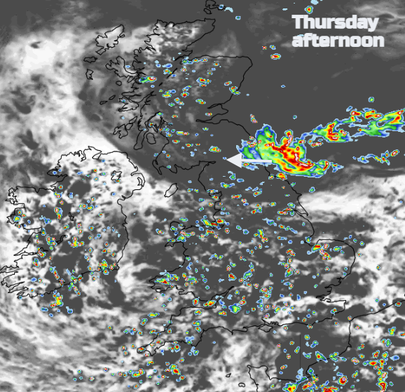
The risk of showers continues into Wednesday evening but they will be more scattered by then away from the southwest. Closer to the low centre the showers remain frequent and heavy. The low will move towards Pembrokeshire during Wednesday night. By Thursday the showers spread over most of England and Wales, again with heavy downpours and thunderstorms. There is a signal for another heavy band to move into Yorkshire and northern England by the afternoon. As the low continues to move over Britain, eastern Scotland sees an easterly wind and a westerly wind sets in for the Bristol Channel. This pattern continues, of scattered heavy showers rotating around the low which moves slowly eastwards across Britain. The winds shift with a cooler northerly breeze and a westerly by Friday. This long-lasting low finally fades and clears away to Denmark at the weekend. With all this moisture there will be shallow fog in places giving eye-catching autumnal scenes for early mornings as the winds ease.
There looks to be a lull from the showery downpours this weekend but tropical cyclones in the Atlantic are adding uncertainty to the forecast. Danielle will transition into an extratropical cyclone that could affect western Europe, with ex-Earl swirling further west. More in the weekend forecast issued on Wednesday afternoon.