Another warm and humid day in the east, heavy thundery showers for northern England and Scotland. Turning cooler and fresher but windier over the weekend, as low pressure moves in close to the west, with showers in the north and west.
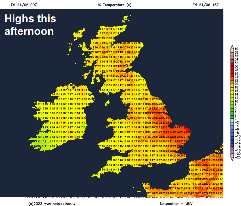
It’s been very warm and humid so far this week across large parts of Britain, with temperatures reaching 28C in East Yorkshire on Wednesday then NW Wales and North Yorkshire yesterday. The very warm and muggy conditions will hang across the east on Friday, but heavy thundert showers will affect northern and western areas wile cooler, fresher and windier conditions will spread in across western areas by evening.
Then turning cooler, fresher and windier across all parts over the weekend, as an area of low pressure moves in over Ireland, with showers mostly affecting northern and western areas. Best of the drier and sunnier weather along with highest temperatures towards the southeast. So the Glastonbury Festival could be affected by showers at times over the next three days, but hopefully the heavier showers will stay further north.
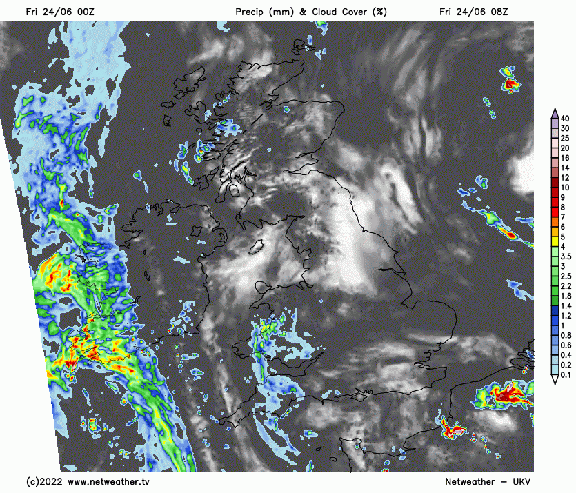
For now, a warm start for many, some early mist and low cloud across the east, but for many, a mostly dry and sunny start to Friday. However, showers will develop across northern and western areas – locally heavy with thunder across northern England and Scotland. Though some places will escape the showers and stay dry, particularly across Scotland. Also, a cold front moving in across the west will bring a band of showery rain across SW England and Wales later this afternoon and this evening. SE England and East Anglia will likely escape with a mostly dry and sunny day, just the odd shower passing through this afternoon. Still rather warm in the east, temperatures reaching 24-28C across eastern England, elsewhere 21-22C, though across the far west 17-19C as the cold front moves through.
Cold front will push eastwards across all parts tonight, bringing a brief spell of showery rain with it, cooler and fresher conditions following. Showers clearing eastern areas in the early hours to drier and clearer conditions, showers lingering across northern and western areas.
Cooler and fresher across all parts on Saturday, low pressure slow-moving over Ireland will mean further showers, mostly across northern and western areas, where they will be locally heavy and thundery. Drier and sunnier for eastern England, though the odd light shower is possible in places. Windy across the far SW of England, Wales and Irish Sea coasts. Temperatures reaching 20-23C across northern, central and eastern England, 16-18C across Scotland, Wales, N. Ireland and SW England.
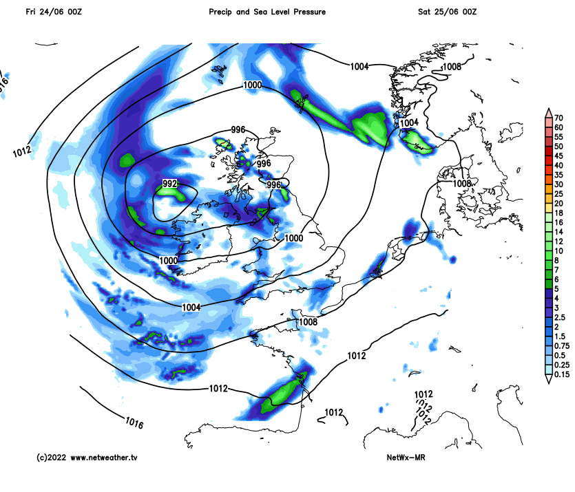
A fairly deep area of low pressure will drift north across Ireland on Sunday – bringing strong winds across the west along with further heavy and thundery showers across Ireland, N. Ireland, Scotland and NW England, showers also for Wales and SW England, but much of central southern, southeastern and eastern England is looking mostly dry and sunny with just the odd light shower. Temperatures reaching 18-21C.
Remaining changeable with temperatures close to average next week, with further showers for northern and western areas on Monday, drier and sunnier towards the southeast. Area of low pressure moving in towards the northwest looks to bring outbreaks of rain, perhaps heavy, across northern and western areas on Tuesday, mostly dry again for southern and eastern England. Showers or longer spells of rain affecting many parts for the rest of the week – with low pressure close by. Rain could be heavy and thundery across England and Wales. So the start of Wimbledon is looking dry Monday to Wednesday, but rain may threaten Thursday onwards.