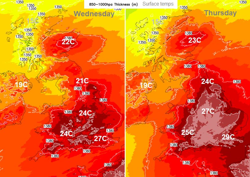
Dry and fine for the next few days with warm, strong sunshine. Temperatures will be rising again, into the mid 20s Celsius although cloudy with rain for far NW of UK.
Not as hot this week, although temperatures will be rising over the next few days for parts of the UK. Last Friday, the top temperature in the UK was 32.7C (90F) at Santon Downham in west Suffolk. Jersey saw its hottest ever June day, the 15th hottest of all days with records back to 1894 at the Maison St. Louis Observatory with 33.2C.
.png)
The heat was quite something over the later part of last week for England. There was intense and extreme June heat for France and Spain. This wasn’t the height of summer but still relatively early in the season with local records being broken on Friday through til Sunday for mainland Europe. AEMET said San Sebastian, Basque Country saw 43.5°C on Saturday and Meteo France commented “remarkable values, often located 10 to 14°C above normal” as Strasbourg reached 38C on Sunday,
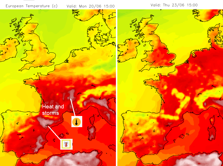
For the UK cooler and fresher air had taken hold from the northwest on Friday and during the weekend reached right down to the south coast. East Sussex still managed 27.3C and then by Sunday UK temperatures peaked in the mid to high teens.
There will be a steady increase with temperatures across parts of the UK this coming week. Back up into the mid 20sC for much of England and inland Wales with eastern Scotland also feeling warm. There will be a westerly breeze for Scotland, very light for Angus but moderate through The Minch.
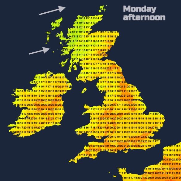
Temperatures will be lower here with more cloud from a weak warm front and rain over the Western Isles by teatime. And rain over NW Highland and Northern Isles this evening. It turns more patchy overnight as it edges southwards but will leave a grey, damp start for Northern Ireland and west coast Scotland on Tuesday. Eastern inland Scotland could see a few isolated showers set off by the afternoon.
The warm, strong sunshine continues elsewhere. With high even very high pollen levels.
The high pressure out in the Atlantic manages to exert enough influence over the UK to keep the fine, settled weather in place. Frontal bands will edge into the far northwest bringing more cloud and rain and keeping the temperatures in the mid-teens.
By Thursday evening there could be showers breaking out for southern England with the risk of some heavy even thundery downpours. That risk continues for Friday over SE Britain ahead of an Atlantic front that manages to push in from the west over more of the UK bringing rain.
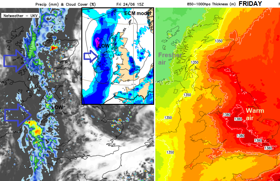
The models vary a bit about the timing of the front but ahead of that in the very warm air there could be thunderstorms for eastern England during Friday. Wet weather to end the week for western Scotland and look more unsettled for everyone on Saturday with heavy rain in places.
Jersey Photos - Thanks to Carly G.