The latest forecast for Glastonbury - it's looking good for a fine, warm and sunny start but some potential complications may arrive into the weekend.
It's getting towards squeaky bum time for the Glastonbury forecast this year. Although there's a lot of warm sunshine in the forecast during the upcoming week, there's some uncertainty as we move to the latter part of the week, particularly into the weekend.
So, if you want a TL;DR type summary, you will want to pack both sunscreen and waterproofs.
If you're heading to the site on Wednesday or Thursday, it's very positive news, as you're not going to need to worry about rain as you get set up. With high pressure in charge, there'll be sunny skies and temperatures rising into the mid-twenties with just the very outside risk of an afternoon or evening shower.
Friday should be more of the same, but one or two models move a small 'surface low' up off of the continent and in towards southern England later in the day. If it materialises, it will bring the threat of some thundery downpours with it, but as it stands, the chances of it affecting Worthy Farm are around 20%, so it's a low risk - but one which is worth keeping an eye on.
The ensemble graph below shows what's happening - there are very few of the runs showing any rain at all during the majority of the week, but a few wetter options start to appear from Friday onwards. Initially, that's down to the surface low on Friday. Later into the weekend, a number of the models (but not all) bring low pressure in from the west, which at the moment means a downhill trend through the weekend, with the highest chance of getting wet arriving on Sunday.
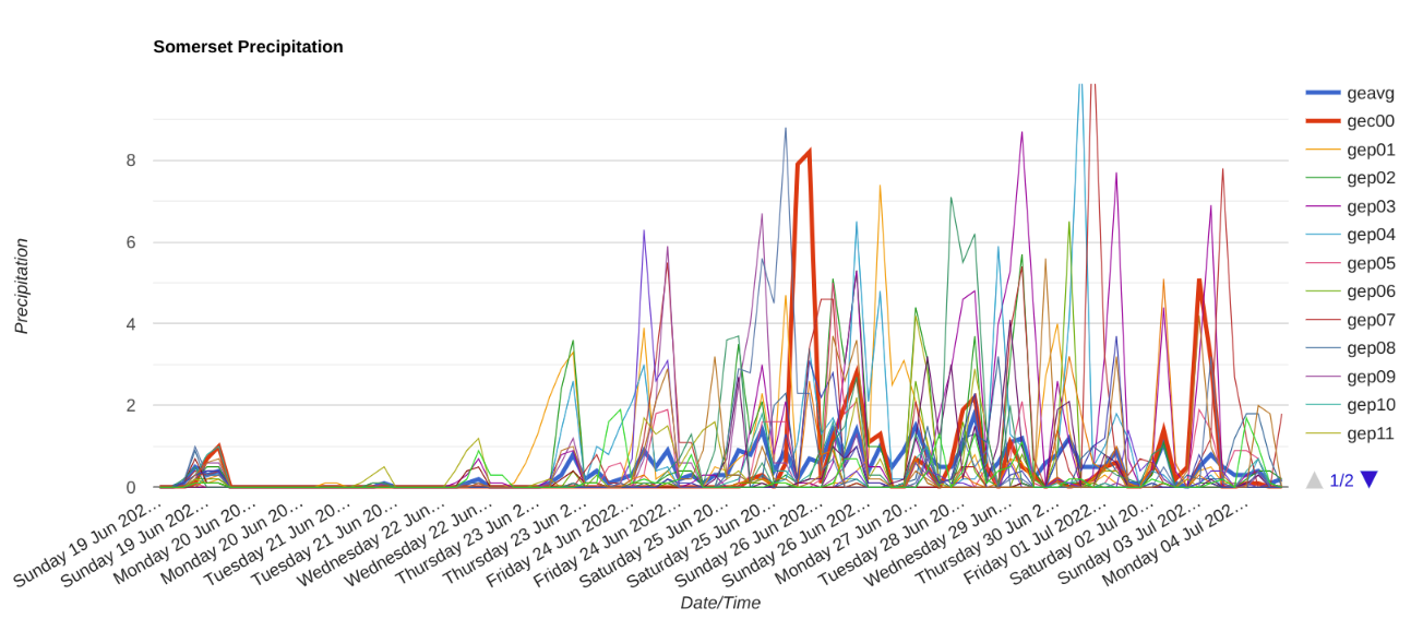
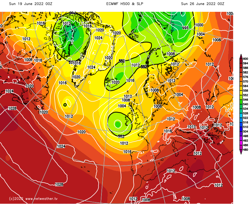
Taking a look in more detail at that low - and here's the forecasting challenge. Two respected (leading in fact) models show quite different solutions. First, the ECMWF shows the low moving in at the weekend, bringing showery rain northeast later Saturday and Sunday.
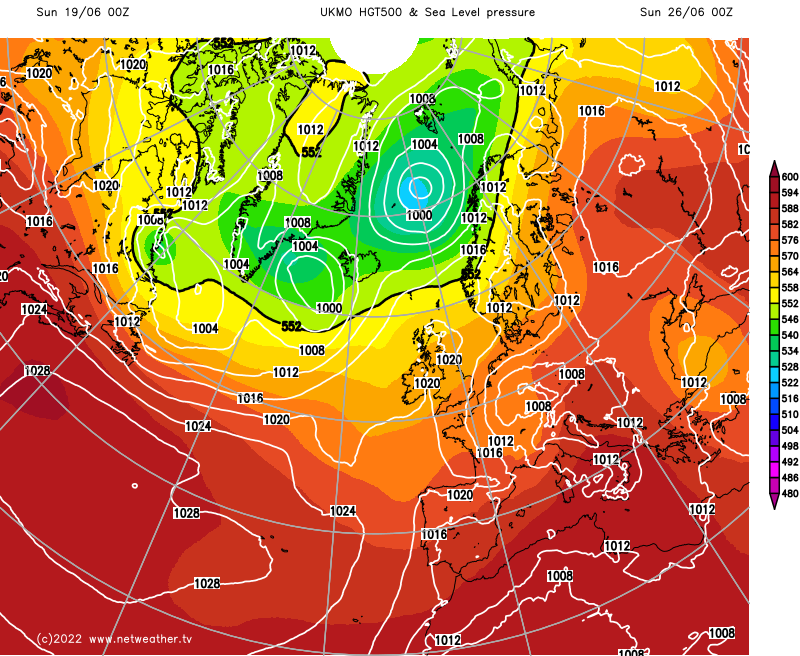
The Met Office model, on the other hand, makes a lot less of the low, takes it further north as a much smaller and shallower feature and keeps pressure high in the southwest, which would keep it mostly, if not completely dry.
The Met Office model (showing the driest outcome currently) is a bit of an outlier at the moment, with most of the others wanting to make a bit more of the low pressure at the weekend. So, the likeliest scenario is that there will be the threat of some showers from Saturday onward. However, there should still be some warm sunshine in between regardless, with temperatures most likely climbing up into the low-twenties. Plus, there's still a 30-40% probability that it stays mostly dry throughout.
So, quite a lot to be optimistic about - keep an eye out for the next update on Monday.
Top photo by James Genchi on Unsplash