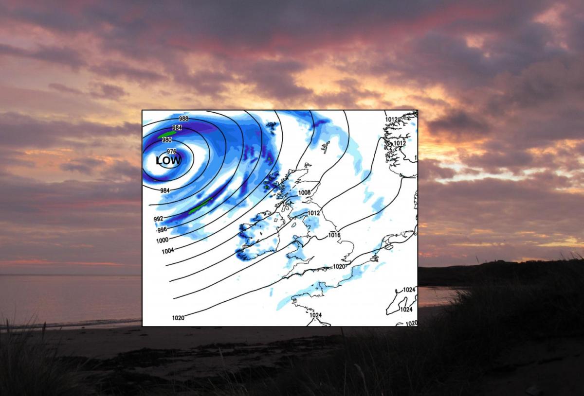
A large low pressure is throwing rain over western parts this morning and will bring very windy weather to NW UK through Friday and Saturday with heavy showers. Fine elsewhere at 17 to 24C
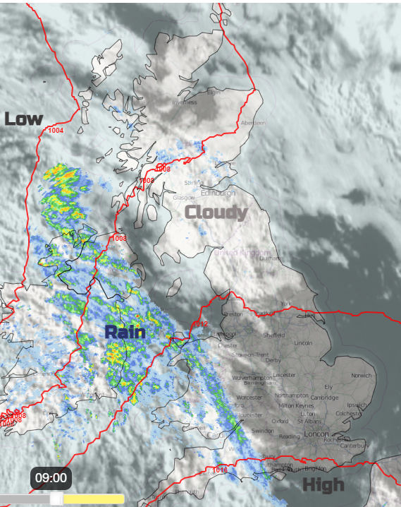
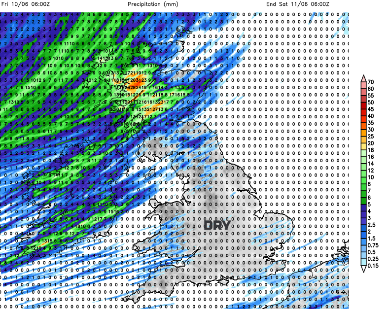
The main feature of the UK weather for the rest of this week will be a large low pressure moving by NW Scotland. This will bring blustery winds into the weekend and its frontal rain is already showing on the radar over Northern Ireland and Wales on Thursday morning. Northwest Scotland could see gales for a time in some unseasonably windy weather and heavy downpours Friday into Saturday.
The UK temperatures remain in the mid to high teens just tipping into the low twenties. Hence the newspapers are choosing to shriek about “UK hot weather forecast: Britain to bake in scorching 23C mini-heatwave as maps turn RED” Thanks Daily Express, 23C (73F) it’s not up into the 30sC. There is little change in the temperatures this week and it is still fairly cool by night. Strong direct sunlight feels very warm at this time of year and the pollen count is High or Very High as the grass pollen season gets going. But it’s not sweltering heat, nor mugginess. The air is fresh enough, coming in from the southwest. Friday will feel warm.
There is more cloud over northern Britain this morning with some dampness, although with a large sunny gap for parts of Moray and Highland. Further south a good deal of England is starting with glorious sunshine and fine weather but the frontal cloud and rain has been edging over SW England, Wales and Northern Ireland already this morning. Behind this there will be bright spells and a scattering of showers. Belfast up to 20C and Cardiff 17C with more cloud about today and the frontal rain which fades as it moves inland. Ahead of the rain band eastern Britain and London will feel warm enough in any sunshine, 19 to 22C as the maximum.
Fresh to strong southerly winds will blow from the Irish Sea up the west coast of Scotland tonight. Most of the UK will start off fine and bright on Friday with good sunny spells but hefty showers soon appear for Highland Scotland, the Western Isles and then Northern Ireland. England and Wales have a fine day but becoming more breezy and just a small chance of a shower inland. Northern Ireland, Scotland, Cumbria, Gwynedd and the Isle of Man will be windy. Gales for exposed coasts. The showers will rattle through but they will bring heavy rain, hail and even thunder.
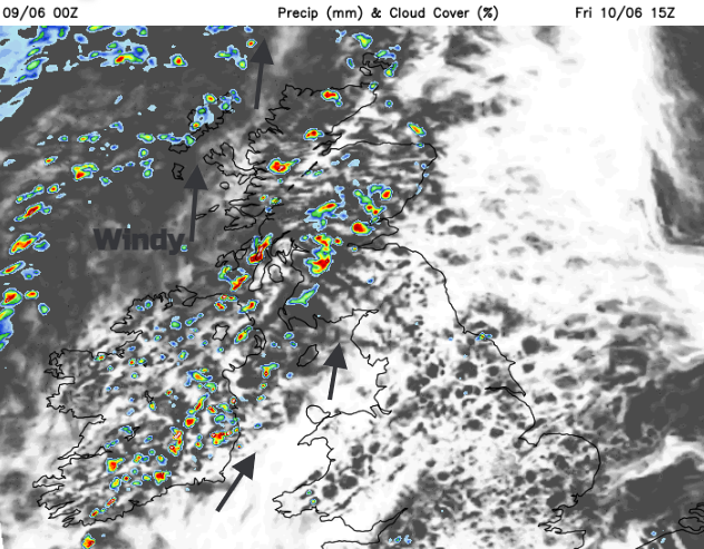
The showers will be well scattered as they reach SE Scotland by the evening however an area of heavier rain will move over western Scotland during Friday evening. The windy conditions continue into the night. Fine elsewhere and warmer for England at 18 to 24C on Friday.
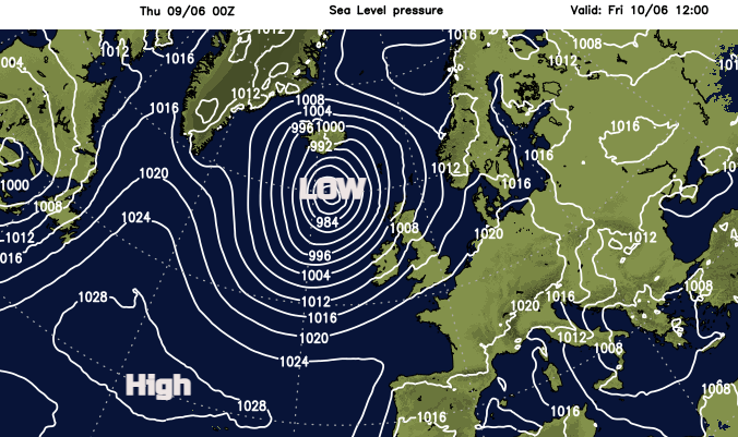
On Saturday, the low centre moves to the north of Scotland and showers continue to feed into the far NW of the UK. Fine again elsewhere. Windy everywhere, particularly in the far north. By Sunday the wind will be from the west, still bringing in showers and another blustery day for the northern half of the UK. Further south breezy but not as windy and dry with a nose of high pressure extending over southern Britain for the weekend.
This pattern continues into the start of next week with settled, fine weather for most, but still, blustery showers feeding in for the northwest.