A mixed and changeable picture in the week ahead. An improving picture Monday through Tuesday, with increasingly warm sunshine. Wednesday showery, Thursday mostly dry, before an ex-tropical storm arrives in the northwest Friday.
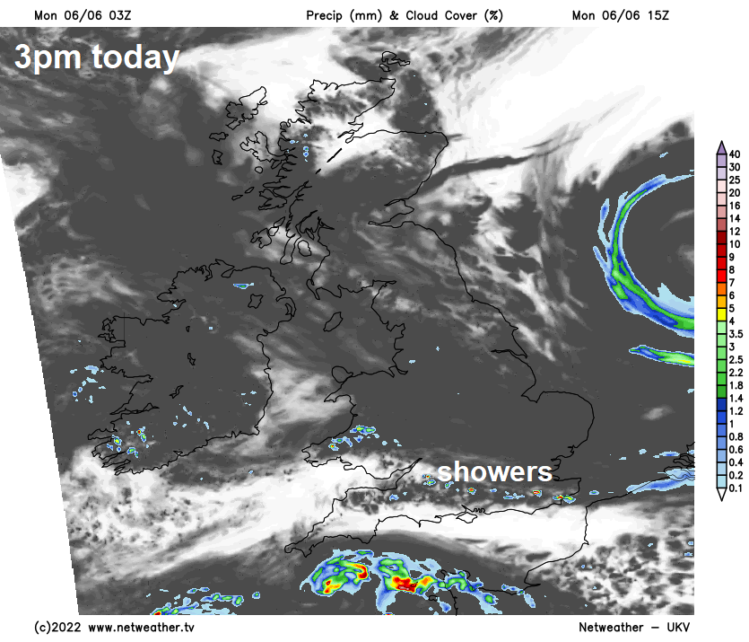
Although much of the long Jubilee Weekend was warm and sunny for many, Sunday ended the celebrations with a rather grey, cool and, in places, damp day across England and Wales, Monday should see an improving picture, with early cloud across many parts and rain in the east clearing to brighter, drier and warmer conditions by the afternoon, just a few showers here and there. Tuesday will see sunny spells and scattered showers, but warm. Scotland and N. Ireland have a had a pretty decent weekend, thanks to high pressure in control close to the north, which will remain in control here to start the week. It will stay dry here today and tomorrow, with the best of the sunshine.
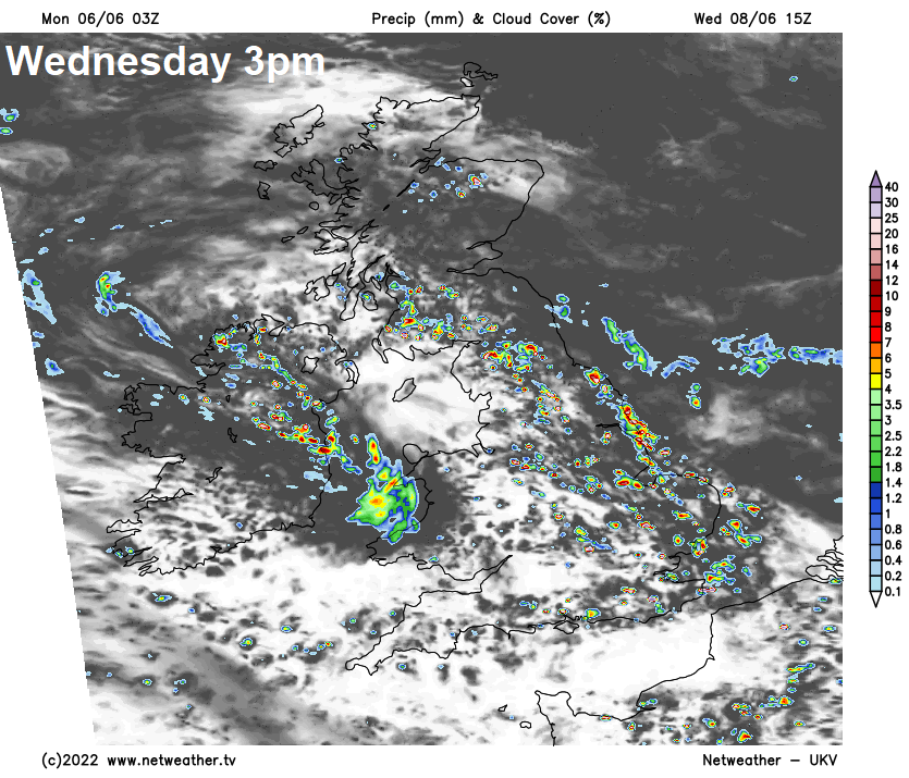
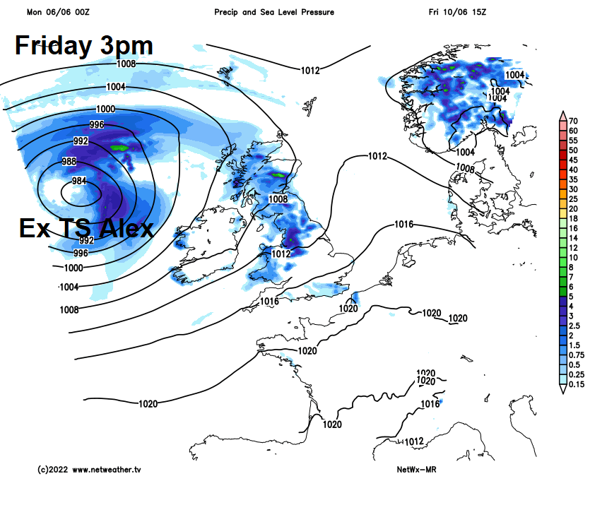
However, after the promising start to the week, low pressure looks to move in close the northwest by mid-week, bringing outbreaks of rain or showers across many areas on Wednesday, drier and sunnier on Thursday. Friday turning windy, as an unseasonably deep low, formed from the remnants of Tropical Storm Alex, moves past to the northwest. It will bring blustery showers across many parts.
For now, a cloudy and grey start for much of England and Wales, with some patchy light rain or drizzle in places, some heavier and more persistent rain across East Anglia, Lincolnshire, North and East Yorkshire Ridings. Drier and generally brighter start for much of Scotland, N. Ireland and far southwest of England, though some low cloud, mist and fog in places.
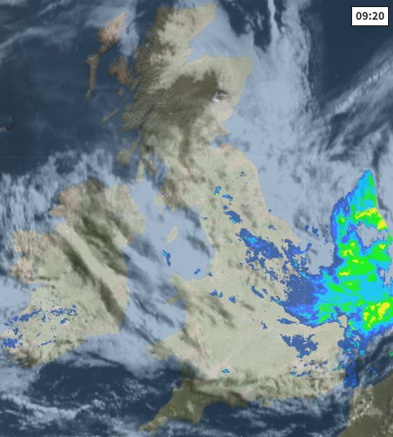
Cloudy skies will likely linger across much of England and Wales through the morning, but patchy rain will ease and the heavier rain towards eastern England should clear out over the North Sea too. Sunny spells developing into the afternoon and, although many should stay dry, the sunshine will trigger a few showers across southern England and south Wales. Scotland and N. Ireland will have another fine and sunny day, once early low cloud and mist clears. Temperatures reaching 17-20C generally, but cooler towards eastern coasts with an onshore breeze – 14-15C here.
Becoming mostly dry with clear spells overnight, cloudier across SE Scotland and the south coast of England, with a few showers possible. Temperatures falling to 8-12C.
A mostly dry and bright start on Tuesday, then most will have a dry day with warm sunny spells, though some well-scattered showers will develop. Turning cloudier and windier across SW England, Wales and N. Ireland by evening, with showery rain moving in during the evening. Temperatures reaching 15-19C in the north, 18-22C in the south. About average for this stage in summer.
A different picture for Wednesday, an area of low pressure and its frontal system brings cloud and outbreaks of rain northeastwards across England and Wales during the morning, followed sunshine and showers for the rest of the day. Some of the showers heavy and thundery. Outbreaks of rain will then spread north and northeast across Scotland through the day, after a dry and sunny start across the north. Windy across the south, particularly across the English Channel coasts and SW England. Temperatures reaching 15-18C in the north, 18-20C in the south.
A brief ridge of high pressure builds in for Thursday, so after some early showers in the north, most places will become dry with decent sunny spells. Cloud will thicken in the west through the afternoon, with showery rain arriving across the far west in the evening. Temperatures reaching 16-20C.
Windy on Friday, as the remnants of Tropical Storm Alex, passing just north of Bermuda today, forms a deepening low that will pass northeast to the northwest of Britain. The low will spread showers eastwards across many areas.
Windy and showery in the northwest and far west over the weekend, thanks to low pressure parked to the northwest of Britain, but also some sunny spellls between the showers. Drier, sunnier and warmer but perhaps breezy across central, southern and eastern areas.