


VIDEO forecast from Jo Farrow- weather for the Jubilee long weekend across the UK. Fine with warm sunny spells although there are showers in the forecast
Many people have a few days off for the Jubilee weekend and overall, the UK weather is looking fine and pleasantly warm with bright or sunny spells. There will be some rain, from the west on Thursday/ Friday and the threat of heavy, even thundery downpours in the south during Saturday/Sunday. There will be light winds for the next few days but a noticeable east then northeast wind for England at the weekend. Temperatures will be in the high teens to low twenties Celsius with strong sunshine at times.
High pressure will slide over Scotland during Friday night and remain for the weekend but before that, a low pressure will move towards Ireland today and bring showery rain to counties Tyrone, Derry and Fermanagh this afternoon. For most of Britain, the weather stays fine and bright but there will still be a scattering of showers this afternoon. Not as many as in recent days but still, slow-moving and heavy so worth checking the radar.
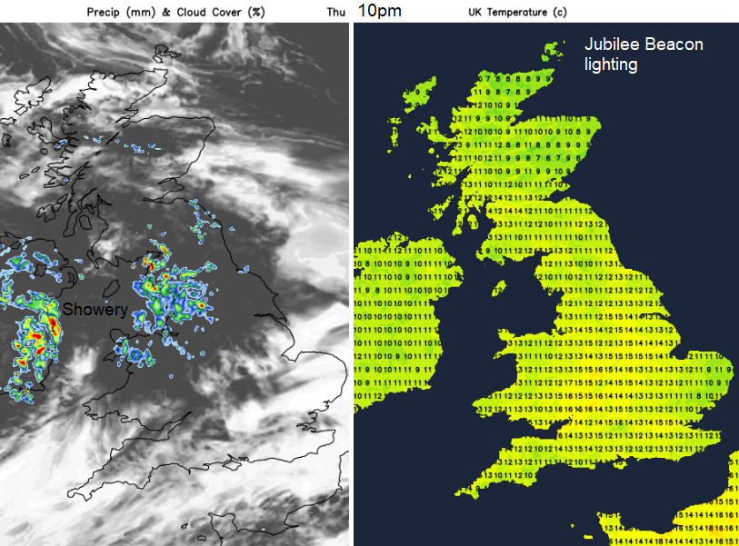
The showery rain will reach across the Irish Sea and be over NW England around the time Jubilee Beacons are being lit. The rain will be more patchy by 9/10pm for Northern Ireland but there will also be some showers for north Wales. Southern Britain looks dry, northern Scotland looks dry and the rest of the area in-between carries a low risk of a shower. More likely to stay dry
.The showery rain will still be around on Friday for counties bordering the Irish Sea, Merseyside and Morecambe Bay. BY lunchtime the downpours look to be over Wales up to Lancashire, spreading to Cumbria with a few over Northern Ireland. Elsewhere looks fair and bright with sunny spells and temperatures in southern England up to 23C just a breeze picking up from the east for England later on.
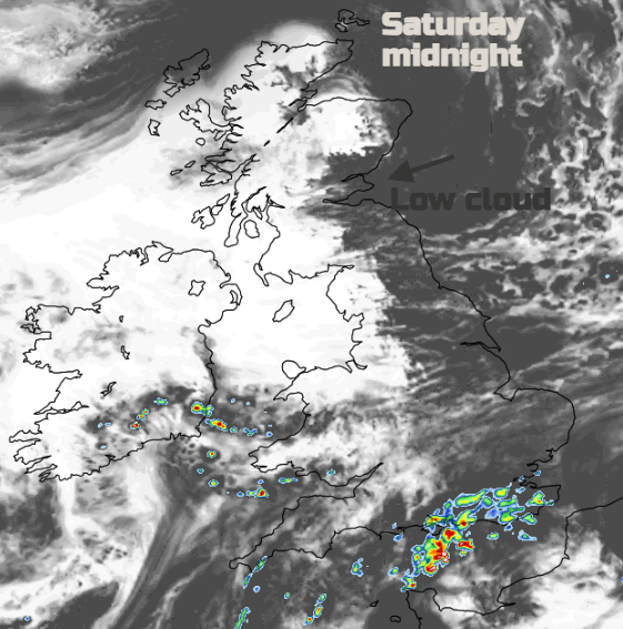
Saturday starts with the easterly breeze and low cloud will have drifted in off the North Sea. Soon enough it will disappear and the UK will see a fine morning with warm sunshine. Overnight there will have been the risk of heavy, even thundery showers for the southeast across to Hampshire. Then through the afternoon, showers for inland Wales and SW England at risk of a downpour. So, London could see a downpour but there is low confidence around this. Further north, a fine day.
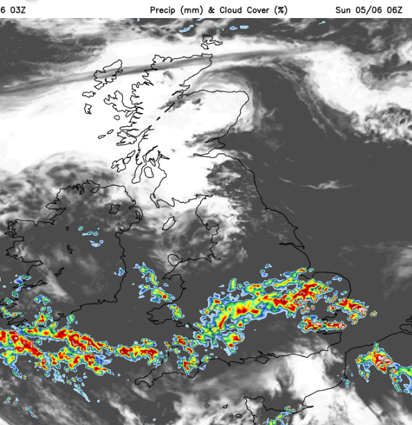
There are signs that a band of showery rain will push up from the English Channel during Saturday night. This could bring some heavy downpours as it moves over southern Britain on Sunday morning with East Anglia potentially seeing a cool northeast wind off the sea and thundery downpours. The ECM model has the rain reaching Co. Down later Sunday afternoon and up through England whereas the UKV model sees the rain reaching Yorkshire by evening but not much further. Western Scotland could see 22C but further south temperatures will depend on the cloud cover and showers although could jump up in any sunny spells. If you have a few days off, enjoy!


