Rain clipping SE Britain today with showers feeding in from the west. Temperatures this week stay in the teens and feeling cool in the breeze or where there is more cloud.
This week looks blustery with showers and rain at times. It will be cooler overall than last week but still, in any sheltered sunny spells there is still warmth in those rays.
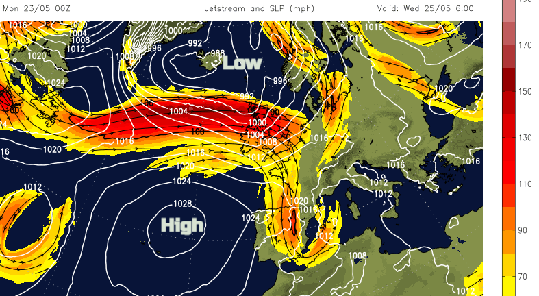
The Jetstream is powering across the Atlantic with Azores high starting in its named place at the surface today. This high will edge towards southwest Britain by Friday settling the weather down.
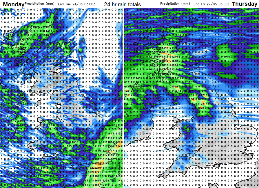
Before that, there are a collection of low pressures whirling around the north and east of the UK to start the week. The flow in between the lows and the Azores high comes in from the west then a cooler north-westerly direction. During the week there is an overall drying theme. The far north of Scotland keeps showers or rain throughout but away from today’s rain for Southeast Britain, it is mostly northern and western parts of the UK seeing the bulk of the showery rain.
Temperatures this week will be in the teens with the weekend looking a bit warmer. France continues with thunderstorm warnings although it’s not as hot here now and Spain sees more cloud and some relief from the heat over northern areas. Last week southern Spain passed 40C, tornadoes in Germany and there were vicious thunderstorms in France with tennis ball size hail yesterday
There is a fair amount of cloud around today with an area of rain clipping SE Britain from a low pressure developing over the Low Countries which will pull over the North Sea tonight. Around a low pressure to the north, there is a developing feed of showers with a wet start for NW Highland. Through Monday the highland rain moves over Grampian, Orkney and the Moray Firth with some heavier bursts possible for Aberdeen and Angus this afternoon. The showers really get going for Northern Ireland, Wales and SW England. Some of these could be heavy and thundery today.
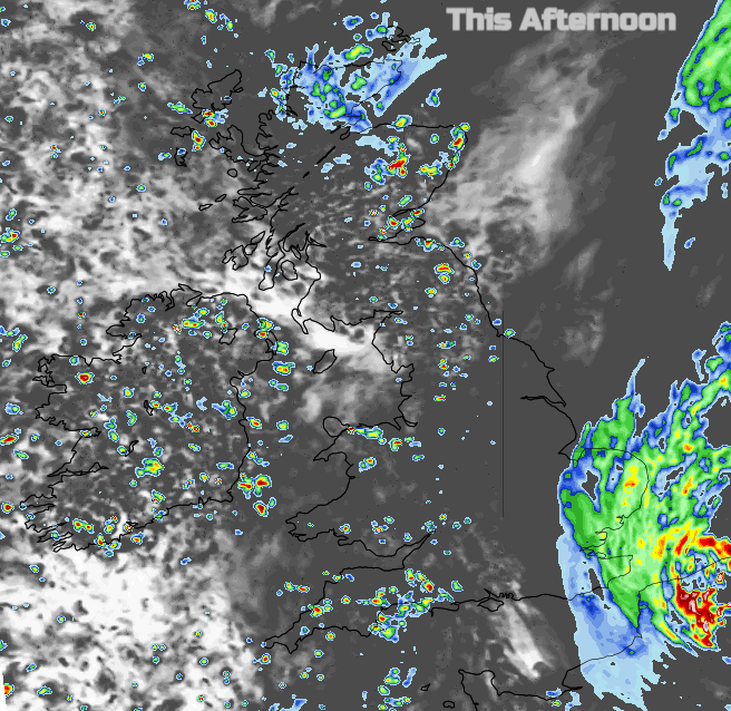
The rain in the southeast will continue to affect Kent, E.Sussex, Essex, Suffolk and eastern Norfolk. There is some uncertainty about the development of the rain by the afternoon, how far inland it will push and over how much of Greater London. At lunchtime, the main focus is still for Kent and E.Sussex and around the Thames Estuary but through the afternoon it looks to be up through the eastern half of East Anglia. This evening it pulls away over the sea and allows the showers from further west to spread over the Midlands, southern England and then East Anglia tonight. Some welcome rain.
The low pressure moves up through the North Sea and showers break out again, particularly over Wales and England on Tuesday, again with some heavy and thundery ones. More for southern Britain at lunchtime and a shift eastwards in the afternoon.