Low pressure to the west and high pressure to the east will pull in warm, muggy but unstable southerly flow during first half of the week, with risk of thundery downpours. A little cooler and more settled later in the week.
Saturday saw glorious blue skies and warm sunshine for many, London was the warmest place again, with Northolt reaching 23.5C, just shy of the warmest day of the year so far of 23.6C at Faversham, Kent on May 6th.
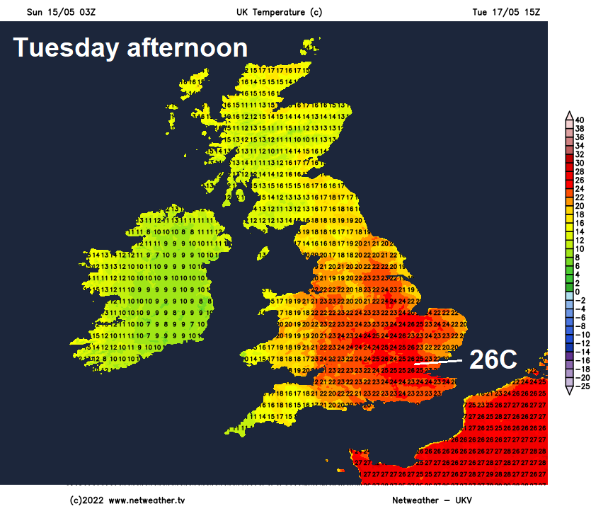
However, the weather has taken a downhill turn overnight, Sunday will see a lot more cloud and there will be some showers spreading north across many areas, some of these will be heavy and thundery, especially across southern England. And the general theme of the coming new week will be more unsettled a times during the first half, with a risk of occasional thundery downpours for many, but there will also be some lengthy drier and sunnier spells, particularly Tuesday, while it will feel rather warm and muggy, temperatures reaching the low to mid-twenties Celsius in the south. Tuesday could be the warmest day, with 26C possible in the southeast. Turning drier and more settled but not quite as warm Thursday and Friday, but a risk of rain in the northwest.
Unsettled at times in week ahead - especially the first half, with risk of heavy thundery downpours, but also some very warm sunshine. Drier later in the week away from the northwest.
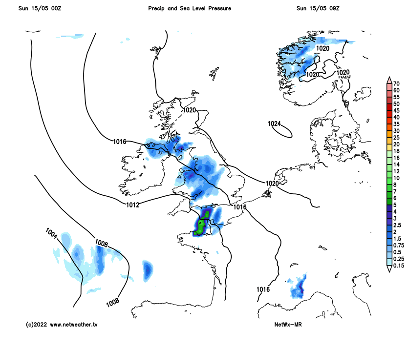
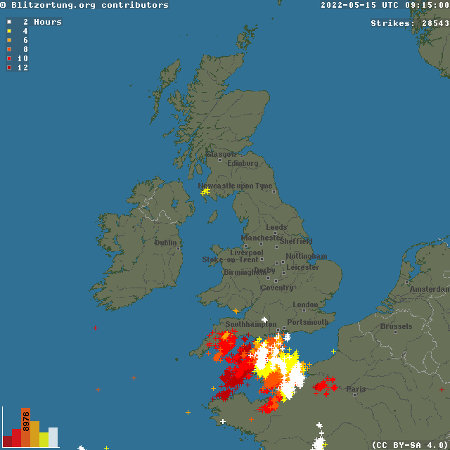
For now, Sunday morning will see cloudy skies spreading north across many areas, bringing some showers in places, some of which will be heavy with a risk of thunderstorms – particularly across southern England and also for a time across western Scotland. The map below shows lightning for the last 12 hours, confined mostly to parts of SW England and English Channel, but more recently (in white) inland across southern most counties of England:
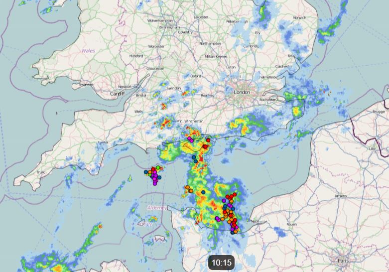
The showers should ease from the southwest through the morning and into the afternoon for England and Wales, with somewhat drier and sunnier conditions following from for a time – temperatures reaching a warm 19-22C. But further heavy showers and perhaps a few thunderstorms look to develop to the southwest before pushing northeast across south Wales and southern England through the evening. Showers at times across western Scotland but eastern Scotland looks to stay mostly dry and sunny, temperatures here reaching 15-20C.
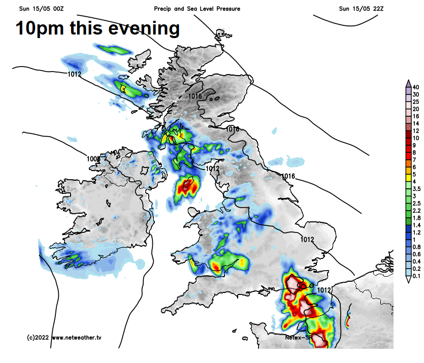
Heavy showers and thunderstorms will spread north and northeast across England and Wales this evening and during the overnight period, but not everywhere will catch one. Greatest risk of thunder across southern and southeastern England. Thundery rain reaching southern Scotland and N. Ireland in the early hours, remaining dry across southern Scotland, drier conditions with clear spells following from the south across southern and central areas.
Outbreaks of rain, locally heavy with the odd rumble of thunder, will continue to spread north across Scotland through the morning, clearing the north through the afternoon. Brighter conditions following across many areas through the morning and dry with sunny spells continuing through the afternoon too for many, but there will be some scattered heavy showers or thunderstorms developing in places, more especially across northern and western areas. Temperatures reaching 14-17C across Scotland and N. Ireland, 17-23C across England and Wales. Warm in the sunshine across the south.
Tuesday is actually looking dry, sunny and warm for many, very warm in the southeast, as ridge of high pressure builds from the near continent and pulls up very warm and humid air. Perhaps the warmest day of the year so far, temperatures reaching 25-26C in the southeast, 19-23C elsewhere. The exception will be across the far west which will be cooler with cloud and rain. Low pressure close to the west over the Atlantic will throw a cold front east across Ireland before stalling across the Irish Sea and western Scotland, bringing a band of slow-moving heavy and perhaps thundery rain.
Wednesday is looking mostly fine, sunny and warm or very warm too for much the day, but a cold front in the west will finally push east through the afternoon and will trigger some heavy and thundery downpours across many areas through the evening.
Any thundery rain clearing the north and east early Thursday, then it’s looking a mostly dry and bright day as high pressure builds in, though a few showers possible in the northwest, not as warm as previous days, but pleasant enough in the sunshine.
Looking cloudy and breezy with some outbreaks of rain spreading in from the west for Scotland on Friday, dry and sunny for England and Wales, though some thundery showers may clip the southeast later in the day, but uncertainty of this.