A few changes on the way with our weather over the next few days as we break out of the pretty typical northwest to southeast split that we've seen of late.
A few changes on the way with our weather over the next few days as we break out of the pretty typical northwest to southeast split that we've seen of late.
For now, thanks to high pressure being close by, those further south and east are enjoying the best of the warmth and sunshine, while those further north and west see a more breezy, showery regime. But, into the weekend with high pressure ridging up from the south, the more settled, warmer weather will spread north. That warmth will come with a possible sting in the tail as the high slips further east, the atmosphere destabilises and brings the potential for thunderstorms and heavy downpours from later Saturday onwards.
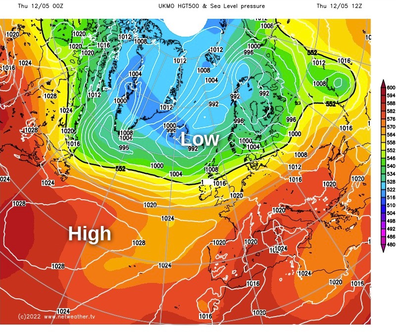
Following the change on the forecast maps from the Met Office global model, today has low pressure to the North of Scotland and high pressure centred way out in the Atlantic, but ridging east towards the south of the UK. A similar setup will follow on Friday but with that high pressure just extending its influence further north, limiting most of the showers to Scotland.
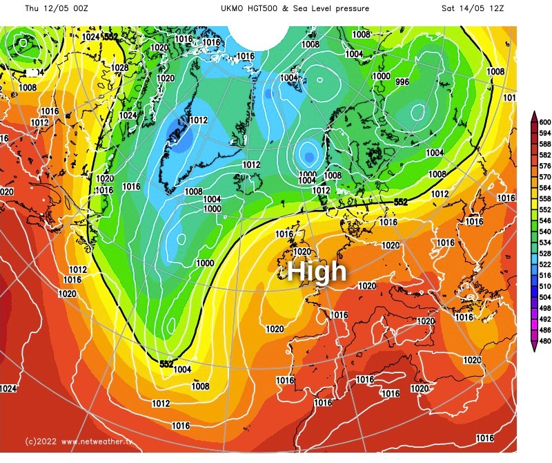
By Saturday, it's quite a different looking chart, with high pressure centred over the southern half of the UK at this point. That change will be enough to push the influence of low pressure away from Scotland, leaving virtually all parts dry for the most part of the day. We'll just need to watch to the south to see when and if that destabilisation in the atmosphere occurs.
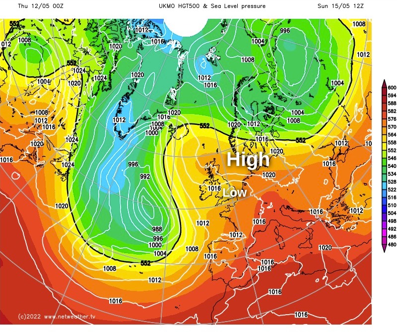
There is some uncertainty over the threat of thunderstorms and showers from the latter part of Saturday onwards, some models are more bullish than others - the Met Office modelling being amongst the more bullish currently. The reason for this is that it forms a small area of low pressure and drifts it north into southern England late Saturday and into Sunday.
So, after what's been a quite static period of weather, with changes often slow and quite sparse, we're going to see a couple in the space of a few days. As ever, when the weather is on the change the details can be tricky to pin down, particularly when it comes to potential thundery outbreaks. You can catch up with the latest chat about this possibility over on the community. Keep an eye out for a blog from our convective specialist, Nick, later today or tomorrow - as he'll be looking at the storm potential in more detail.