Cooler with some rain or showers for most at some point next few days. Turning more settled and warmer later in the week and through the weekend, warmer still next week, but no heatwave and a growing risk of thundery showers
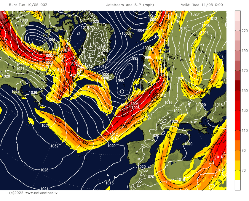
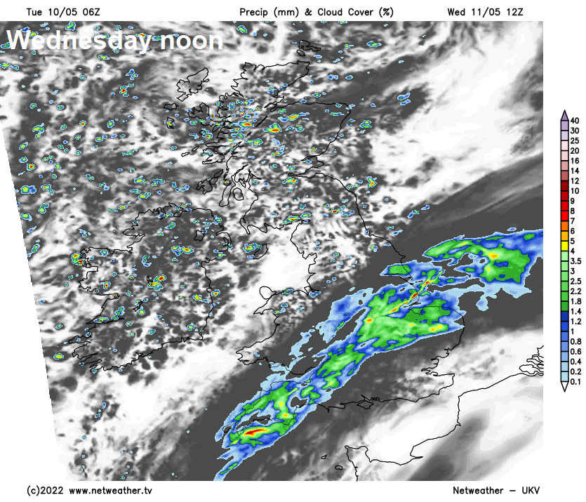
Following a dry and settled weekend, with some warm sunshine, the weather is turning more unsettled, cooler and windier through this week – particularly in the north and west, as the jet stream moves in across the UK. Most of the rain this week will be across Scotland and N. Ireland, however, a spell of rain looks likely across England and Wales tomorrow too, even in the south.
Jet stream atop of the UK tomorrow, meaning rain or showers for many
Monday was the equal warmest day of the year so far, thanks to a warm and sunny day across southern and eastern areas, the temperature reaching 23.4C at Heathrow, equal to the temperature reached at St James Park, London on the 15th April.
We may reach 20C across the south today with any sunshine, but generally through the rest of the week it will become cooler, with temperatures reaching the high teens in the southeast of Britain, low to mid-teens elsewhere.
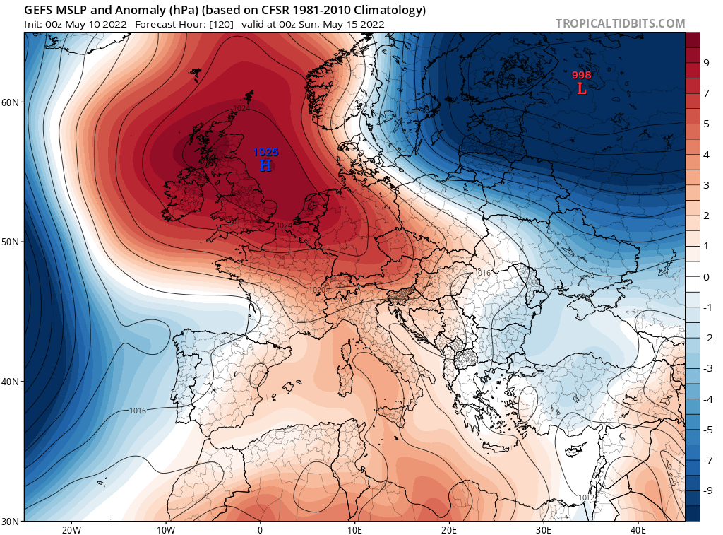
Dome of warm air spreading north this weekend and early next week
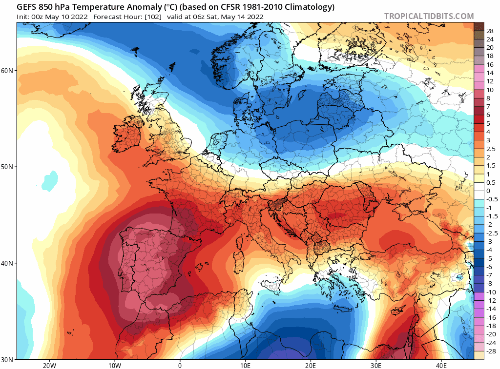
However, there are increasing signs from model output that it will become settled again from the weekend, while turning warmer. Warmer still next week, as high pressure shifts east and we draw in a deep southerly flow, with temperatures reaching the mid-twenties Celsius. But with the rising temperatures will be rising humidity and the risk of thundery showers.
For now, a mild start this morning across southern areas, ahead of a cold front which will bring a spell of rain or drizzle before clearing the southeast this morning. Following will be sunny spells and patchy cloud, dry for most, but there will be some showers, locally heavy, across the northwest. A southwesterly breeze for all, windy across the northwest. Highs of 14-16C in the north and west, 18-20C across central, southern and eastern England.
An area of low pressure moving in off the Atlantic will bring cloud and a swathe of rain sliding northeast across England and Wales through the day, though SE England and much of northern England may stay dry and bright or sunny, rain reaching the southeast later in the evening. Scotland and N. Ireland seeing a mixture of sunshine and showers. Highs of 14-18C.
Mostly dry with sunny spells for southern areas for the rest of the week, northern areas breezier, cooler and often cloudy – with showers or longer spells of rain.
The weekend turning drier, sunnier and warmer from the south across all parts, as high pressure builds north across Britain, settling the weather down but also pulling in warmer air.
Next week may see temperatures reach higher, perhaps the mid-twenties Celsius in the south, as the high eventually shifts east and settles over eastern Europe while low pressure edges-in to the west, drawing a very warm deep southerly flow across the U.K. Peak temperatures could be Wednesday and Thursday, reaching 25-26C. But with the warmth is likely to be rising humidity and instability, with a risk of thundery showers spreading north at times. But no sign of a heatwave as some media outlets have suggested, but it looks like it will become very warm, well above average highs for May nonetheless.