High pressure will move over the UK after a band of rain moves through today. The wind direction will be important and how much sunshine you see. Temperatures could reach into the high teens, low 20sC
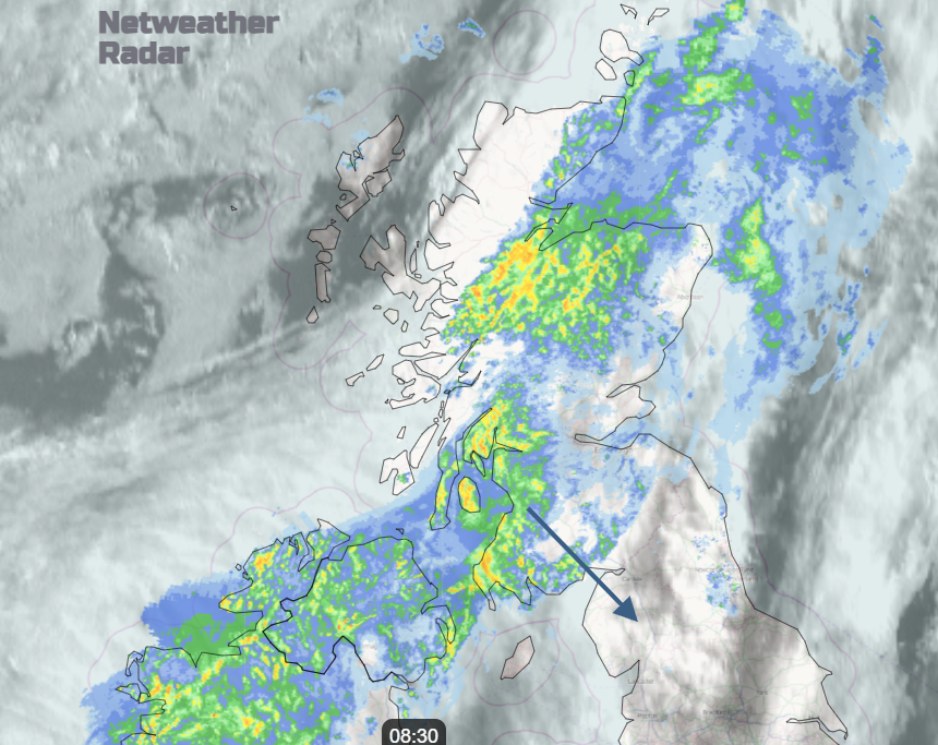
Today there is a band of rain working its way down the UK but it fades as it reaches SE Britain tonight. Then a good deal of dry weather this weekend with warm sunshine but a few showers on Saturday with an easterly breeze. A southerly by Sunday with a mix of cloud and sunny spells with temperatures to end the week ranging from 13C to perhaps 23C.
Yesterday Larkhill in Wiltshire saw the top UK temperature 21.4C and several spots across the UK saw over 19C. The sun is strong at this time of year and sitting in a sheltered spot can feel very warm. Colder air will reach northern Scotland tonight and the flow off the cool North Sea will last into Sunday for eastern England.
Today the warmth will be ahead of the rain, although with increasing cloud. So, a balance of the sunshine over SE Britain warming things up into the low twenties but the frontal cloud arriving from the northwest. Behind the front, there will be clearer skies and the sunshine could still lift temperatures to 17 or 18C. The colder air arrives tonight with temperatures in the Highlands well down into single figures.
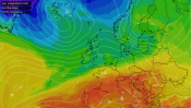
A westerly flow and rainband today affecting the UK temperatures
The tree pollen season is underway, not the grass pollen yet. In the sunshine the pollen risk will be moderate to high for much of the UK. Birch and oak are the main airborne types and there plenty of oilseed rape has been flowering which could cause very localised irritation.
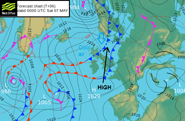
High pressure will move over the UK on Saturday to the North Sea by Sunday
There are two cold fronts for the end of the week. One is today's rainband which has a bit about it and will bring a spell of grey, wet and cooler weather as it trudges southwards on Friday. There will still be a bit of cloud and a few showery outbreaks of rain over East Anglia, London and SE England first thing on Saturday but essentially it is drying up. The second front, has colder air behind it but only a few showers over northern Scotland in the late evening on Friday and then it fades.
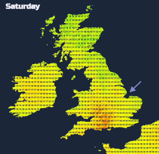
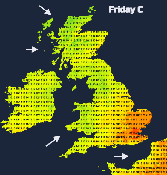
Cooler air in the far north and an easterly flow off the North Sea affecting the temperatures on Saturday
There will be more cloud over eastern Britain on Saturday with low cloud around the Forth and lingering showery bits for SE Britain with a few sharp showers edging southwards by lunchtime to Sussex and south Kent. Most places will be fair and dry but there will be a scattering of showers from SW Scotland through Cumbria and Lancashire, down through the Midlands to the Home Counties and the morning showers in the SE. Just a few but need a mention. The West Country looks warm inland, and Cardiff could reach 20C. Co. Down or Co. Antrim also could have the odd shower on Saturday but still the focus is on fine weather.
For eastern England down to the Thames Estuary and Kent, the breeze veers from northeast to east and keeps the cooler air off the North Sea on Saturday night There will be some high cloud from the west overnight from an occluded Atlantic front.
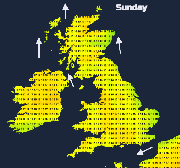
Another change by Sunday with a wind from the south
Sunday looks fine across the UK with high pressure sitting over the North Sea. Patchy frontal rain will try to move in from the west, but it struggles and now looks to wait until Monday.
There is still a Very High Fire Severity Index FSI for inland SE Britain and the Midlands. And many of the rivers in England are normal, below low or notably low, it has been rather dry. “The FSI is an assessment of how severe a fire could become if one were to start. It is not an assessment of the risk of wildfires occurring.” So do follow the local advice if out this weekend to protect the countryside.
Plenty of fine weather this weekend, feeling warm in the sunshine with temperatures just tipping into the low 20sC but it's not a UK Heatwave The coming week looks rather mixed but hints on the outlook charts of something warmer taking hold during the mid May weekend. That's a fair way off though.


.png?w=350)