Showers breaking out across England & Wales today, Thursday & Good Friday drier, sunnier and warmer. Weekend starting fine, dry and warm, but looking more mixed Easter Sunday and Monday.
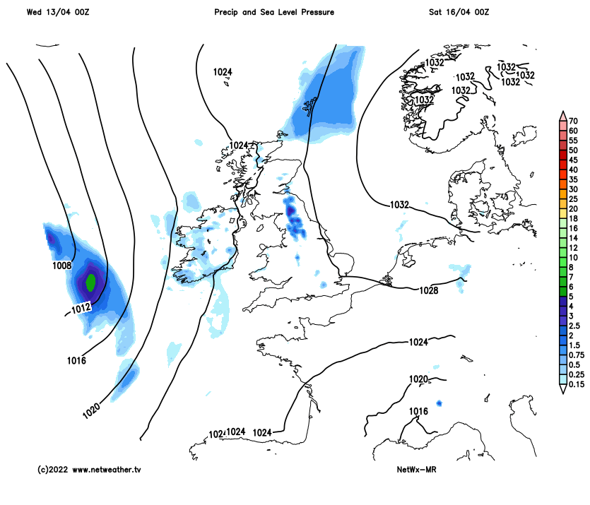
Many parts of the UK have seen some rain over the last few days, particularly in the west. Wednesday will see rain clear the north, with sunshine following, but also showers breaking out in places. However, after today, high pressure looks set to build in to end the week and will linger into the first half of the Easter Weekend, bringing mostly dry, settled, sunny and warm weather - though a few showers possible in the west. For the second half of the Easter weekend, Easter Sunday and Monday, there looks an increasing threat of showers or longer spells of rain and strengthening winds for northern and western areas spreading in from the west, southern and eastern areas fairing better with drier and sunnier conditions hanging on, though even here could see some rain by Monday.
For now, a mild if rather cloudy start for many, some outbreaks of rain across Scotland for a time this morning, before clearing away late morning, otherwise a few showers here and there this morning but generally brightening up with sunny spells. But the warmth of the sunshine will trigger more widespread scattered showers to break out – mostly across England and Wales. Some of the showers could be heavy with hail and the odd rumble of thunder. Warm in the sunshine, particularly across southern, central and eastern England – where temperatures will reach 16-19C, perhaps 20C in a few spots. Elsewhere 11-15C.

Showers fading this evening then mostly dry tonight, but low cloud, mist and fog will become extensive across southern and western areas overnight – particularly towards and around coasts. Elsewhere clear spells. A mild night.
Likely starting cloudy Thursday morning, perhaps staying on the cloudy side across northern and western areas, with outbreaks of rain arriving across N. Ireland and western Scotland through the afternoon. Early cloud thinning and breaking through the morning across more eastern areas leading into a mostly dry and bright or sunny afternoon, best of the sunshine towards the SE England and East Anglia. Some breaks allowing some sunshine further west east of high ground too. Warm with any sunshine – temperatures reaching 17-20C, where it remains cloudy – 12-15C.
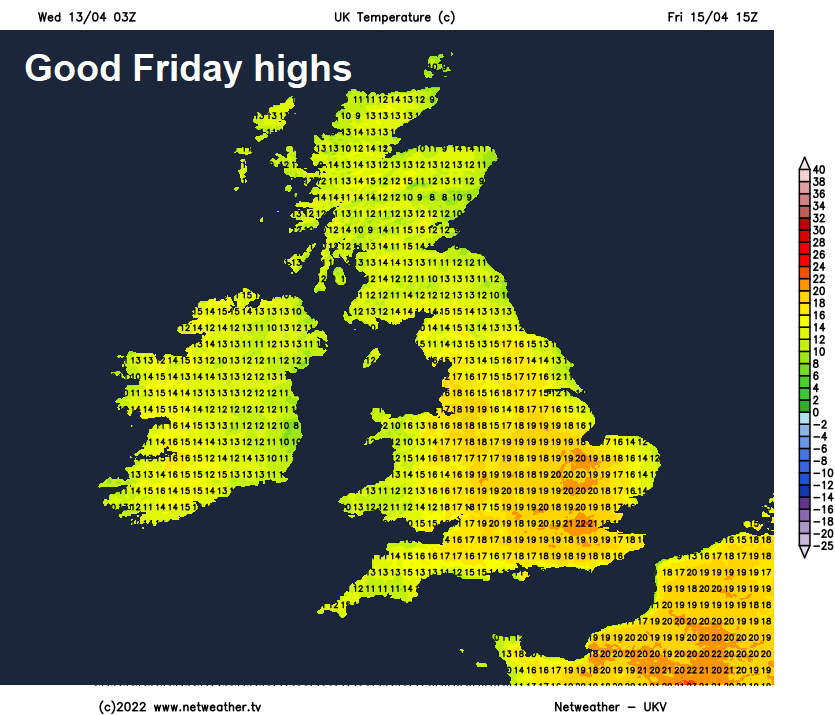
Good Friday seeing some patchy rain in the morning across northern and western Scotland, otherwise some warm sunny spells developing after some early mist or fog in places clears. Some isolated showers possible in the west. Temperatures reaching the high teens in the south, perhaps 20-22C in some spots in the southeast.
Some uncertainty over the weekend, especially Sunday onwards. Saturday is looking most likely to be dry, sunny and warm for eastern England , but in the north and west we may see more in the way of cloud with some showers. Warm everywhere though, with the flow from the south, especially warm for the sunnier east, with temperatures reaching 20-21C.
Uncertainty grows from Easter Sunday, one model shows strengthening winds, cooler air and rain spreading east on Sunday, followed by blustery showers on Monday. Another model shows Sunday mostly dry, warm and sunny, apart from a few showers in the west, then Monday seeing showery rain spread in across the west, eastern areas dry, warm and sunny. Most likely the Good Friday and Saturday will be the best days weatherwise, Sunday and Monday perhaps more unsettled and cooler with some rain or showers, more especially for northern and western areas.