The 20C highs over the weekend will feel like a distant memory over the next few days, as cold arctic air brings wintry showers and overnight frost for many.
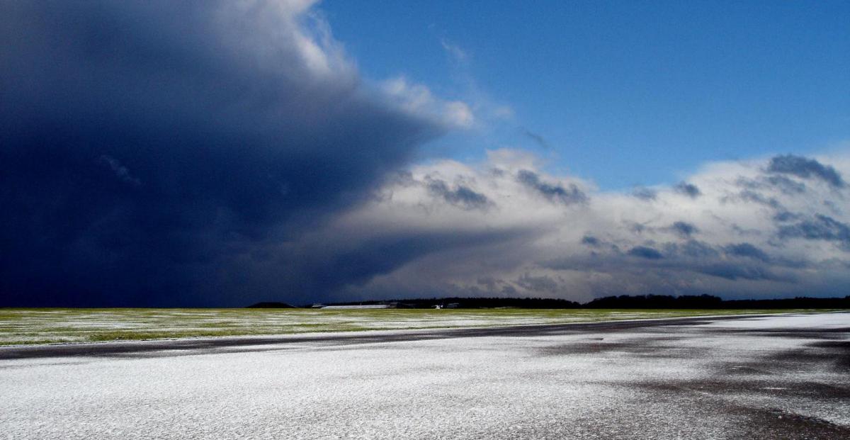
Winter has retuned across the UK this morning, with snowy scenes across eastern parts of Scotland and England on social media. A cold front cleared the south coast from the north overnight, introducing much colder arctic air. Parts of the UK reached 20C over the weekend with mid-teens to high teens since the beginning of the week, but today most places will fail to reach double figures, with the strong northeasterly wind bringing a wind chill that it will make it feel close to freezing.
The cold arctic northerly flow will continue on Friday, after a cold frosty night, with further wintry showers in the east and northwest. Cold with further wintry showers developing across England and Wales on Saturday, though not as windy. Less cold on Sunday but mostly dry away from the far north. Temperatures further recovering early next week, but cloud and spells of rain will spread southeast across most parts, heralding what looks to be more unsettled start to April. It may turn colder later next week, with a return of snow, especially in the north.
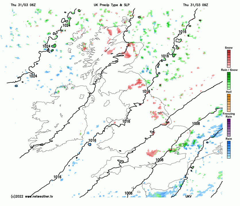
For now, wintry showers from the word go this morning across eastern areas, falling as snow inland and particularly over higher ground to fairly modest elevations – where some areas have woken to a covering of snow. Thunder and lightning too in some the showers, so thundersnow for some. This continuing throughout the morning, accompanied by a strong and bitter northerly wind. Western areas will be mostly dry and sunny this morning, wind not as strong as further east, but still a brisk chilly breeze.
.JPG)
As the sun warms the air near the surface, it will allow shower clouds to bubble up inland, so we will see wintry showers breaking out inland and further west. So into the afternoon – many areas could catch a wintry shower. Showers falling mostly of rain, sleet or hail at lower elevations, falling as snow over higher ground, but in the heavier showers wet snow may fall briefly to lower levels. The odd rumble of thunder in the heavier showers too – particularly towards eastern areas. Sunny spells between the showers. Northern Ireland perhaps escaping the showers generally away from coasts and staying mostly dry and sunny.
A cold day, although temperatures will reach 5-9C, 10C across the southwest, it will feel more like freezing in the wind chill of the strong northerly wind.
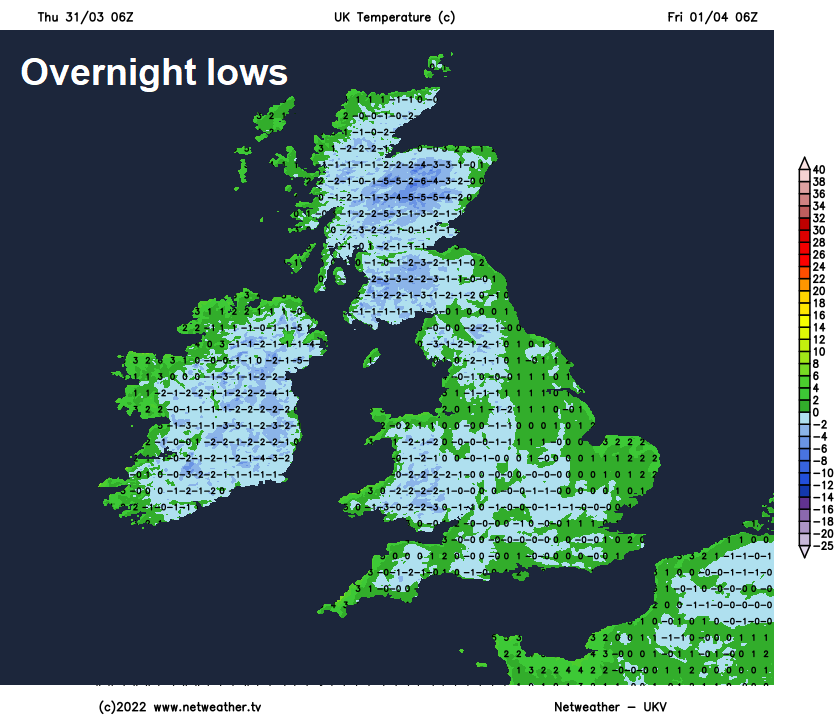
Further wintry showers will stream in from the North Sea on the brisk northeasterly wind across eastern areas tonight, giving a covering of snow in places. A more persistent area of rain, sleet and hill snow looks to clip East Kent. Isolated wintry showers elsewhere, particularly around coasts, otherwise dry with clear spells. A cold night, with a widespread frost developing, which may lead to icy patches where showers have fallen.
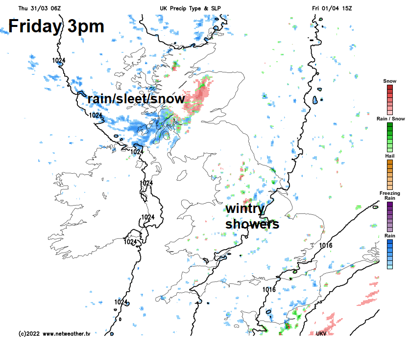
Another cold but bright day on Friday, with a brisk northerly or northeasterly wind feeding in further wintry showers across England and Wales, initially towards eastern England, then more widely inland further west as the sun warms the air beneath the cold air aloft, building those shower clouds. Sunny spells between the showers. Cloudier day across Scotland and N. Ireland – with outbreaks of rain, sleet and snow spreading southeast. Temperatures a little higher than today, reaching 6-10C, but disappointing for the first day of April and still feeling raw in the wind.
Temperatures not really rising much over the weekend, with the flow from the north and northwest, so feeling cold for early April. After another cold and frosty night, Saturday starting bright with wintry showers in the east, before showers become more widespread across England and Wales into the afternoon. Scotland cloudier with fewer showers. Sunday drier with fewer showers across England and Wales, bright or sunny at times. Thicker cloud spilling down across Scotland and N. Ireland – with outbreaks of rain preceded by hill snow spreading southeast in the afternoon.
Unsettled northwesterly flow next week, with areas of low pressure tracking southeast near the UK bringing spells of rain or showers at times, with a risk of snow later in the week in the north, but also some drier spells. Not as cold early next week, with temperatures recovering to around average or slight above, but colder air may return from the north later in the week.