The sunshine and warmth continue. Cooler by night with fog in places into the weekend as the dry weather lasts.
More warm sunshine for the rest of this week. High pressure is sticking around and will drift across, over the UK, so the winds will become very light. This brings cool nights with a bit of frost and also more fog but by day it’s fine and dry. This will last through the weekend but next week looks decidedly colder with even wintry showers for northern hills. It is still only early Spring.
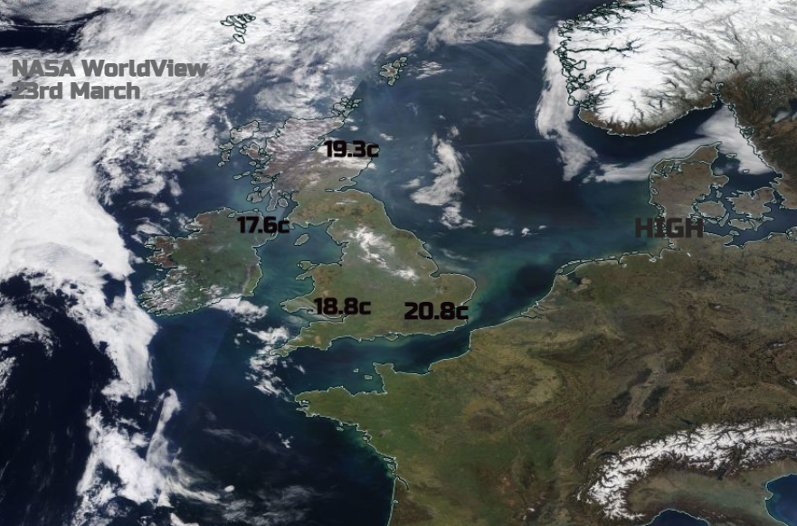
Temperatures yesterday rose to 20.8C in London and for many, it has been lovely to have fine weather with warm sunshine and feel that we are leaving winter behind, particularly with the clocks changing this weekend. The lack of rain continues this month. January was very dry, February wet as a whole across the UK, such fluctuations.
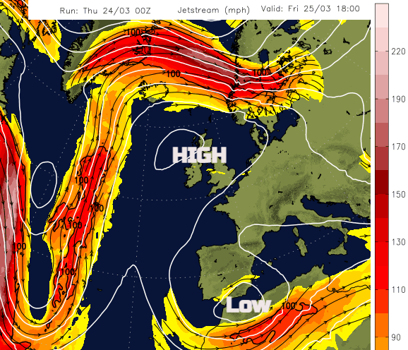
The Jetstream is still being deflected very strongly by the high pressure. Part diving south and aiding the low pressure over NW Africa with ongoing unsettled weather for Spain and Portugal. More sandy, muddy rain affecting Malaga this week. For anyone on holiday, it has been disappointing cool, cloudy with rain at times. Although this jetstreak is getting cut off, another boost is on its way at the weekend. The main jet is still being forced northwards which will bring blustery, more unsettled weather to Shetland and also Iceland and Norway.
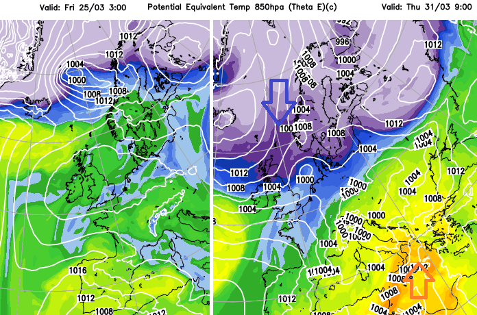
The high pressure keeps the surface air quite still, there is little stirring. So local emissions and roadside pollution remain and are not dispersed but there can be a gradual flow of air around the high pressure and this has been from the southeast so far this week.
“Further import of long-range particulate pollution … is expected to continue. Widespread 'Moderate' PM10 and PM2.5 particulates are expected across Greater London, many of these locations possibly realising 'High' PM10 and PM2.5 particulate levels as the episode intensifies.” LondonAir
You may have noticed the haze in the air and Hull saw Very High levels of Particulate pollution recorded by 7am today. There are health considerations, particularly for at-risk individuals. Within the Very High (10) category of the Air Quality Index the advice even for the general population is “Reduce physical exertion, particularly outdoors, especially if you experience symptoms such as cough or sore throat.” Eastern England looks at most risk today and SE Britain tomorrow
Northern UK improves (green) as the breeze over the top of the high pressure picks up and mixes the atmosphere slightly, but enough. Also, it is further away from the Europe sources.
Today
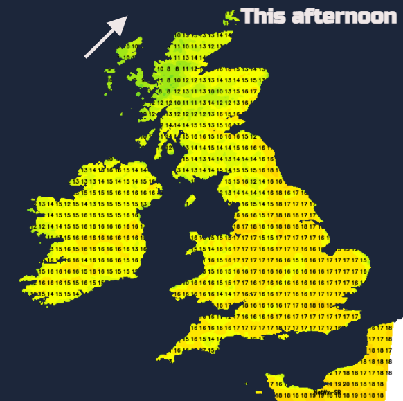
There will be more cloud over northwestern parts of the UK by this afternoon, still sunny with blue skies for much of England and Wales. Scotland and Northern Ireland will be 13 to 17C, England and Wales again mid to high teens with the odd 20C. Similar tomorrow with more sunshine in the north than today. There is just the smallest chance of a shower for western areas but overall, we just continue with the fine weather. Cool by night with increasing fog by the weekend in places before the rising temperatures by day.
Next week Low pressures over western Russia and Scandinavia begin to push cold air southwards. There is some uncertainty with this signal but by midweek UK temperatures look to dive away. Down around 10 to 12C although the strength of this colder plunge and its reach will need firming up over the weekend. If you read anything that mentions ‘deep snow’ ignore it.
More weekend weather details