High pressure dominates for the rest of the week and through the weekend, warm next few days before temperatures ease over the weekend, but still above average. It looks like turning a lot colder from the north next week though.
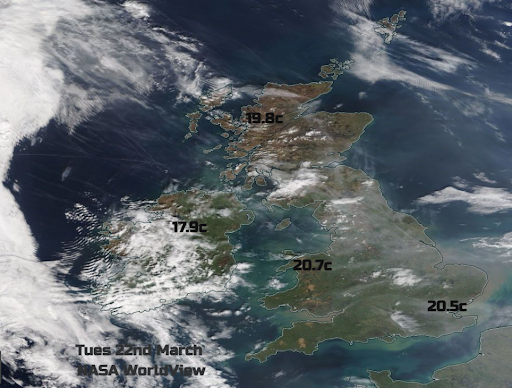
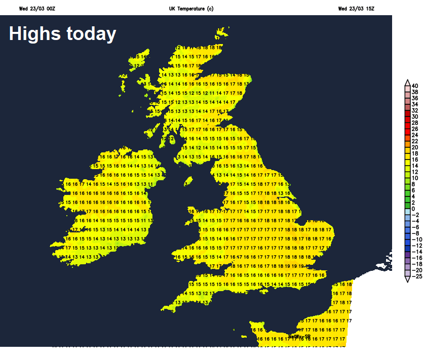
Yesterday saw the warmest day of the year so far, top temperature was 20.7C in Porthmadog in north Wales, while England’s highest temperature was 20.5C in Northolt, London. The average maximum daytime temperature for this time of year is 10C in the north, 13C in the south. With high pressure remaining in control, it will remain mostly dry and settled for the rest of this week and through the weekend too. It will be warm in the sunshine by day, but as often is the case at this time of year, clear skies at night and the dry air means it will turn cold at night, with a risk of frost. So, a large diurnal range of temperatures.
National highs yesterday
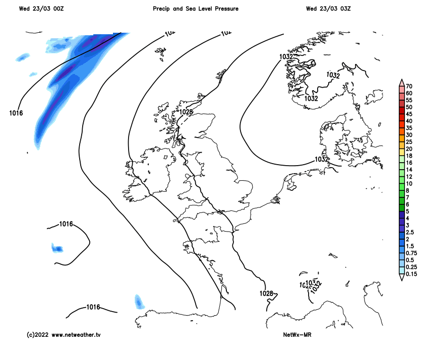
High pressure remains in control this week and through the weekend, though drifting west
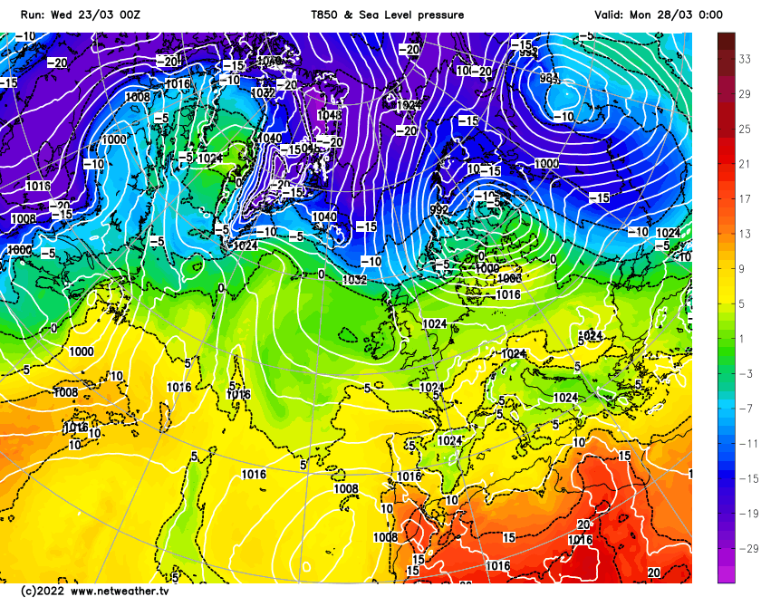
Today will likely see temperatures breach 20C again, perhaps higher than yesterday, with 21C in a few spots. Highs will likely drop a few degrees Friday and over the weekend, as high pressure to the east drifts west and pulls in slightly cooler air and more in the way of cloud. Then a change through early next week, as high pressure retreats to the northwest – which is looking increasingly likely to allow colder arctic air to spread south by the middle of the week, bringing a big drop in temperature, more in the way of cloud and a chance of some wintry showers in the north and east.
Potentially turning much colder from the north by the middle of next week
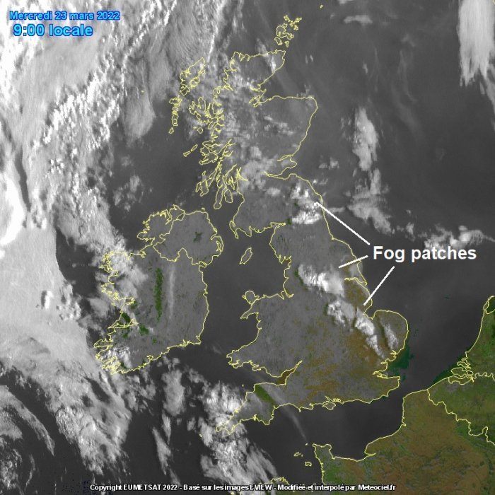
For now, a sunny but chilly start for many, temperatures fell close to freezing in some northern and western spots, bringing a frost. Also there is some fog to watch out for across NE England and parts of eastern Scotland this morning. A yellow fog warning is in force until 9.30am for dense fog patches across parts of NE England, with visibility less than 100m in places.
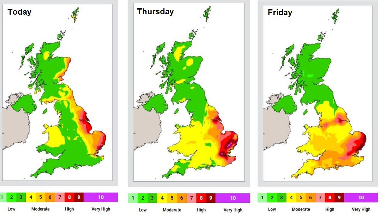
Any fog or mist should burn away by mid-morning and it will quickly warm up in the sunshine. For most it will be another dry day with long spells of warm sunshine, just outside chance of catching a shower across northern England and southern Scotland this afternoon, where cloud will bubble up. Generally light winds, with a southeasterly flow off the near continent, eastern England will see high air pollution levels today, tomorrow and Friday, thanks to drawing in pollution from urban, industrial and agricultural sources over France and Belgium combining with local emissions.
A warm day, temperatures reaching 16-18C inland across Britain today, 19-20C across SE England and East Anglia, perhaps a few spots reaching 21C. Cooler around coasts, with 13-15C likely.
Turning chilly again tonight under mostly clear skies with light winds, a rural frost forming in places, also some fog patches developing – especially across eastern England. More in the way of cloud and perhaps the odd spot of rain in the far northwest.
More of the same on Thursday and Friday, mostly dry with warm sunny spells once early mist and fog clears. More in the way of cloud than of late across the far north and northwest – thick enough for the odd spot of rain. Temperatures reaching 12-16C across Scotland and N. Ireland, 16-19C across England and Wales on Thursday, perhaps 20C in a few southern spots. Highs perhaps a degree or two lower on Friday generally.
High pressure will remain in control over the weekend, bringing generally dry and settled conditions with warm sunny spells by day for many, though nights will turn chilly with a continued risk of frost. Always more in the way of cloud for the far north, while Sunday could start cloudy, before burning back to southern and eastern coasts where it may linger. Not as warm as this week, but temperatures still reaching the mid-teens generally, perhaps high teens with prolonged sunshine.