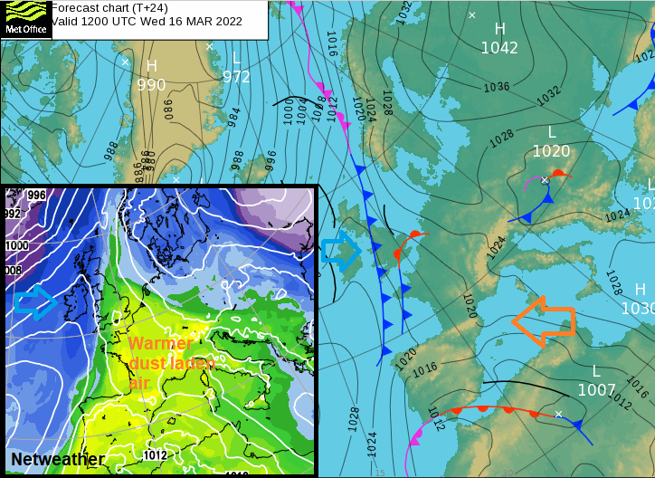
Midweek rain will clear to leave a dry, settled weekend. For Wednesday there is a cold front from the north. Warmer, moist dusty air from the south and heavy rain or showers in between the two.
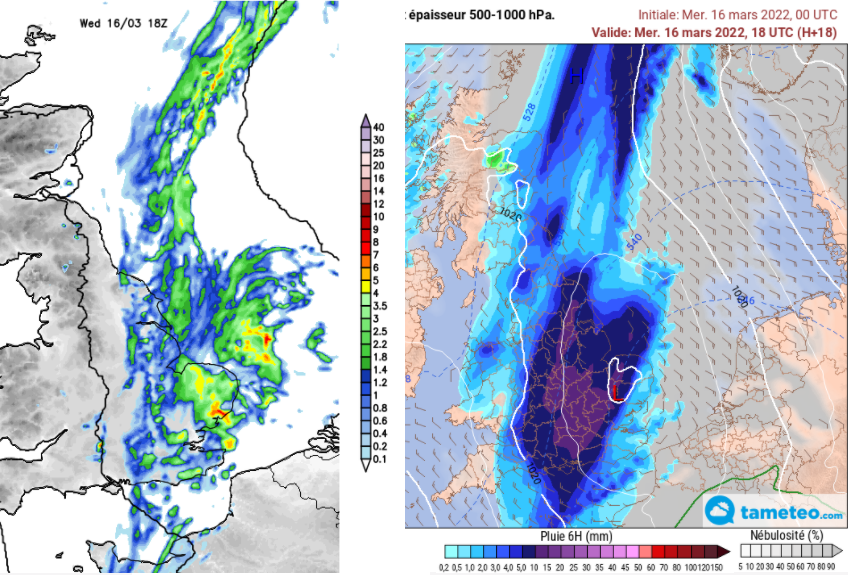
There is a synoptic collision showing on the charts today. A cold front from the northwest is bringing a band of rain over the UK this morning and a nip in the air behind it. Also in the mix, an influential low pressure over NW Africa and southern Iberia which has been bringing very unsettled conditions to the Canary Islands, Spain, Portugal. A feed of red Saharan dust has moved across the Mediterranean into western Europe on this warmer, moist flow. It has coated Spain on the ground and given red skies, reached Germany and is likely to affect SE Britain today.
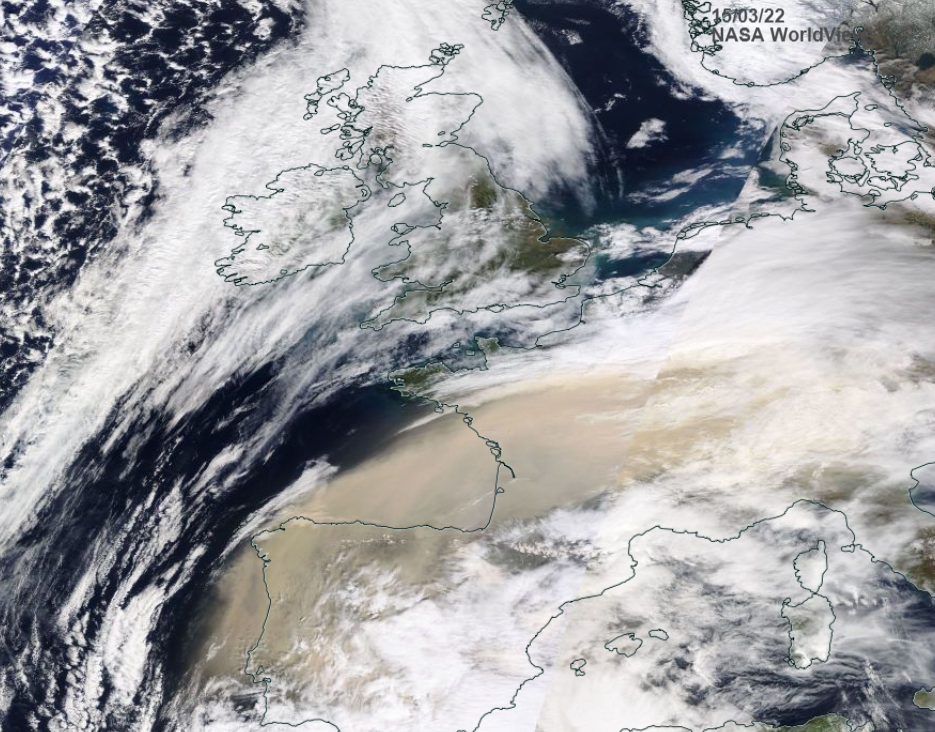
Satellite image from NASA yesterday showing Saharan dust over Portugal and France
On this southerly flow, there will be clusters of heavy showers working their way across the English Channel and over southern and eastern Britain today. There is some variation between the computer models about how invigorated these two rain areas become when they meet. The cold front edging south and the incoming showery rain.
The ECM model shows heavy rain developing this afternoon and evening moving from Dorset across much of England then away from Yorkshire overnight, around a low pressure. The Met Office UKV shows a cluster of heavy showers into central southern England this morning which moves across to SE England and East Anglia by mid-afternoon.
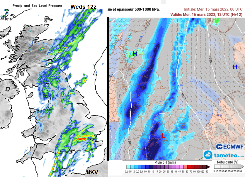
Still with some heavy downpours. Cheltenham might (might) get away with it today for Ladies Day but do pack a brolly. The GFS model develops heavy showers moving from Wales into the West Country by teatime, and the UKV also shows a line appearing late afternoon for Gloucestershire.
High pressure is trying to build in and although there will be showers from the far northwest on Friday most places will be dry to end the week and it stays that way for the weekend.
The temperature contrast across the country will follow the divide. Around 7 to 9C for Northern Ireland and Scotland but still 11 to 15C for SE Britain. The winds start off light from the south or northwest, but the dig of colder air takes over with blustery conditions for Pembrokeshire, Cornwall and Devon by late afternoon. It will feel cooler everywhere in that breeze although Kent could stay mild for much of today.
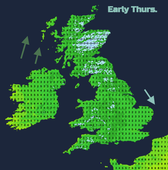
As the rain and showers clear the east coast later today, away over the North Sea, it leaves clear skies and light winds for the UK. Temperatures will fall down to around freezing and there will be a slight frost in places for the start of Thursday. High pressure is nosing in trying to bring fine, settled and sunny conditions. However, a low pressure in between Iceland and Greenland will throw its weather fronts our way. This will bring hefty showers which will bring snow over the Scottish mountains as they move in from the far northwest. Rain and sleet showers will pass over Northern Ireland first thing in an unstable airmass. As the first band fades over Scotland mid-morning, a more definite band of heavy showers with hail will move in. There will be gusty winds around this, and it will march eastwards bringing another wet spell. The showers could reach Cumbria and Gwynedd by early evening but otherwise it will be a fair day for England and Wales, even east coast Scotland. Windy for the north and west, calm for SE England with temperatures around 8 to 13C.
For the end of the week, high pressure will park itself to the east of the UK. This will result in plenty of dry, often sunny weather. Some fog and frost overnight where the winds drop. By day feeling warm in the sunshine but cooler in the wind, wrapping around the side of the high from the east or south.

A joke from Spain “my neighbour and I going out for a stroll this morning”. The Pyrenean snowcaps are tinged orangey pink and the Saharan dust is moving across the English Channel over southern England. It has been causing air quality issues elsewhere.