Before high pressure settles near to the UK later this week there will be a few bands of rain, which interrupt the fine spring weather. Still nippy at night but there is warmth in this March sunshine.
The weather looks settled for next weekend, nippy by night but mild by day out of the east wind. We have some midweek rain on the way but plenty more spring sunshine as well.
By midweek there will be a high pressure over western Russia and the Azores high where it belongs. The UK will see a frontal band from the Alntatic bringing rain with colder air behind but mild air being drawn up ahead, from the south.
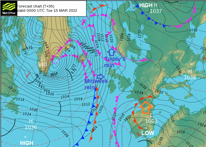
This rainband could turn heavier later on Wednesday as it heads to the North Sea. By Thursday the Azores high will have extended over the UK, settling the weather down and then merging with the other high over the Baltic Sea. This remains over southern Sweden and Demark into the weekend and will pull colder, continental air around its southern side. However, it looks to sink a bit further south, over Poland and so the flow of air towards the UK won’t be that cold. And the sunshine in mid-March has a fair bit of warmth in it.
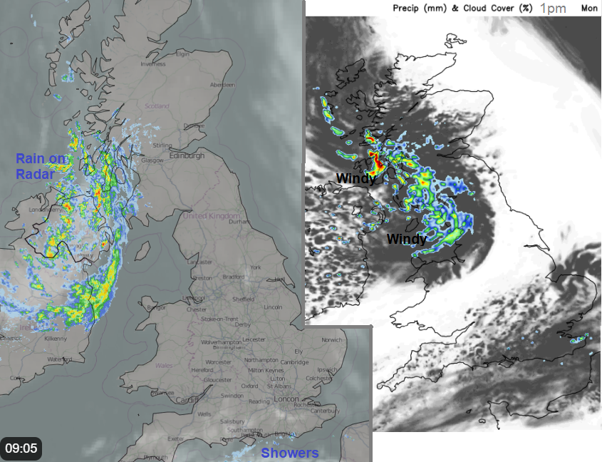
For those lucky enough to have clear skies last night, and time/energy available to look, there were stunning aurora displays. The cloud was a nuisance for some but a lot of that has now cleared leaving blue skies and sunshine with a real feeling that spring has arrived as the birds sing. However, the last remnants of the weekend low pressure are bringing a wet start for Northern Ireland on Monday. This showery rain along with blustery winds will move across to NW England and SW Scotland by lunchtime. There will also be a few showers over southern England where the winds are very light today, but most places stay dry.
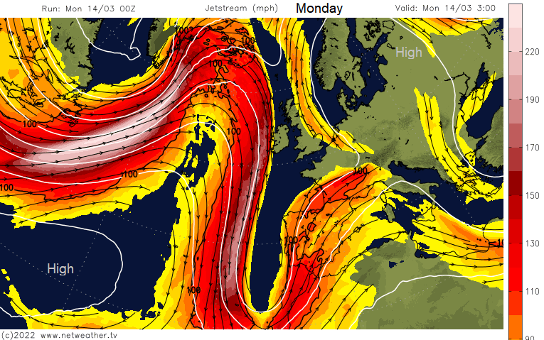
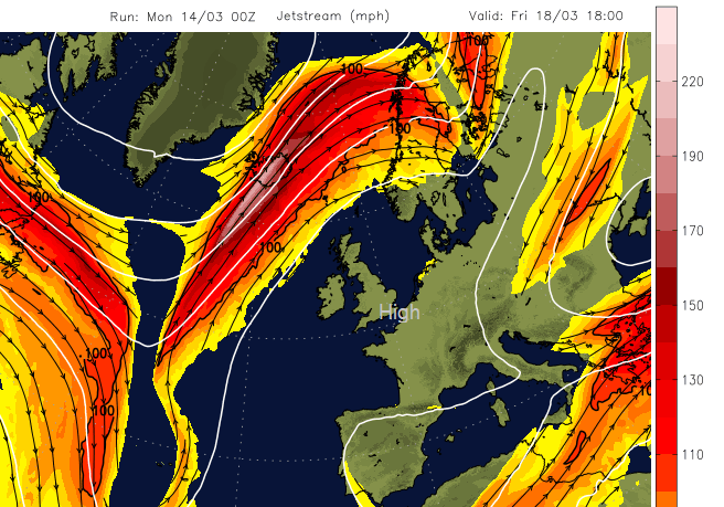
The Jetstream has a huge buckle in it to start the week with a surface low over Iberia bringing unsettled weather to Spain and Portugal. Even down to the Canary Islands and NW Africa with wind and large wave warnings. That loop gets cut off and a more zonal jet pushes across the Atlantic midweek with that band of rain. After that the high pressure builds, the Jetstream is forced to the north and the unsettled weather bothers Iceland and Lapland.
Northern Ireland becomes drier and brighter with sunshine through the afternoon. The westerly wind taking until this evening to ease down. The showery rain continues to edge north-eastwards, over the Pennines and more of Scotland. Fine for the southern half of Britain and temperatures across the UK vary from 9C to 14C.
Tonight
The showery rain fades somewhat tonight before an occluding front arrives from the far northwest. In between, there will be lighter winds, some clear spells and a touch of frost with patchy fog too. Temperatures fall away overnight down into single figures.
Tuesday
For many Tuesday starts off fine however there will be frontal rain for NW Scotland with strong southerly winds. Most of the UK stays dry tomorrow although with increasing cloud. The rain will edge over Highland and reach western counties of Northern Ireland in the afternoon.
After a murky start on Wednesday, we then see the mid-week band of rain, cold to the NW but mild for SE England with temperatures into mid-teens. A chilly start on Thursday with patchy frost Then the potential for temperatures to creep up, to around 17C but it will depend on cloud cover and the breeze. It will be nippy at night with frost in places, but by day where there is sunshine, the temperatures will be in the teens, just feeling colder if you are in that east wind.