The mild and changeable weather continues, for now, changing to warm and settled for a time next week. But, with signs a Scandinavian high may develop beyond that.
The spell of warm, changeable weather will continue for another few days. There are signs that high pressure will build around the middle of next week, bringing in a spell of more settled weather. Then, there is the potential for it to turn colder from the east towards next weekend, but that is a long way off and subject to change.
This morning will continue cloudy with some outbreaks of rain over much of Scotland, but the cloud and rain will clear northwards from all but the far north of Scotland during the afternoon, leaving some sunny intervals. Elsewhere, it will be mostly dry with sunny intervals, but there are currently some scattered showers in the south, and these will spread northwards to other regions during the day.
It will cloud over from the southwest over Wales, central and southern England and Northern Ireland during the afternoon as another belt of rain heads into Northern Ireland, south and west Wales and southwest England. It will also become windy in Northern Ireland, Wales and southwest England, with gales likely near exposed south and west-facing coasts and hills.
With winds remaining southerly, it will be another warm day for the time of year, with highs of 13 to 15C over the majority of England and Wales. Scotland and Northern Ireland will be less mild, but still reaching 10 to 12C in many places.
Tonight, this rain belt will move north-eastwards across the country but tending to fragment and peter out as it heads into northern and eastern Scotland and eastern England. It will be a wet night in Northern Ireland. Winds will remain strong in the west, especially near west and south-facing coasts. The Met Office has issued a yellow weather warning for wind in south Wales and southwest England. With the cloud and rain and southerly winds, it will be a mild night, with lows generally between 5 and 8C.
Cloud and light rain will clear from eastern and north-eastern Britain during the morning, but high cloud may prove slow to clear over East Anglia and the south-east. It will generally be a day of sunshine and scattered showers, the showers generally heaviest and most frequent in the southwest, where they may locally be accompanied by thunder. Much of northern and eastern Scotland will stay dry, but a few showers will push into north-eastern districts late in the day. It will continue warm for the time of year, with most places seeing highs between 12 and 14C.
Winds will be strong in the west overnight and into the morning, where the Met Office has a yellow weather warning covering parts of Cornwall, West Wales, southwest Scotland and the east of Northern Ireland, but these will tend to ease.
The changeable, warm theme will continue through to midweek. Monday looks like having a north-south split, with rain affecting much of Scotland, Northern Ireland and northern England, and just limited brighter intervals, but just isolated showers with sunny intervals further south. Through Tuesday and Wednesday, we can expect a band of rain to spread slowly south-eastwards across the country. To the south and east of this rain band, it will turn very warm for the time of year away from south and east-facing coasts, with highs of 17 to 19C in parts of England and perhaps even 20C locally.
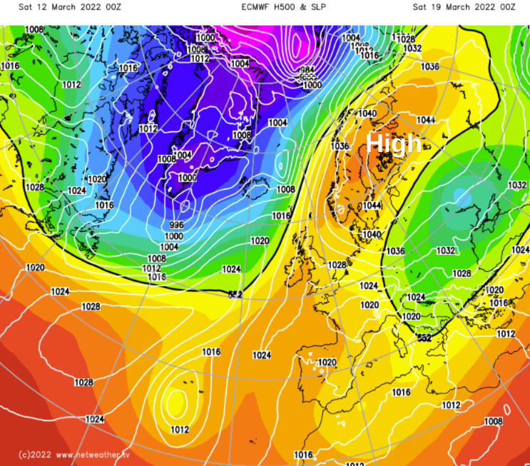
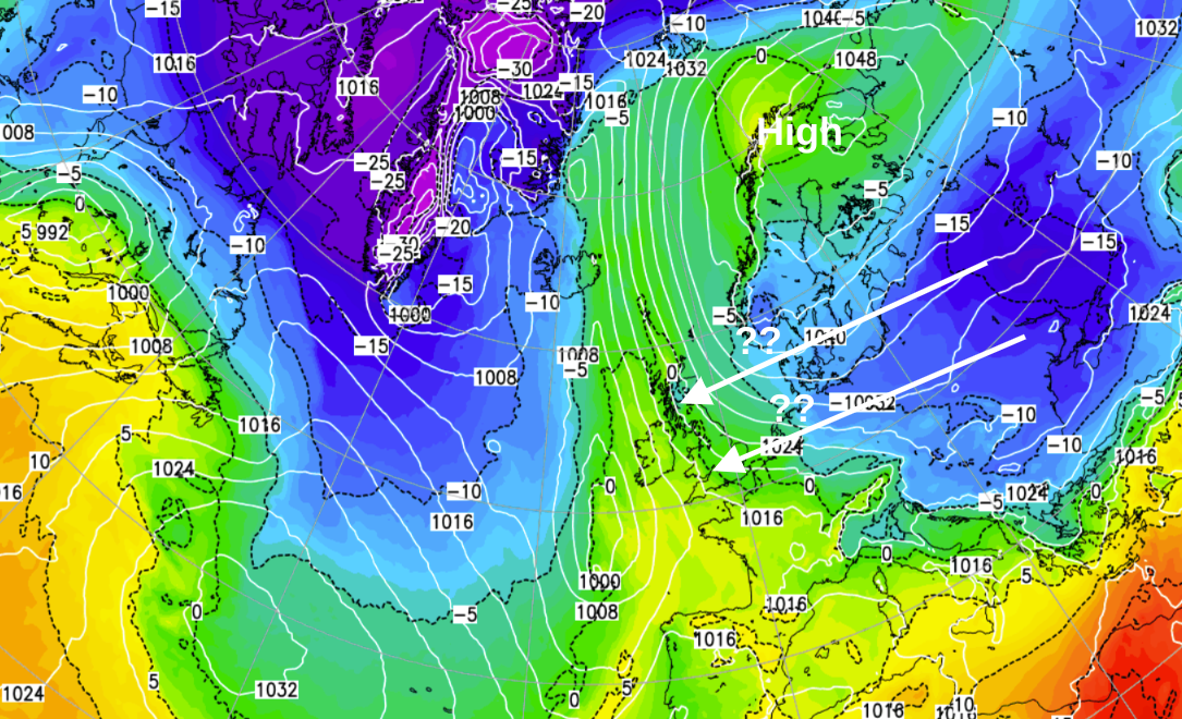
After that, high pressure will build over Scandinavia, promising more settled weather. This is when it may start to turn colder, with easterly or southeasterly winds developing, but there is a lot of uncertainty over how much colder it will become.