An area of low pressure will deepen as it heads towards the UK for this weekend. There will be spells of rain and strong winds with coastal gales, large waves and high gusts. Possible disruption.
Am Atlantic low pressure is heading our way which means that the weekend will be wet and windy at times. The UK Met Office has already issued yellow wind warnings. There will still be some fair weather with sunshine, and it won’t be particularly cold but if you do have outdoor plans, particularly for western parts of the UK it will be worth taking note of when the strong winds are expected.
Some areas were battered by storms over the winter and now a few leaves and buds are appearing on the trees, just giving a little more surface area to branches.
We’ve seen some wet and blustery weather move over the UK on Friday linked to a larger low by Iceland and then clearer, brighter skies as the cold front moved through. Saturday will start off fine for many parts, but a new low pressure will be deepening as it moves our way on Saturday.
The gusty strong winds and rain look to reach Cornwall at lunchtime. Met Eireann has a rain warning for Saturday and gale warnings for all coasts Saturday pm and all Sunday.
Heavy rain and strong winds will bring a risk of flooding and hazardous conditions. From 3pm til end of Saturday. Met Eireann.
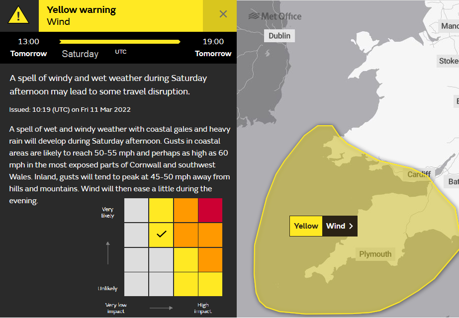
As the low pressure still has to go through its developmental stage there is uncertainty within the forecast. The UK Met Office use a matrix to explain their level of warnings. The up axis shows how likely is this severe weather, this is deemed Likely. And the across axis shows what impacts are expected. Currently there are low impacts being forecast.
This would include: “Some transport routes and travel services affected, longer travel times. A few power interruptions. Coastal routes, sea fronts and coastal communities affected by spray and/or large waves. “for example. It’s the weekend, its not a school holiday travel time so that may have added into the pot of which level of impacts to choose.
By teatime, the strong gusty winds and rain will also have reached Pembrokeshire. Then more of Wales, particularly the coastal west and more of Devon and Dorset by early evening. The current forecast shows Northern Ireland turning wet once more for Saturday evening with strong gusty winds hitting the coast of Co. Down.
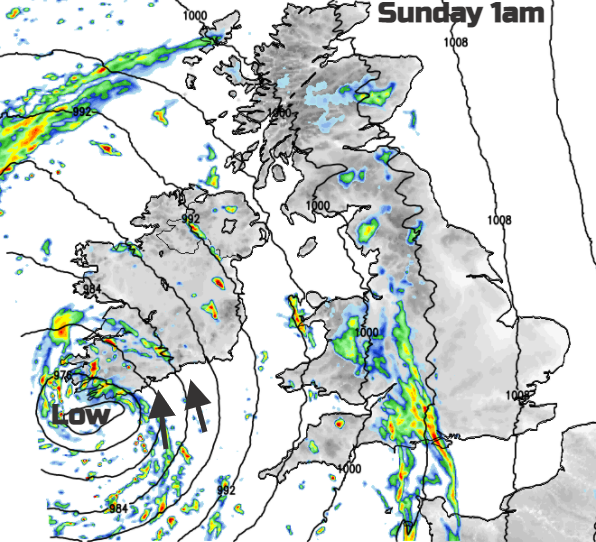
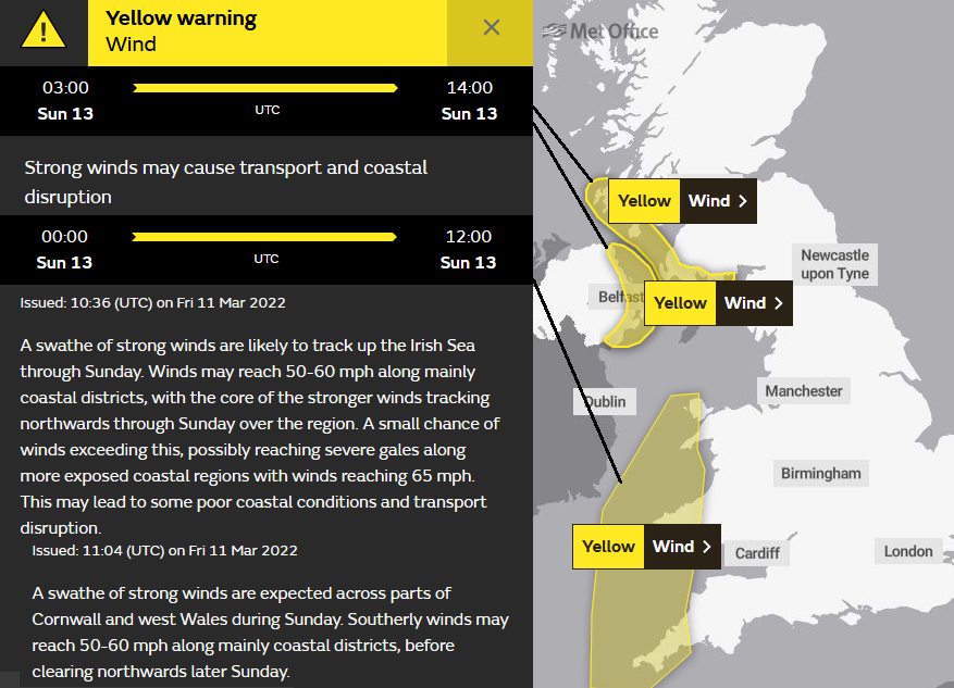
As the low centre heads towards Co. Kerry and Co. Cork and severe gales could hit the south coast in the small hours, bands of showers will swirl around. SW England has another yellow wind warning. Gales will move up the Irish Sea by dawn and we see new areas of yellow warnings for Sunday. Over Northern Ireland which looks to have a wild start on Sunday along the east coast and across the North Channel for SW Scotland and the Inner Hebrides. Areas beyond the warnings could still have a very windy night and with the coasts seeing large waves.
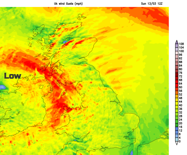
The low gradually moves northwards through Ireland on Sunday. It will be windy everywhere through the middle of the day with the rain and gales easing through the day. The winds will be lighter for southern Britain later on Sunday but still windy for northern England, Scotland and Northern Ireland until the evening.
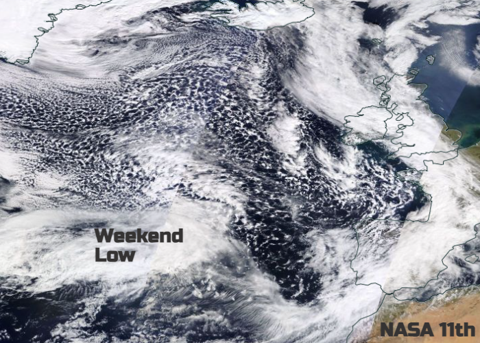
Top image NASA WorldView