Windy with sunshine and blustery wintry showers spreading across the UK, falling readily as snow to low level in the north. Turning drier and more settled for many Friday and through the weekend.
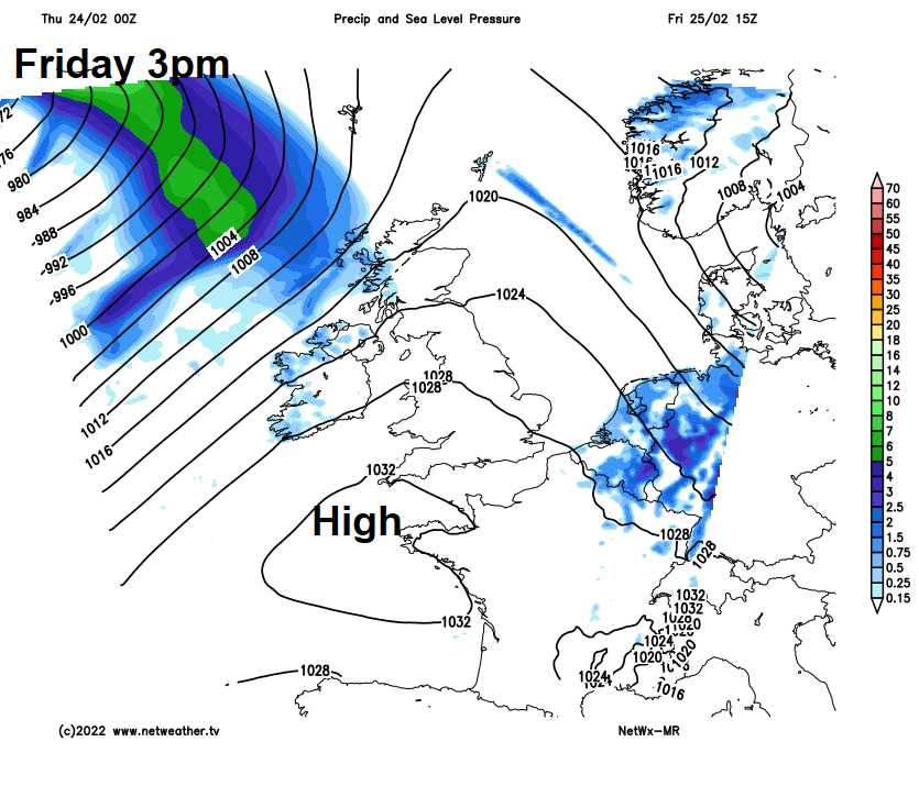
The good news is that high pressure will build in from Friday bringing drier, sunnier and more settled conditions for many to end the week and through the weekend. But before then, Thursday will be a rather blustery and showery day, the air cold enough for showers to be wintry in nature, with snow or hail and the odd rumble of thunder. Snow falling to low levels in Scotland and N. Ireland, over hills further south.
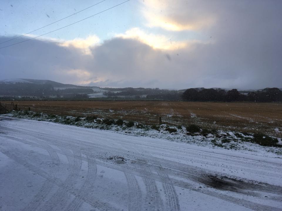
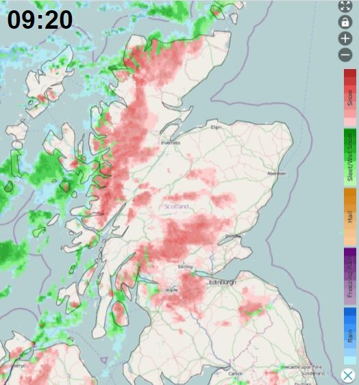
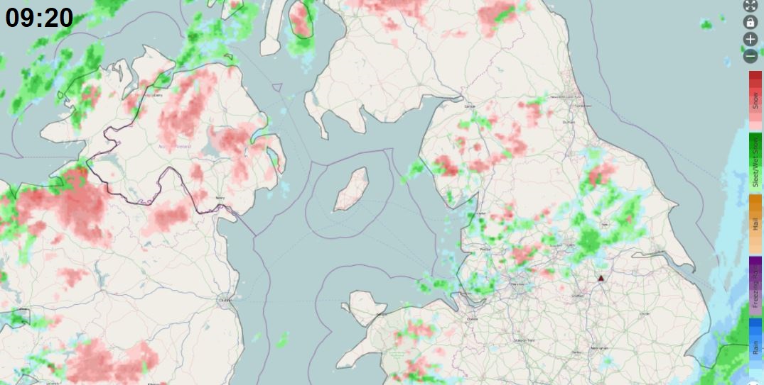
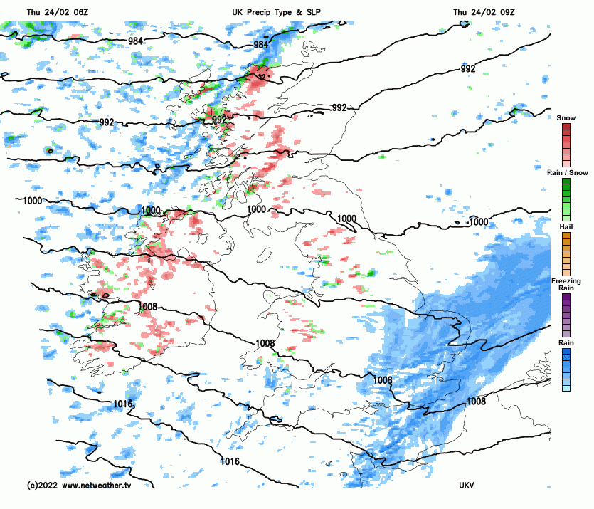
A cold and showery polar airstream has moved in from the west across many areas overnight behind a cold front clearing SE England at breakfast time. Frequent snow showers are piling in across Scotland, N. Ireland and northern England for the morning commute and will continue throughout the day here, settling even at lower levels. Some significant accumulations possible over the Highlands, drifting in the strong wind. Hail and thunder may also accompany the heavier showers, particularly in the west. A Met Office yellow warning is in force for snow and lightning – in force until 8pm today:
Further south, cloud and outbreaks of rain, locally heavy, across much of southern England, Midlands and East Anglia at breakfast time, will clear east through the morning. Following will be brighter but showery conditions, already across Wales and SW England, spreading east across all parts by late morning. Showers will be wintry in nature, with a mixture of sleet, hail and hill snow and perhaps the odd rumble of thunder in the heavier showers. Showers tending to ease from the west by evening. Temperatures reaching 4-6C at best in the north, 6-8C in the south.
A band of more organised sleet and snow showers along an occluded front looks to sweep southeast across N. Ireland and northern England later this evening, giving a covering in places, wintry showers continuing across northern and western Scotland and towards the north of N. Ireland this evening and overnight. Elsewhere, any wintry showers fading to leave a dry but cold night with clear spells, allowing a frost locally in rural areas, with some icy patches possible where showers have fallen.
A ridge of high pressure builds in from the southwest for Friday, pushing away east the windy and showery conditions. So, after any lingering overnight showers in the east clear first thing, for most it will be dry and there will be plenty of sunshine. Milder too, with temperatures reaching 8-11C generally. Cloud and rain, preceded by hill snow, will spread northeast across northern and western Scotland during the evening.
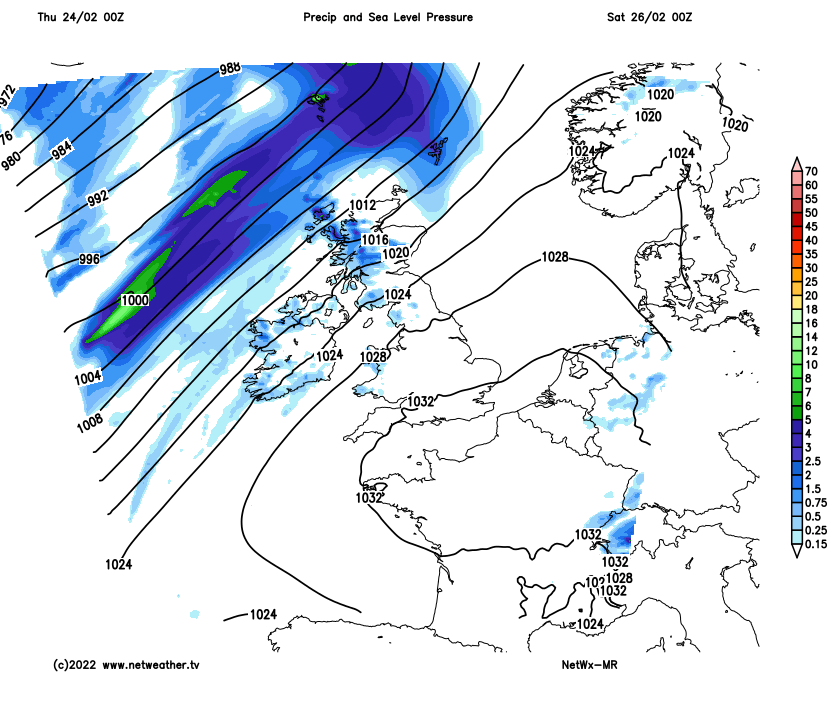
High pressure will centred close by over the near continent over the weekend, keeping England and Wales mostly dry and settled through the weekend, with sunny spells by day – temperatures reaching 10-11C. However, it will turn cold at night under clear skies, with a risk of frost developing. Scotland and N. Ireland will be more at the mercy of Atlantic fronts, so it will be cloudier and windier here, with some patchy light rain or drizzle on Saturday, particularly towards western Scotland and N. Ireland. A cold front moves in from the west on Sunday morning, bringing a more organised band of rain across western Scotland and N. Ireland, though weakening as it moves towards eastern Scotland. Frost less likely here overnight under the cloud and southwesterly wind.
Turning unsettled from the west to begin next week, with a frontal system moving east across the UK bringing a spell rain and stronger winds across the UK on Monday, though turning brighter but showery across Scotland. High pressure looks to build back in from the southwest on Tuesday, bringing a drier day with sunny spells. Wednesday probably mostly dry and bright too, with high pressure in control. Some uncertainty for Thursday and Friday, but it looks like frontal systems will try and push in from the Atlantic, but will come up against high pressure over the near continent and also trying to build in from the southwest. So northern and western areas may see some cloud and rain on Thursday, but this perhaps fizzling out as it moves east on Friday.