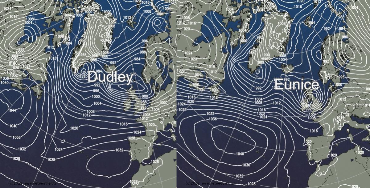
There are two named storms on the way this week, both liable to bring disruptive weather. Storm Dudley arrives on Wednesday and Thursday, with Eunice following on Friday.
It's going to be a stormy week, with two named storms inbound. First, Dudley will arrive Wednesday into Thursday, affecting the northern half of the UK. Then Friday sees Storm Eunice, which currently looks likely to affect central and southern England, along with Wales - but there is some uncertainty over its track at the moment.
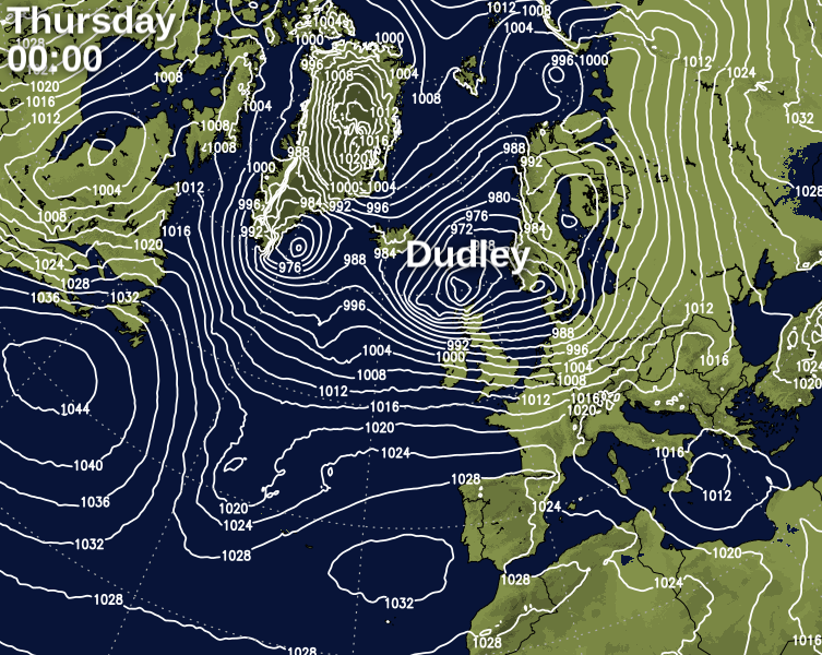
Starting with Dudley, it's expected to track just over or to the north of Scotland, with the strongest gusts likely to be through central and southern Scotland, into Northern England and also Northern Ireland. But, slight changes in that track could shift that core of very strong winds further north or south. Gusts may well peak in excess of 90mph in exposed locations, with 60-75mph possible more widely.
Storm Eunice is a different kettle of fish to Dudley, as it'll be a rapidly deepening system, which will have started life just 36 hours or so beforehand, out in the mid-Atlantic. It'll be going through a phase of 'explosive cyclogenesis' as it approaches the British Isles, as it will likely deepen more than 24mb in that period. That sort of deepening takes into the category of what some call a weather bomb.
The problem with rapidly deepening lows is that they're really tricky to forecast. All the forecast models tend to struggle to nail down their track and intensity until much nearer the time, which isn't particularly helpful in the case of a system that is looking very likely to bring disruptive weather.
Currently, the consensus between the various models is that it will bring the strongest winds across the south of Ireland, Wales, central and southern England. But, it could move further north, bringing Northern Britain more into play. Or, some models are suggesting a more southerly track. On top of the wind, with colder air in the mix to the north of the low, there will also be the risk of some heavy, disruptive snow as well.
Taking a snapshot at midday on Friday, this is how three of the major models are handing it currently:
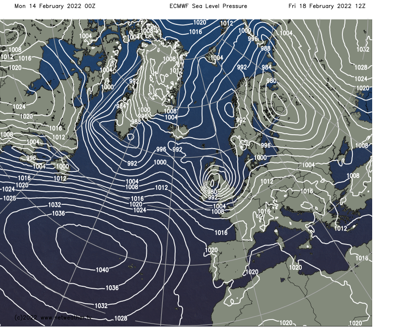
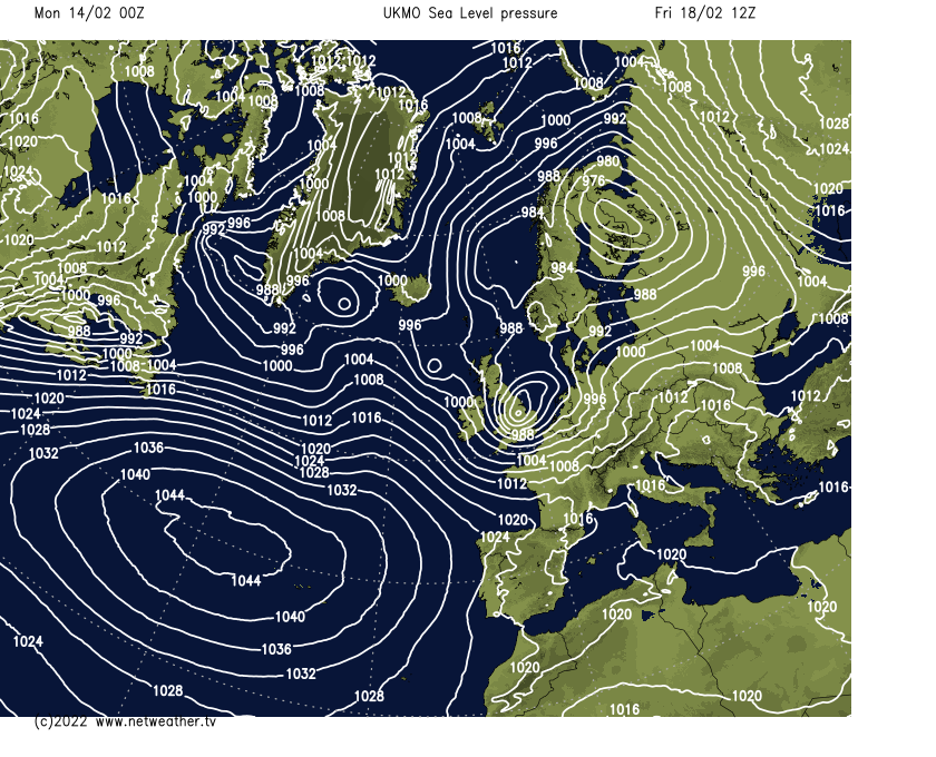
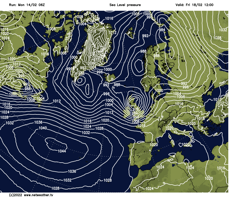
The ECMWF at the top is the middle ground currently, with the GFS (bottom) showing a more northerly track and the UK Met Office model taking it further south. These are just three options, though, with some models taking the low further south than any of these shows.
Just as with Dudley, though, winds of 80-90mph, perhaps higher, are likely in exposed locations in the worst affected regions, with the strongest winds likely to be around the southern flanks of the low. On the northern sides of the low, the winds will still be strong, but there'll also be the threat of snow, with blizzard conditions possible. Especially bearing in mind that Eunice is expected to arrive in the daytime on Friday, disruption is likely, and don't be surprised to see Amber or maybe even red warnings from the Met Office during the coming days.
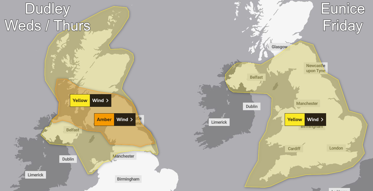
For now, though, an Amber warning has already been issued for Storm Dudley, for parts of northern England, southern and central Scotland and the north of Northern Ireland. That area may be adjusted in the coming days, though. There is also a yellow warning in place across Northern Britain for Dudley. And similarly, for Eunice, there's a broad yellow warning in place, covering England, Wales, Northern Ireland and Southern Scotland.
It's going to be a busy week, with a lot happening and with the potential for things to change at quite late notice as well. So, make sure you stay up to date with the latest local forecasts and weather warnings. And, if you do have travel or outdoor plans for Wednesday, Thursday or Friday, be aware that disruption and some dangerous weather conditions are likely.