A change in the weather pattern is starting to appear in the distance, but for the time being it's still quiet and dry with high pressure continuing to run the show.
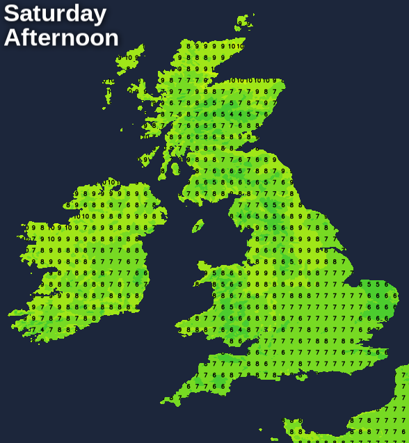
With high pressure still the dominating feature in our weather, you can throw a blanket over both days this weekend forecast wise, as there'll be little to choose between them. But as we progress through next week and into the start of February, there are some signs of change as our resident high slips slowly southwest.
Quickly looking at this weekend, there's more cloud around than there was at times last week. That's going to mean less overnight fog and frost, but also less sunshine in the day. There will be some to be had, though, especially to the east of higher ground and, today at least, in eastern England more generally.
With the high centred over southern England, the north and northwest of Scotland will once again be windier than elsewhere, with a few outbreaks of patchy or showery rain moving through at times. Thanks to those Atlantic sourced winds; it'll also be the north of Scotland that sees the milder temperatures, with highs of 9-12c here. For the rest of the country, 7-10c will be more like it.
Overnight, the cloud will keep temperatures widely above zero, but there are likely to be a few pockets of frost where skies clear. Tonight, perhaps chiefly in the far south and southwest of England, along with Wales. Sunday night could see some parts of central and eastern England added to that.
Early next week, we'll have a weather front coming into play again - moving down from the northwest from late Sunday and moving through Scotland on Monday. Initially, it may well have some heavy bursts of rain along it, but just as we saw with the fronts last week, the further south and nearer to the high pressure that it gets, the weaker it'll become. Ahead of it, it'll be a case of as you were, with varying amounts of cloud and the best of the sunnier spells likely to be through central England and Wales. Behind the front, there'll be clearer skies, a fresher, cooler feel and a scattering of showers for the north of Scotland.
Tuesday and Wednesday see a continuation of that theme, with the front perhaps getting stuck under the high across England and Wales for a time, bringing even more cloud.
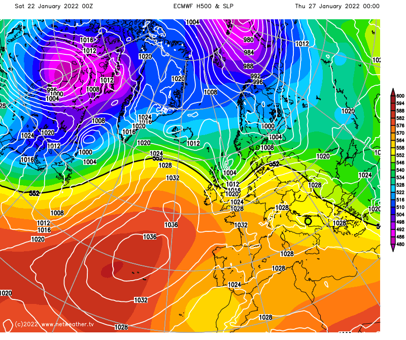
Thursday could be an interesting day, in that one or two models take low pressure over the top of the high and close to Scotland and Northern England, whereas others take that low out into Scandinavia. So that could be something to keep an eye on. The chart above, from the ECMWF, is one of the models taking the low closer by, currently.
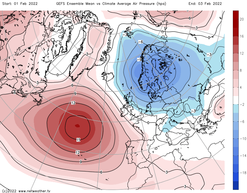
Then, the overall theme into the latter part of the week and the month is for the high pressure to gradually, perhaps somewhat erratically, slip further south and west. That'll allow low pressure to play more of a role across the north of the UK to start with, but as that trend continues into February, it does look like a more mobile, unsettled flavour of weather may eventually spread to all parts.