It's barometer setting time, with high pressure over the top of the British Isles, and likely to be drifting around overhead or very nearby for a good while.
It's barometer setting time, with high pressure over the top of the British Isles, and likely to be drifting around overhead or very nearby for a good while.
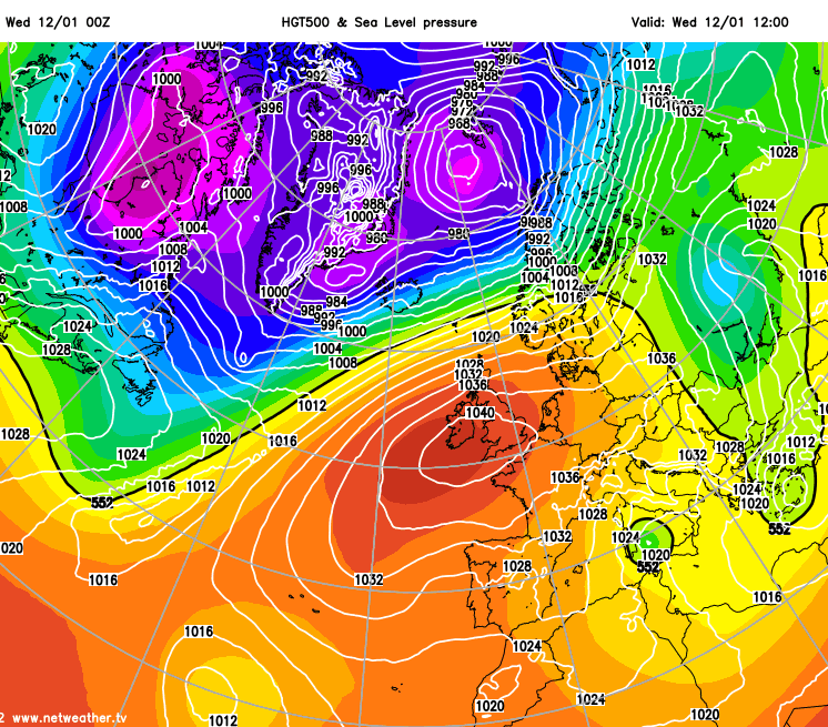
Not everyone is strongly under its influence at this point though, with Scotland, especially the northern half of the country far enough away from the centre to be seeing blustery southwesterly winds and some outbreaks of rain running in off of the Atlantic.
When high pressure is in charge, changes can be slow, so the weather you have today is highly likely to be very similar to the weather you have tomorrow, and so on. As it stands, that means England and Wales are best placed for sunshine, for the time being, particularly southern and central parts. It's also these regions most likely to see widespread overnight frosts and the threat of some dense fog patches.
Where the fog does develop overnight, it may be quite stubborn to clear into the next day, perhaps linger or lifting to just low-cloud throughout. That in turn will suppress the temperatures, with some spots hovering in the low-single figures where this occurs. Elsewhere, with mostly light winds across England and Wales, highs of 5-9c should feel fairly pleasant. Scotland will be a touch milder, with highs of 6-11c over the next few days.
As we end the week and move into the weekend, cloud and fog are likely to be more widespread. So, sunshine by day will be at more of a premium, which in turn will keep more people in a cooler range of temperatures of 3-6c.