Heavy rain clearing east this morning, followed by colder conditions with blustery showers in the west. Sunday drier and brighter in the south, showery in the north. High pressure builds in by Wednesday, so becoming dry and settled from mid-week
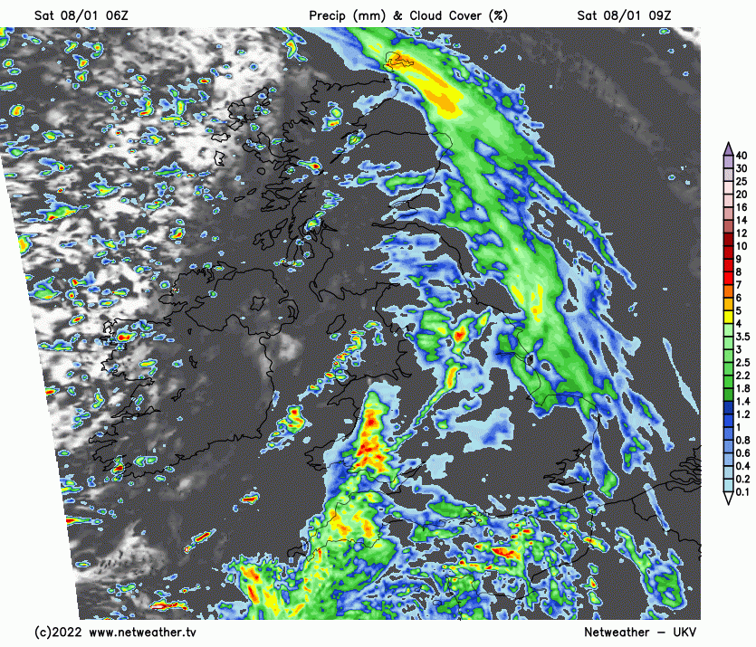
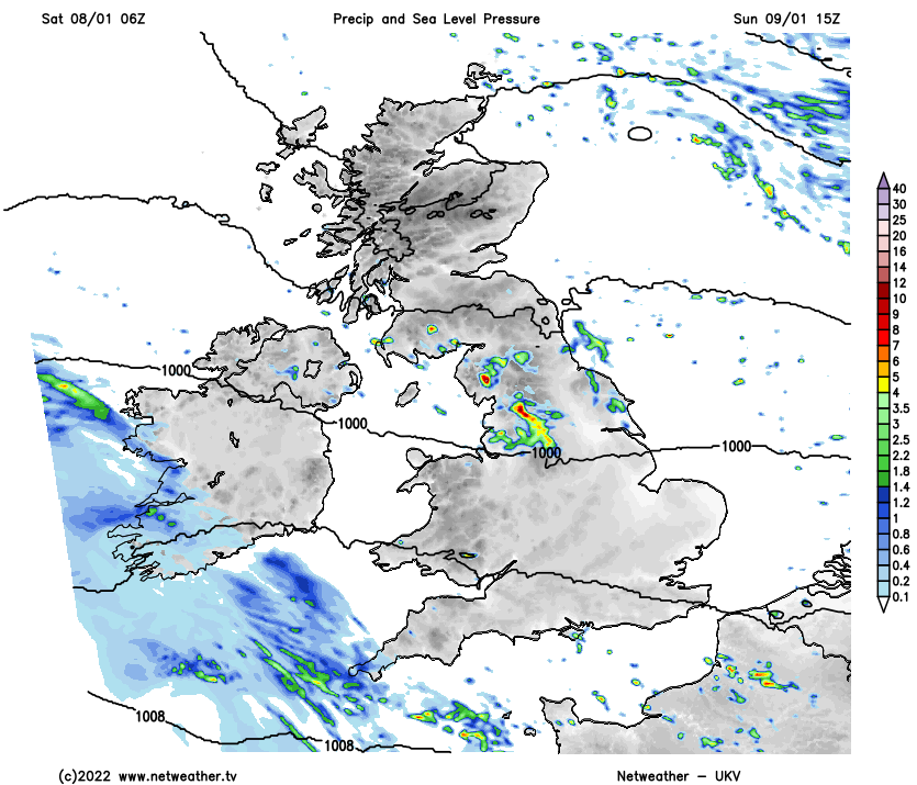
Snow and ice caused some travel problems across parts of Scotland and northern England and Friday and it was a cold day elsewhere too. However, it will be a little less cold through the weekend so there’ll be less issues with snow and ice, but it will be a wet start to the weekend, with some heavy rain moving through many areas today. Sunday will be drier with sunny spells for many, but there will still be some showers, mostly across the north.
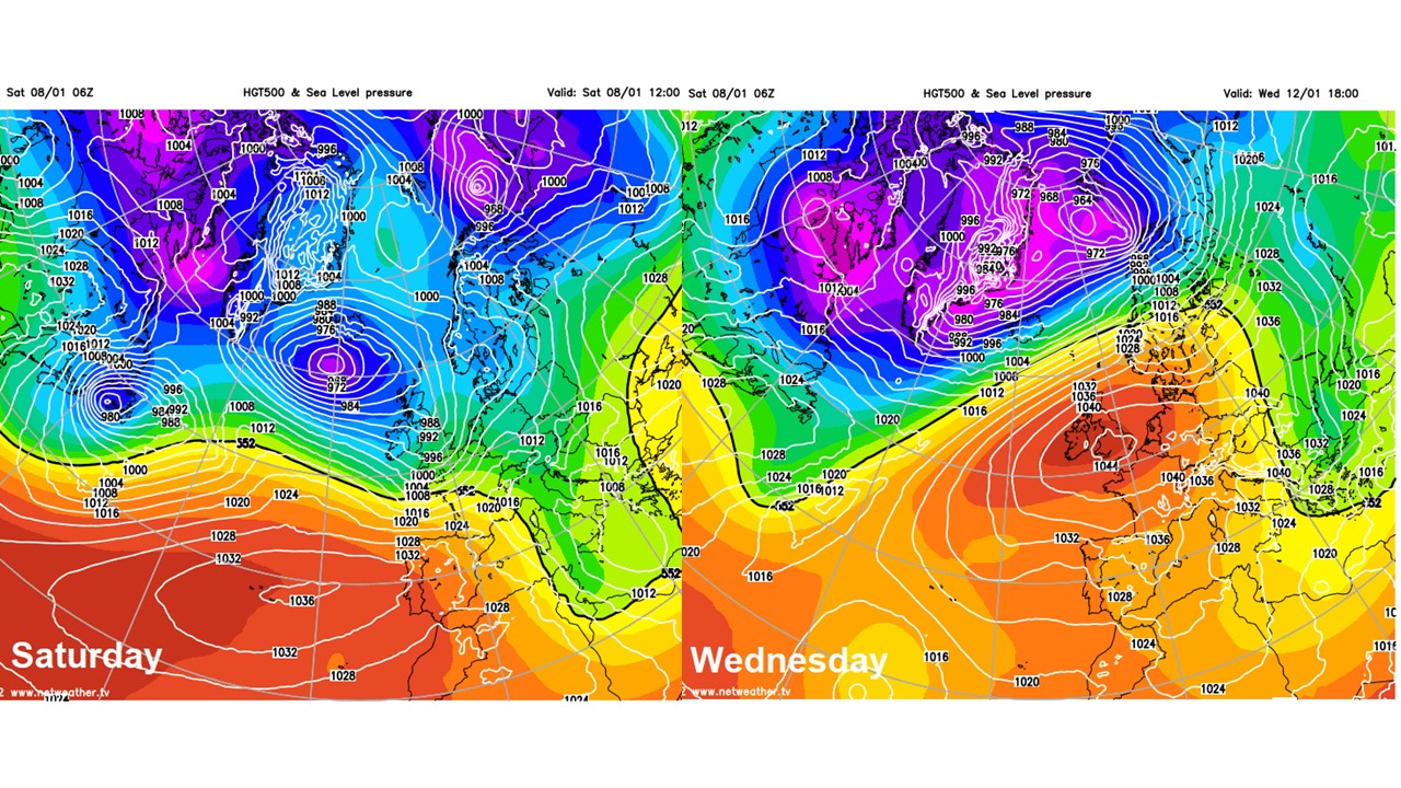
Next will see a slowly improving picture, it will be a cloudy and damp start to the week, as a slow-moving frontal system sinks southeast across the UK, bringing patchy outbreaks of rain or drizzle to many areas. However, from Wednesday, high pressure looks set to build in from the southwest across the UK, bringing dry and settled conditions mid to late week, though there will a risk of patchy fog and frost forming at night.
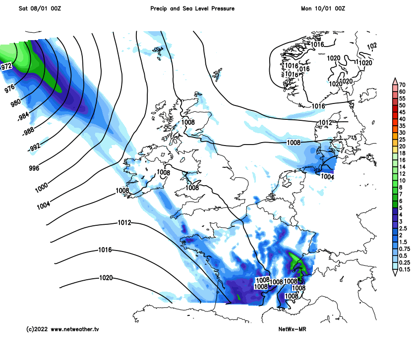
Back this morning, it’s a wet start for many areas, as frontal system moves east across the UK bringing outbreaks of rain across many areas. The rain is clearing east from Scotland and will be followed by drier, brighter but colder conditions from the west for the rest of today, though there will be scattered blustery showers across the west later. Further south across England and Wales, the rain will be slower to clear this morning, with a warm front followed by a cold front moving east bringing a cloudy morning with extensive outbreaks of rain. The cold front, which is across northern England, Wales and SW England at breakfast time, will bring a spell of heavy and squally rain as it clears eastwards this morning, followed by brighter but colder conditions will squally showers. The heavy rain probably not clearing SE England and East Anglia until late afternoon though. Some tricky driving conditions in the heavy rain.
Strong wind gusts along the cold front clearing east across England and Wales, followed by blustery and cold westerly wind. Despite this, it will be a little less cold than Friday, after a cold start in the east temperatures reaching 6-9C generally, perhaps double figures in the far southwest.
Staying blustery in the brisk westerly wind overnight and it will turn cold. Further showers, heavy with hail and thunder in places, across western areas which will also be wintry in the north, falling as snow over higher ground. Drier with clear spells towards the east. Temperatures generally holding up above freezing due to the wind, falling to 2-4C inland away from western coasts, perhaps a touch of frost across NE Scotland and in a few sheltered valleys further south, leading to a risk of some icy patches after today’s wet weather.
A drier, brighter and less windy picture generally across southern areas on Sunday, with some sunny spells, away from Cornwall and Devon, which will be cloudier with some rain moving in during the afternoon. Northern England, N. Ireland and Scotland will see some showers spreading southeast in the morning, wintry over hills, before turning drier and brighter from the northwest in the afternoon. Temperatures reaching 6-9C generally, perhaps 10C across south Wales and SW England.
The next frontal system will move in from the west early next week, but this one will be slower moving – as high pressure starts to build from the south. A warm front will reach western areas on Monday, bringing patchy rain or drizzle to western areas, some heavier bursts across the far northwest. After a dry and bright morning in the east, turning cloudier from the west but remaining mostly dry in the afternoon. The frontal system will then sink southeast across southern areas on Tuesday – bringing a cloudy day with patchy light rain or drizzle, drier and brighter conditions spreading southeast across northern areas, mostly dry but some showers across northern and western Scotland.
A dry and settled picture Wednesday onwards, as an area of high pressure builds in from the southwest across the UK. There will rather a lot of cloud in places floating around under the high on light winds, but there will be some sunny spells in places too. Daytime temperatures will be around average generally, but where skies clear at night frost is likely to form along with some freezing fog patches. With light winds, fog may linger in places during the day with temperatures struggling to get above freezing. The exception to the generally dry theme will be across the north of Scotland – which will be breezier and may see some cloud and rain off the Atlantic at times.