A cold westerly wind will blow in sleet and snow showers across mostly western areas today, drier and sunnier in the east. Unsettled but turning less cold over the weekend, rain for all on Saturday, showers for some on Sunday.
Friday will be another cold day, with sleet and snow showers across western areas blown in on a brisk westerly wind, these giving some tricky driving conditions this morning across higher routes. However, it will turn less cold over the weekend, but it will remain unsettled on Saturday - with a spell of heavy rain spreading east across all areas, with hill snow across Scotland. Sunday’s looking drier and brighter for most of the south, showers spreading east across northern areas.
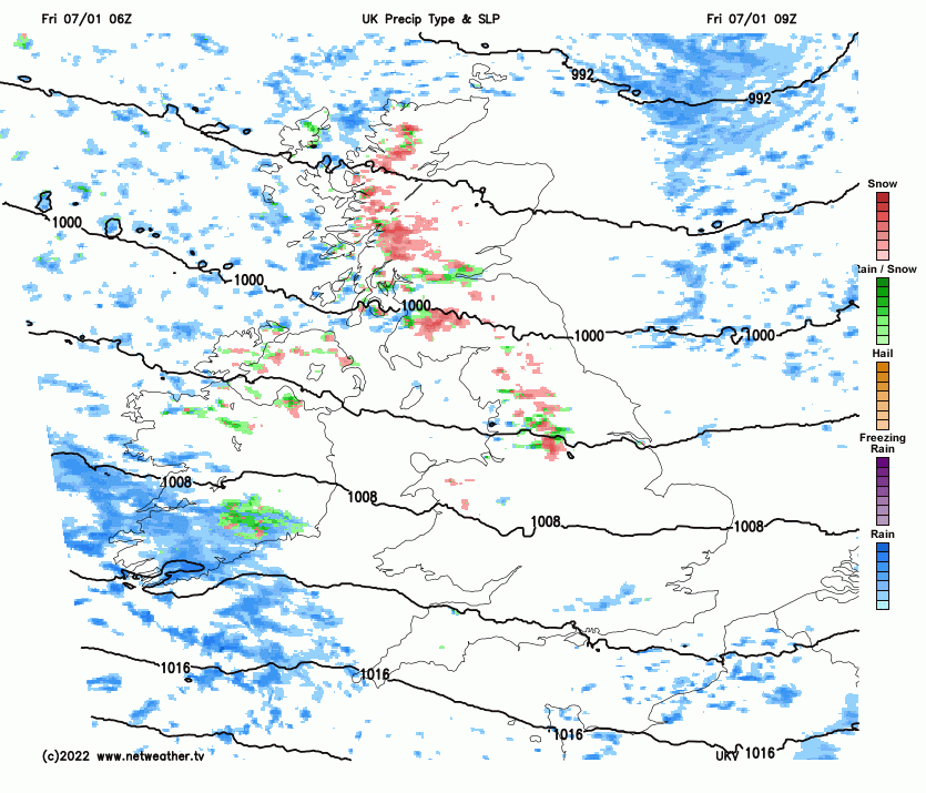
Back to this morning, snow showers have been piling in from the west across western and central parts of Scotland, northern England, N. Ireland and north Wales overnight, giving a covering of snow in places – which is leading to some tricky driving conditions, especially over higher ground. The A66 is closed in northern England as stranded vehicles are recovered. And there are some issues on other higher routes in northern England and Scotland. A met Office Yellow Snow Warning is in force until 11am for parts of Scotland, northern England and N. Ireland:
Elsewhere, temperatures aren’t far off freezing at dawn in some rural areas in the east, so there could be some icy patches on some untreated roads to watch out for on the morning commute or school run.
Sleet and snow showers will continue to be blown in across western areas of Scotland, NW England, N. Ireland and north Wales through the morning, spreading through the Central Belt and across the Pennines to NE England at times. Showers tending to turn back to sleet or rain at lower levels from late morning and then easing through the afternoon. A spell of rain, with sleet or snow over high ground, looks to spread southeast across the far south of Wales and SW England from late morning and into the afternoon, affecting the Channel Islands too. But for much of central and eastern England it will remain mostly dry and bright with sunny spells. A chilly day, temperatures reaching 3-6C generally, 7-9C across SW England and the Channel Islands.
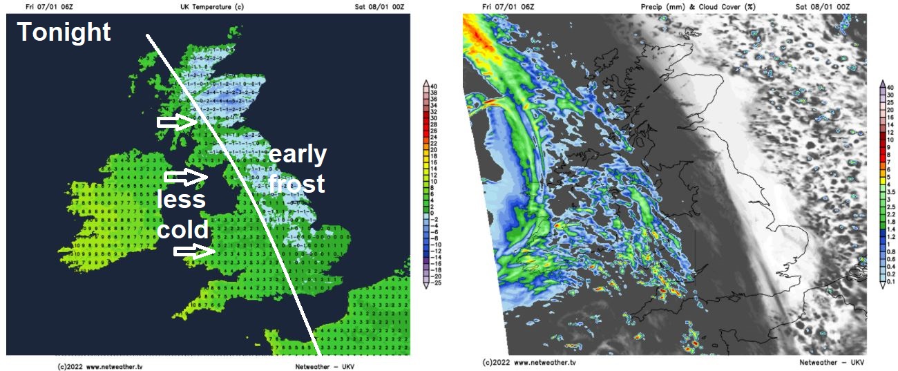
Showers dying out across the west this evening then most areas dry, clear skies in the east leading to a frost for a time, but cloud will spread in across the west by midnight, with outbreaks of rain spreading in from the west across northern and western areas in the early hours of Saturday, turning to snow across Scottish hills. Eastern and southeastern England remaining dry but early frost fading as cloud spreads in from the west with temperatures rising.
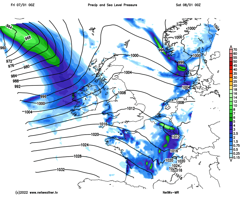
A wet morning for most on Saturday, as extensive outbreaks of rain spread east, the rain turning heavy as a cold front moves in from the west. Rain clearing Scotland through the morning to clear skies but with showers across the west, heavy rain clearing England and Wales through the afternoon to sunshine and showers from the west, though the rain perhaps not clearing SE England and East Anglia until late afternoon. Less cold than today, temperatures reaching 6-9C in the north, 9-11C in the south. But it will be a windy day, making it feel colder than the actual temperatures suggest.
On Sunday, a filling area of low pressure looks to move southeast across Scotland, bringing a spell of showers across northern areas, clearing from the northwest to sunny spells in the afternoon, showers falling as snow over high ground of Scotland. Southern areas looking mostly dry bar the odd shower across Wales, though outbreaks of rain may spread in from the west across the far southwest through the afternoon. Temperatures a little down on Saturday’s, reaching 6-9C across most areas, perhaps double figures across the far southwest.
Early next week and the strong westerly flow we’ll see over the next couple of days will start to ease away from the far north, as high pressure starts to build in from the west across the south into Tuesday. There will be a frontal system trying to cross east across the UK on Monday, bringing cloudy skies and some rain, mostly across Scotland, N. Ireland and northern England – patchy light rain or drizzle further south. Tuesday could be cloudy with patchy light rain or drizzle in the south, brighter in the north. High pressure building in across the UK for the rest of the week, so for most it will become dry and settled.