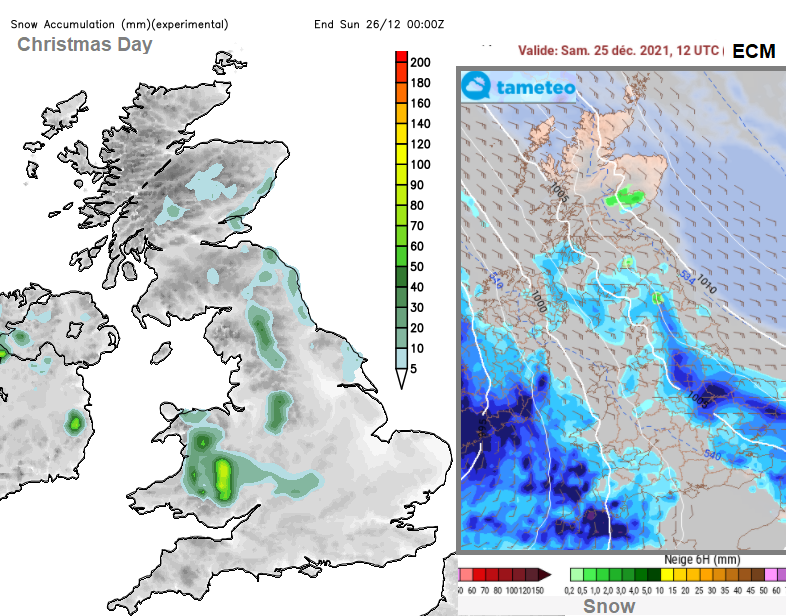
Rain from the Atlantic edges in with a milder southerly flow. Cold air waiting away to the north and wintry hints where the two mix.
Today we see a shift away from the steady high pressure setup to a more mobile Atlantic flow with frontal rain and more of a breeze. The question of the week is where the boundary will settle for Christmas. Between this incoming milder air from the southwest and colder air reaching down from Scandinavia. There could be some snow showers reaching NE Britain, but it will be the north side of the frontal rain that might produce the snow excitement.
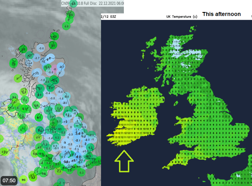
This morning there has been a frost for parts of Britain, others are stuck under the grey murk continuing from the high pressure. Northern Ireland is already feeling the change with more of a southerly wind and rain spreading across all counties. There is milder air with this, and it will reach over Northern Ireland, into Wales and SW England today.
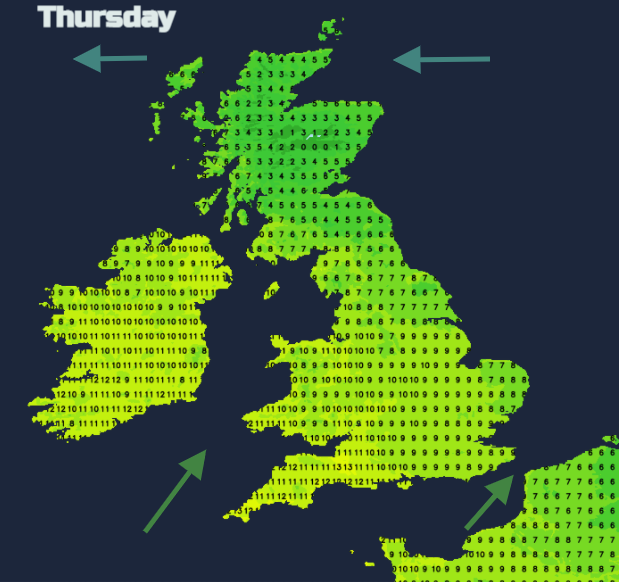
By tomorrow it will feel freakishly mild. Temperatures will move into double figures with 11 to 13C possible for SW Britain, all of Wales and Northern Ireland. It will be cooler for much of Scotland, away from the SW, and also NE England by day. The milder air continues to nudge up through Northern England during the evening, so mild for Thursday night. The far north of Scotland manages to stay in the colder air with an easterly wind. Any rain will be mixed with snow over the mountains.
Rain
There is rain in the forecast for the middle of the week, but SE and central southern England do look dry. The rain skirts up through Wales today, over Northern Ireland, northern England by this evening and then Scotland. Here, with colder air, there could be ice and wintriness for the Central Belt. The warm fronts then become fractured and the rain patchy.
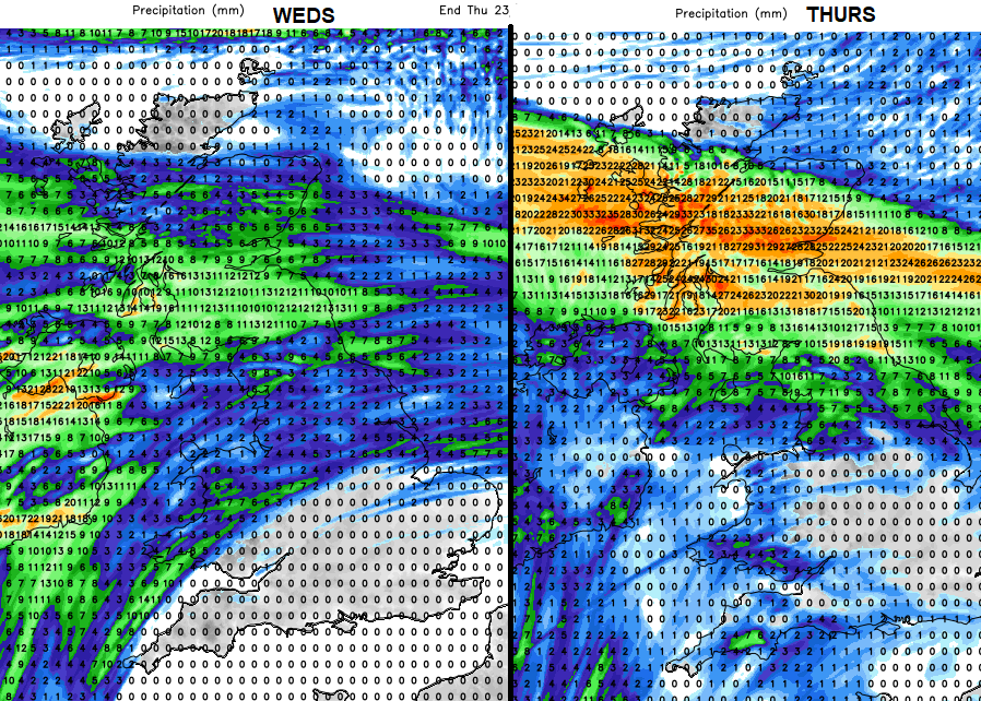
By Thursday morning other fronts will be moving in from the west with some heavier bursts of rain/ These affect Northern Ireland and western Scotland whereas the rain over Wales and SW England becomes lighter and fades. By Thursday late afternoon it will be wet for northern England and the rain spreading up through more of Scotland. Behind these fronts, there will be clearing skies and dry weather but for people travelling, the rain and spray could make conditions on the roads tricky. This rainband slows down over Scotland and becomes stationary through Thursday night, which is when it turns to hill snow.
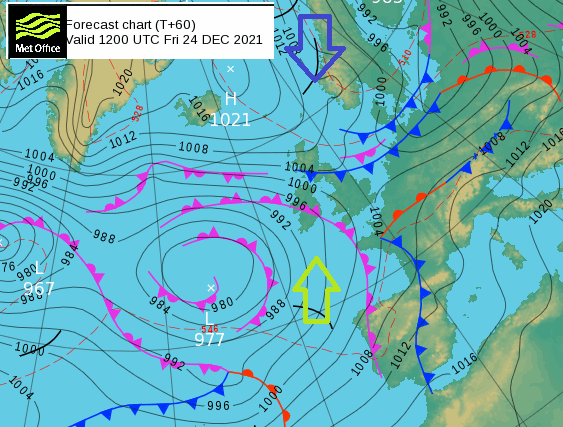
So, we arrive at Christmas Eve with mild air in the south and colder air and an easterly to the north. The northern frontal band edges down a bit, with patchy rain by lunchtime and the colder, clearer air behind.
A new occlusion pushes in from the southwest of the UK bringing a spell of rain, some of which will be heavy for a time. Further bands of rain push up from the south by Christmas Day. The uncertainty remains about the interaction of the cold air and this rain. A cold easterly wind will bring a chill for much of central and northern Britain later this week.