After calm, dry but chilly few days, turning unsettled and milder from Thursday. But the Christmas Weekend sees cold air fight back, with a risk of snow along the boundary between cold and mild, probably central areas.
High pressure has been in charge of our weather since the middle of last week, the anticyclone pulled in mild air initially, but temperatures have seen a gradual downward trend as its changed positions. So chilly but dry today and tomorrow. But we will see a gradual transition to more unsettled conditions from the west to end the week and, with it, milder air too. But, although the mild air will try to hang on across the south through the Christmas Weekend, it will have a battle against cold and dry Polar continental air pushing southwest from Scandinavia. The battle looks to play out across central parts of the UK over the Christmas Weekend and could bring some snow for some.
Chilly weather mid-week replaced by milder and unsettled conditions from the Atlantic, but colder air from fights back from the northeast over the Christmas Weekend, with some snow along this battleground.

It’s the winter solstice today, the shortest day of the year and the good news is the nights will slowly get shorter and the days lengthen from now on, but it probably won’t be noticeably discernible until February.
It’s been rather gloomy though today, but it’s been mostly dry thanks to high pressure over us. Where there have been some breaks in the cloud across parts of southern England, west Wales and NE Scotland, there’s been some sunshine this afternoon.
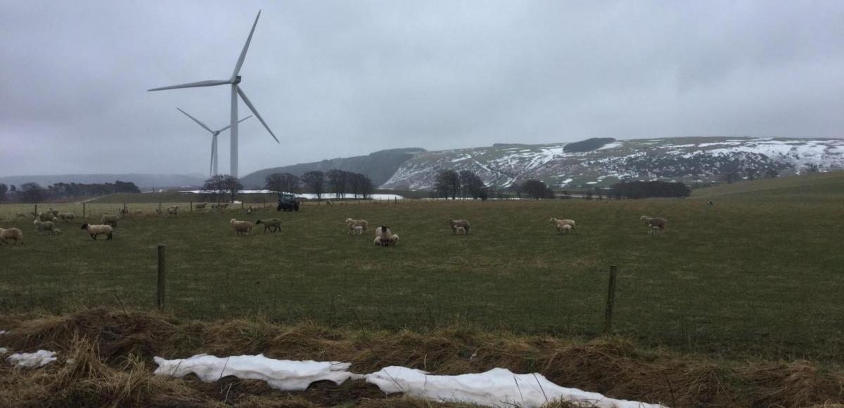
Cold with a widespread frost developing tonight as skies clear from the south
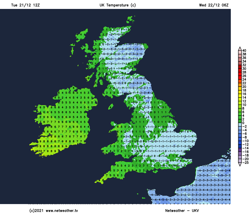
As we head into the evening and overnight, a southeasterly breeze will pick up, particularly noticeable in the far southwest of England and will bring in cold but drier continental air. So today’s cloudy skies should disperse to clearer skies more widely overnight, leading to a widespread frost. Temperatures dropping to -7C in the Grampians, -2 to -5C elsewhere. Likely remaining cloudy with the odd spot of rain in the far north of Scotland, while weather fronts and milder air moving north across the far west will bring thicker cloud, with rain spreading north across Ireland reaching N. Ireland by dawn.
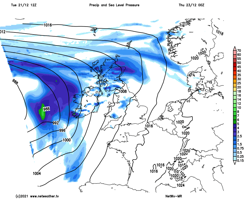
Cloudy across the west and northwest on Wednesday, with spells of rain spreading north across Ireland and N. Ireland in the morning spreading across the Irish Sea to affect west Wales, NW England and western Scotland through the afternoon. Falling as snow over Scottish hills where it will still be cold. Mostly fine, dry and bright across eastern areas, where it will remain rather chilly. Milder across N. Ireland, Wales and SW England, temperatures reaching 8-10C.
Milder air from the Atlantic eventually wins out and spreads northeast across most areas on Thursday, as sets of weather fronts push northeast ahead of low pressure out in the Atlantic, bringing spells of rain across most areas in the morning before turning drier in the afternoon. Staying wet across Scotland. Much milder across England, Wales and N. Ireland, temperatures reaching 10-13C. Colder Scotland, with 5-8C here.
Turning unsettled and milder with rain for many Thursday and Friday
As winds fall light under a brief ridge of high pressure Thursday night into Christmas Eve, there is a risk of some dense fog forming overnight, so something to bear in mind if you are up early travelling, with Christmas Eve likely the busiest day on the roads of the Festive Season. After a dry, bright but, in places, foggy start, turning increasingly unsettled through Friday and into the Christmas Weekend. Friday will see an area of rain move in across the southwest in the morning before continuing northeast across England and Wales in the afternoon. Scotland mostly dry and bright in the west, wintry showers towards the east. Further showery rain in the south during the night, so Santa may get a little wet here.
Christmas Day will likely be cloudy and damp across England and Wales, outbreaks of rain and mild in the south at first, patchy rain in the north turning increasingly to sleet and hill snow through the afternoon, as cold air tries to push south across northern England and north Wales. There is a chance of more persistent sleet and snow developing across parts of Wales, Midlands, parts of northern England and across to eastern England during the evening and overnight as heavier pulses of rain push north and bumps into cold polar continental air trying to push southwest. Uncertainty how far south the snow risk will get. Scotland mostly dry but cold in a raw easterly wind, away from eastern coasts which will see some snow showers.
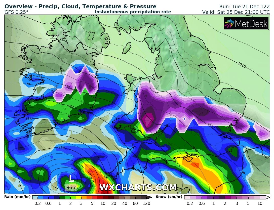
Rain, sleet and snow across England and Wales on Boxing Day, slowly easing and clearing southeast later in the day. Scotland and N. Ireland mostly dry and bright but with a raw easterly wind. Cold everywhere, but particularly so in the north.