The quiet, calm but often cloudy and murky weather continues but as high pressure begins to ease away in the run-up to Christmas, changes are on the way.
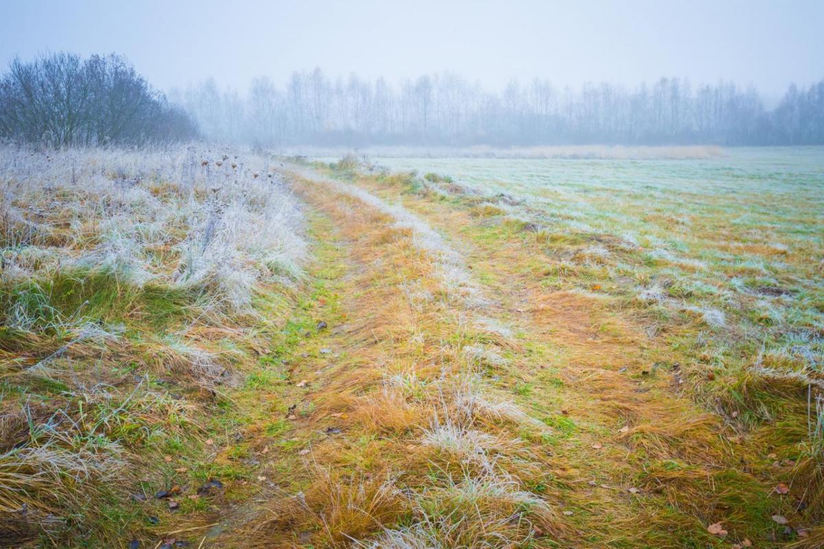
While some parts continue to see sunshine but with cold frosty nights (it was -8C first thing at Braemar this morning), many central, southern and eastern regions, particularly of England, remain in anticyclonic gloom.
This, coupled with the covid situation, adds to the depressing conditions, particularly for those suffering from S.A.D. And today's conditions remain much the same, with tomorrow a little brighter for central and eastern areas, as a light North Easterly breeze lifts the murk a little.
Today, a large anticyclone remains slow moving just o the North of the country, but with pressure gradually leaking away over the next few days as the anticyclone moves slowly to the East. Today will be similar to yesterday, with only subtle changes in mostly light winds across the country. Skies remain clear over much of Scotland and in the West, giving winter sunshine, but with night frost and lingering patches of fog, some are dense and freezing. But where you keep the gloom, it'll be dank and misty generally with fog mostly over hills thick enough at times to give drizzle or light rain here and there.
While we associate anticyclones with quiet, dry weather, it's not unusual at these times in the winter months to register a very light rainfall when murk is accompanied by drizzle. But over the past few days, the air has been so damp that rainfall totals above 2mm have been recorded at some locations in a 24 hour period. This despite often clear skies, only a few hundred feet above the gloom.
Top temperatures in the sunshine today will be 5 to 8C, but where fog lingers over Scotland and in the North, you'll struggle to get much above freezing-point.
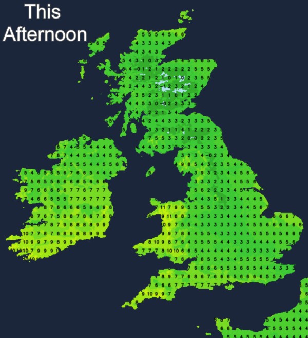
Frost will return where skies stay clear after dark, although patchy fog may not be quite as extensive. with lowest temperatures zero to -2C, but as low as -6C in the coldest spots. The diurnal range will be much less where you keep the gloom, say 6 to 9C by day and 3 to 5C overnight, keeping a frost away.
Tomorrow may be somewhat colder than today, but it shouldn't be as gloomy or damp, with skies lifting a little in a light North or North Easterly breeze. There'll continue to be a lot of cloud, especially in central and eastern areas, with perhaps a few sunny intervals coming through here later. The best of the sunshine should remain in the North and West giving another quite pleasant day for some, once early frost and patchy fog has cleared, which may continue to linger over parts of Northern Ireland and in some Scottish glens. Top temperatures 5 to 8C.
After dark, patchy fog and frost return, and a weak front moving in from the North East will give variable amounts of cloud. Eastern areas should have a better chance of skies clearing once the front moves through, but apart from this giving a little light rain or sleet in places, it'll continue mainly dry. Winds remain light from a North Easterly quarter with lowest temperatures primarily in the range zero to -3C, but where you keep cloud, you'll just about escape a frost.
It continues mainly dry but rather cold until mid-week, but it turns more unsettled as we approach the festive period. For parts of Scotland and the North, there's a good chance of a white Christmas, but further South rain seems more likely than snow, with the latter perhaps chiefly on hills. There's a lot of uncertainty over this at the moment, though.