The unsettled weather continues for now, but high pressure will start to build later next week.
We're currently in an unsettled spell of weather with near-average temperatures, and some eastern parts have woken up to a frost this morning. But, we already have milder air with cloud and rain across most western areas, heavy at times in west Scotland and lighter elsewhere.
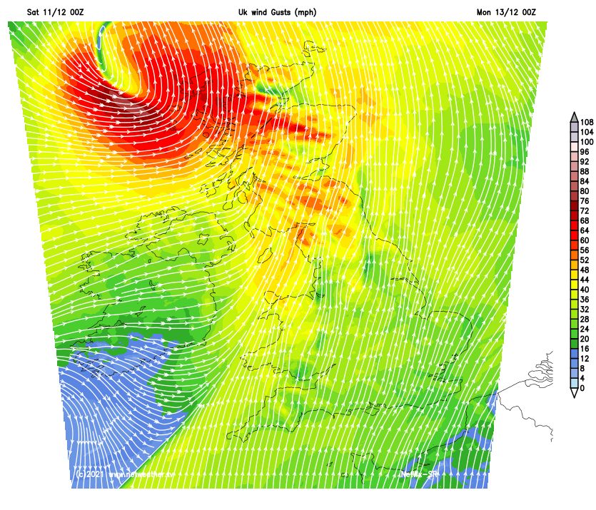
This milder, cloudier weather will spread to the rest of the country through the rest of today and will persist for most of next week. Overnight on Sunday into Monday, some very strong winds are also expected in the north and west of Scotland, which could produce damaging gusts, especially around exposed west-facing coasts and hills.
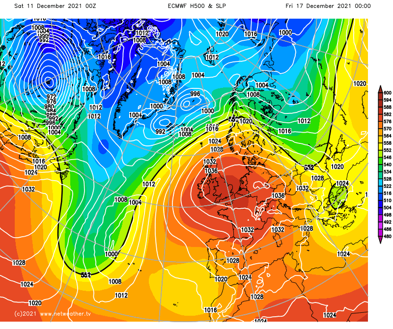
However, for the longer term, there is robust support for high pressure to build from the south by next weekend, which will bring dry weather with temperatures falling back to around the seasonal average.
The cloud and rain will spread to most of the country by lunchtime, though some parts of south-west England, particularly to the east of high ground such as Exmoor and Dartmoor, may stay dry. The rain will generally be light to moderate and intermittent, but with heavier bursts over western Scotland, Cumbria and west Wales. It will take until early evening for the rain to reach East Anglia, but from around midday onwards, East Anglia and the south-east will also cloud over. There will be some snow on high ground in Scotland, mainly in the Highlands.
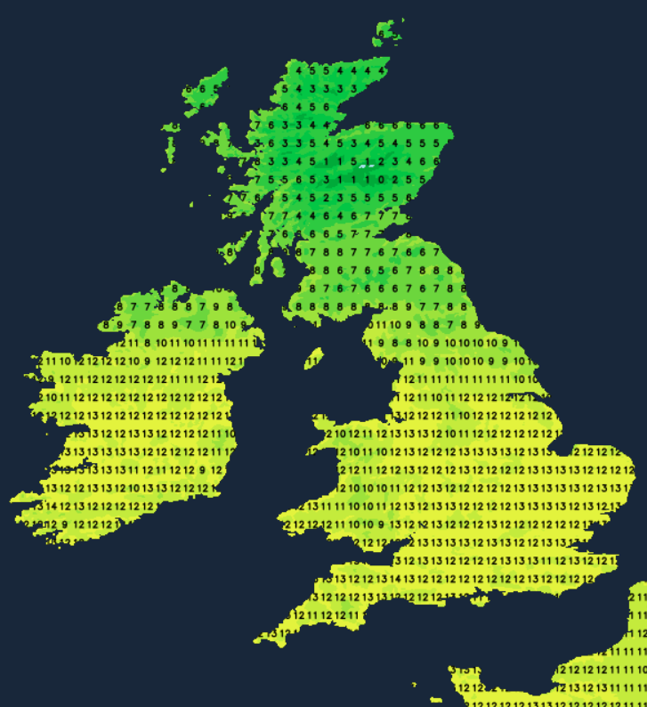
For most eastern parts of the UK, it won't be particularly mild for the time of year, with daytime highs of 5 to 7C, but the milder air will already be making inroads into Northern Ireland, west and south Wales and south-west England, where highs of 10 to 12C will be typical.
The milder air will spread across England and Wales overnight tonight, with temperatures generally rising in eastern areas. Still, some colder air will temporarily move into Scotland and Northern Ireland, with temperatures falling to between 2 and 4C in many places and some frost in frost hollows in Scotland.
Tomorrow will be a cloudy day for most, but it will start bright in northern Scotland, and some sunshine will come through in parts of England and Wales later in the day, particularly to the east of high ground. It will start quite cold in Scotland, and Northern Ireland but mild over England and Wales, and this warmer air mass will spread northwards through the day.
A band of light rain will spread into southern Scotland, Northern Ireland and the far north of England towards midday and will then head northwards through the rest of Scotland. It will also turn very windy in the west of Scotland. Further south, it will be a dry day. Temperatures will be much higher than in recent days over most of England and Wales, with widespread highs of 12 or 13C.
Monday looks set to be overcast over most of England and Wales, with an area of mainly light rain spreading from the south-west. Still, most of Scotland and Northern Ireland look set to have a brighter day, with showers in western Scotland and the north and west of Northern Ireland.
During the early hours of Monday, it will be very windy in the north and west of Scotland, with damaging gusts likely in the far north-west, primarily affecting Orkney and Shetland.
 For Wales and central and southern parts of England, it will be another mild day with temperatures of 10 to 12C, but colder further north, with showers falling as sleet and snow on high ground in Scotland.
Some central and northern parts of the UK will see a slight frost on Monday night, but it looks like being cloudy and mild for most on Tuesday and Wednesday, with persistent rain for western Scotland, generally dry elsewhere. After that, high pressure is set to build across the country, with some unusually high pressure, widely over 1035mb, perhaps exceeding 1040mb, promising dry weather with temperatures falling to around average.