On the chilly side today and tomorrow, rain moving east later, followed by sunny spells and showers Friday. Milder southwesterly flow developing over the weekend, bringing cloud and some rain, temperatures in double digits on Sunday
Storm Barra dominated the weather over the last few days, the low that brought the storm moved across northern England filled and weakened yesterday, but brought a blustery and showery day for many. The low has now moved away northeast and following will be a drier and brighter morning for many. Eastern areas will stay dry and bright this afternoon, while a band of cloud and showery rain will push in across western areas by late afternoon, before moving east across all parts this evening. A brisk northwesterly wind following for Friday, with sunshine and blustery showers, feeling chilly in the breeze.
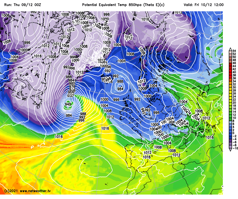
Then all change over the weekend, as winds turn southwesterly – bringing in milder air across all parts by Sunday, but with it, a lot of cloud and some rain in places. It will be an increasingly breezy weekend, turning particularly windy in the northwest on Sunday, with gales, as a deepening Atlantic depression tracks northeast to the west of Scotland.
Chilly end to the week, but milder air will flood in from the southwest through the weekend, with double-digit temperatures on Sunday:
Back to today, a cold start for many. Many areas with temperatures in single digits at breakfast time, across Scotland and northern England temperatures are close to freezing. For many a fine and bright morning, mostly dry bar some showers towards coasts in the northwest. Staying dry and bright or sunny across eastern areas through the afternoon, but in the west it will cloud over with a band of showery rain moving in from the west. For many it will be a chilly day, temperatures reaching 6-8C at best generally, but milder air moving in across SW England and the Channel Islands will lift temperatures to 10-11C.
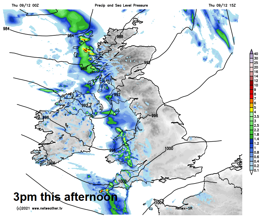
Band of cloud and showery rain will continue to move east towards eastern areas this evening, falling as sleet and snow over higher ground in the north, before the band clears the east coast in the early hours of Friday.
Any lingering overnight rain across coastal East Anglia and Kent clearing by dawn on Friday. A brisk northwesterly wind following and bringing sunnier skies across all parts for Friday, but also blowing in some scattered showers. Most of the showers towards western areas but a few filtering through towards eastern areas too. Showers wintry over higher ground in the northwest. Another chilly day, temperatures reaching 5-8C generally, perhaps 9C in the far southwest.
A chilly start to Saturday, especially towards eastern Britain – where temperatures will be close to freezing with a touch of frost. Winds turning southwesterly and strengthening through the day, so it will turn milder across the west, though eastern areas perhaps staying chilly until later in the day. The southwesterly wind will bring in increasingly cloudier skies through the morning after the dry and bright start, with outbreaks of rain pushing in from the west across Scotland and western areas further south by lunchtime. Outbreaks of rain spreading east and affecting most areas through the afternoon.
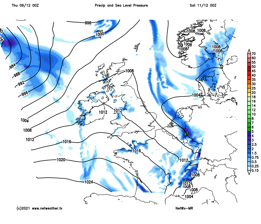
Sunday another cloudy day, with patchy rain across northern and western areas, patchy drizzle elsewhere, perhaps more persistent rain for western Scotland. A breezy day, windy across the northwest, with gales or severe gales developing later in the day across N. Ireland and western Scotland, as a deep low moves northeast to the west of Scotland. But the brisk southwesterly wind will bring rather mild air – with temperatures widely reaching double figures, as high as 13C in the south – which is way above average.
Potential for gales or severe gales in the far northwest later on Sunday

Credit: wxcharts.com
Continuing mild or very mild and windy at times next week with a southwesterly flow persisting. Mostly cloudy though, with rain at times in the north and west, southern and eastern England mostly dry with the best chance of seeing some sunshine.