Overall mild with no widespread frost but often a good deal of cloud and some fog. Wet and windy in the far northwest but drier and calmer further south.
More mild weather this week although there could be a shift for the start of next week. There will often be a lot of cloud with grey, murky conditions. Some fog but no widespread frost and only weak weather fronts giving patchy rain, except for the far northwest. Here, Scotland will see wetter and windier weather.
The only signs of snow are over the tops of the Scottish mountains, in wintry showers on Tuesday night when colder air brushes past the far north of Britain. Otherwise, we see temperatures just into the teens by day and falling down into single figures by night but still not a proper chill.
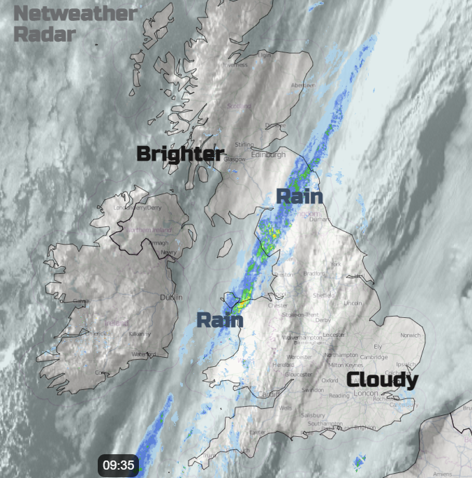
With all the beautiful autumn leaves now turning and falling it is a shame not to see more sunshine to set off the beautiful colours. There is a frontal band across the UK today and behind that, there will be clearer skies and so sunny spells appearing for most of Northern Ireland and parts of Scotland.
The Azores high keeps trying to settle our UK weather down although low pressures run in off the Atlantic, closer to Iceland. That provides more unsettled weather for northern Scotland and the rain for the far NW, but the high pressure keeps much of England and Wales drier this week.
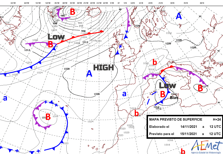
The Azores high is keeping the weather fine for the Canary Islands, some cloud with sunny spells but temperatures in the low 20sC seem okay. There is unsettled weather through the Mediterranean with low pressures just stuck, bringing heavy rain to Mallorca, blustery winds and troublesome waves around the south of France and Corsica now. Meteo France is calling the main low ‘depression #Blas’. This is the second name on the Western Group Storm list for this season.
No storm action for the UK, it’s all been rather quite as well as strangely mild. We’ve yet to see an autumn storm, no Arwen used yet from the Northwest naming group.
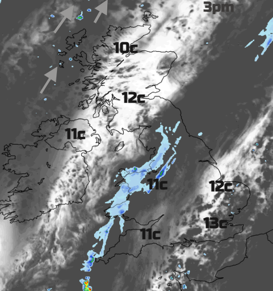
The fog will be slow to clear in places and the grey cloud remains this morning. Through the afternoon brighter spells will appear for SE Britain with temperatures up to 13C and hardly any breeze. The frontal rain band nudges down to NW England and north and west Wales. This becomes more light and patchy overnight as it drifts across the Midlands. The far northwest of Scotland will become windy with strong SW winds and rain. However, there will be clear skies over northern mainland Britain and Northern Ireland allowing temperatures to dip down into single figures. Other breaks in the cloud from the Wash down to the Isle of Wight could allow a touch of frost but nothing much.
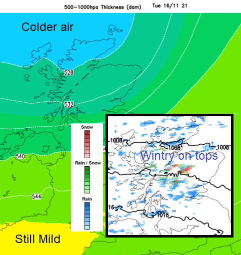
Tuesday a more active cold front pushes in from the northwest on Tuesday with heavier rain for western Scotland as the winds pick up. It looks to be a wet week here as frontal systems keep clipping this part of the UK. A colder start on Wednesday, bright with a few wintry showers over the Scottish mountains but still calm and fine in the south with mist. By Thursday we will be in the warm sector and daytime temperatures will be up to 14 or 15C.