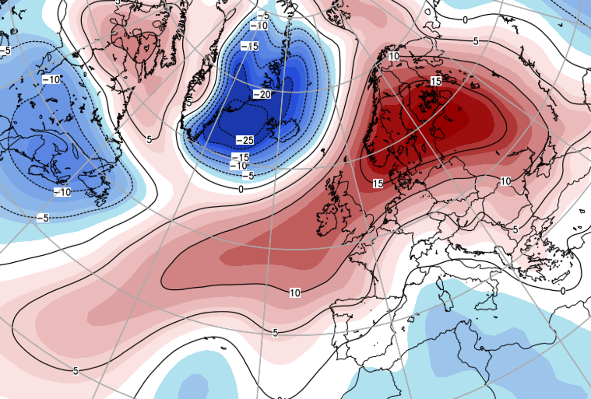
High pressure is well in charge of the UK's weather this weekend, so for the majority, it's going to be dry, with temperatures still warmer than normal for the time of the year. There will be a couple of exceptions though, at opposite ends of the country.
High pressure is well in charge of the UK's weather this weekend, so for the majority, it's going to be dry, with temperatures still warmer than normal for the time of the year. There will be a couple of exceptions though, at opposite ends of the country.
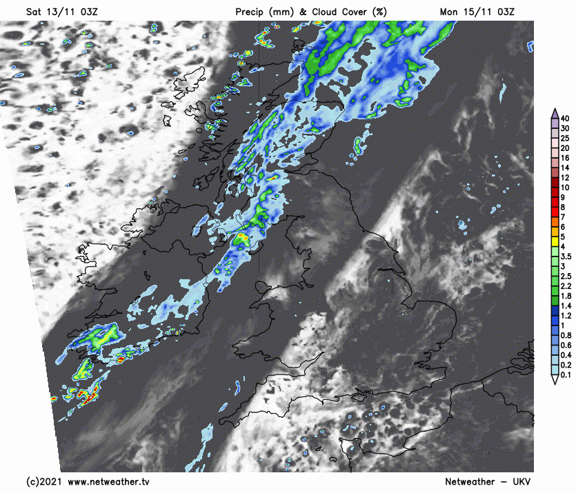
Firstly, there'll be a feed of scattered showers in the southeast corner, East Anglia and perhaps a bit further north in other eastern coastal counties of England. These thanks to low pressure nearby over the continent. It'll drift ever further away through the weekend, so by Sunday, and the showers should be even fewer and further between. Second, the far northwest, where fronts will be moving in from the Atlantic over the top of the high pressure, bringing some mostly light, patchy outbreaks of rain later on Saturday, ahead of a more organised and heavier band on Sunday.
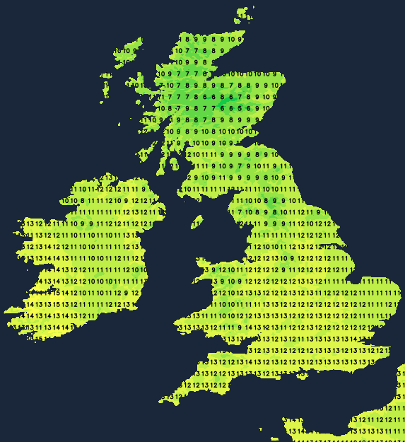
Beyond those two regions, though, there'll be some long sunny spells - especially in western and central areas today (Saturday) and across a good part of England and Wales on Sunday. So, with temperatures of 10-14c, it'll feel a lot more pleasant than usual at this time of the year. Average maximum temperatures in November are around 8-10c.
With clearer skies, and despite the mild airmass, temperatures will tend to take a dip in central, inland parts of the country overnight. That'll allow for a ground frost to form in places, along with some potentially dense patches of fog, which may take a little while to clear on Sunday morning.
Looking ahead into next week, the front, which will have brought rain into the northwest for the end of the weekend, will work its way further south overnight and into Monday. The further south it gets, though, the less rain will be along it, with southern and central regions probably not seeing more than a few spots by the time it gets there later in the day on Monday. Ahead of it, there'll be a fair amount of cloud with sunnier spells more fleeting than we'll have seen over the weekend. Behind it, there should be plenty of sunshine with just a few showers moving into the far northwest. It'll be windy across the north and west of Scotland, with low pressure not too far from Iceland exerting an influence.
That low will push another weather front southeast into Tuesday, again though the rain along it will become increasingly patchy the further south and east it gets, as it runs more into the influence of high pressure. But even so, it looks like having a bit more about it than Monday's effort, with some heavier bursts of rain likely. With the low pressure itself a bit closer by on Tuesday and Wednesday, it'll be blustery across the northern half of the country, and breezy elsewhere, blowing from the west to northwest and making for a cooler feel.
If you're wondering about the prospects of colder weather, the latter part of November may see a change arrive with some northerly outbreaks a possibility.