With an ongoing flow from the southwest, it will often be mild. Mostly dry in the south but blustery rain passing the far northwest and occasionally spilling down through the UK at the start of this week.
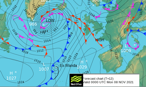
A deep low pressure close to Iceland will be throwing its weather fronts over the UK today and tomorrow. The warm front brings heavy rain to NW Scotland with strong southerly winds, but the cold front looks to be a weaker, fading affair. Even though the frontal boundary by then includes the remnants of ex-Wanda, an old Tropical Storm which has wandered about the northern Atlantic until finally it got caught up by the large extra-tropical system.
The weather is still unsettled in the central Mediterranean, with a low pressure edging its rain westwards over Sardinia, the south of France and towards Mallorca, Ibiza and Barcelona. For SE Europe it is turning colder as a cold front pushes south through Greece and Turkey. Autumn is being seen across Europe now although little snow so far. Upland Scandinavia will see snow during Tuesday as the system over the UK reaches colder air over Norway tomorrow,
Another low pressure looks to work its way across the UK by Thursday, but High pressure could then build to bring a more settled but cooler weekend. This week looks warmer than average with the winds from the southwest or west.
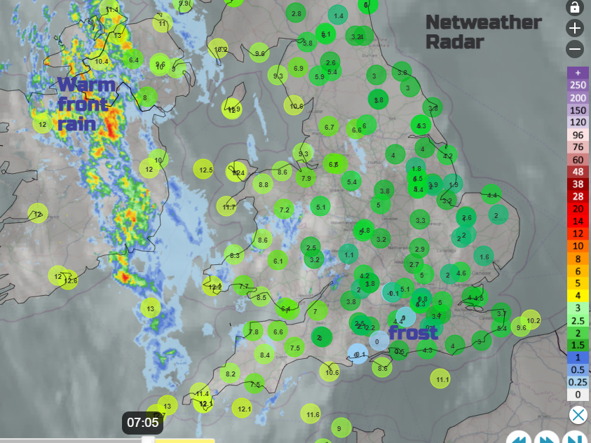
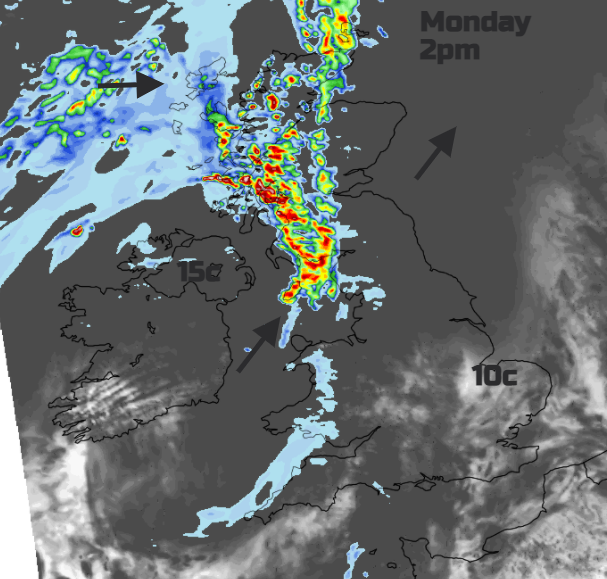
This morning was cold with a touch of frost for inland central southern England but soon wet for Northern Ireland as the warm front moved in. This district band of rain will reach western Scotland by midday with strong southerly winds along the coast. Ahead of the rain, it will be quiet, bright but cool with temperatures of 9 to 13C. Further west, in the warm sector, up to 14 or 15C as the wind veers to the southwest.
At times western coasts will become damp and grey in this flow but the main rain area will still be the far northwest this week. Much of the UK has a dry week overall. The cold front will make its way southwards on Tuesday, soon away from Northern Ireland. Then from southern Scotland and NW England, it stalls over Merseyside, Lancashire and Wales through the day.
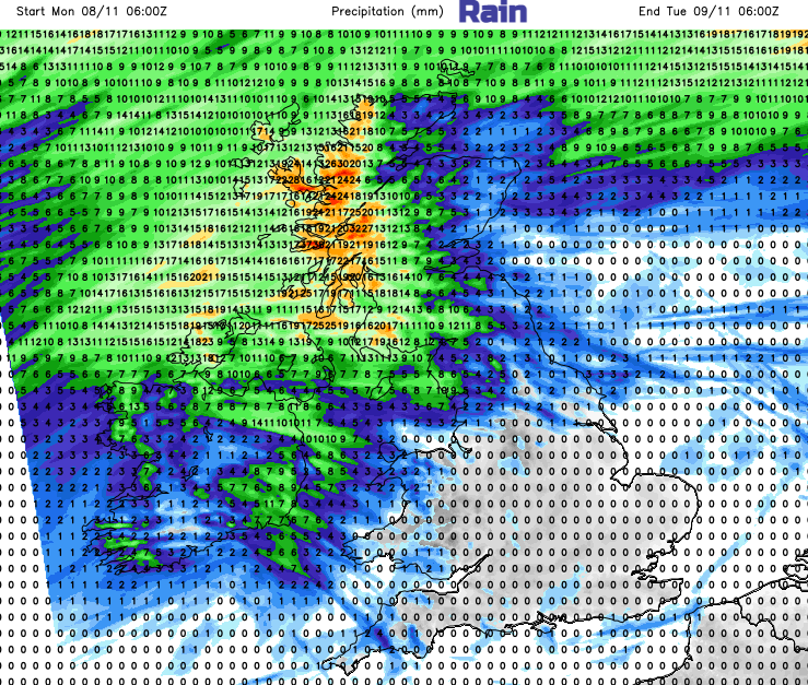
As the weak front slips over the Midlands for Tuesday night it will be murky and damp but mild whereas further north temperatures dip down into single figures. The faded front leaves more cloud over southern Britain for Wednesday morning but sunshine and a nip in the air to the north. In the colder air, Yorkshire could see some fog and the frontal band could give more rain by day, there is uncertainty here in the forecast.
Then the high starts to build in, although as so often happens at this time of a year, a low pressure swings by as a rude interruption. That looks to bring a spell of wet and blustery weather to N. Scotland from Thursday night and more of the northern half of the UK on Friday.
So milder than average overall for this working week, mostly dry in the south and east and unsettled in the far northwest.