Winds will ease in the north during Sunday, while many parts of the country see a dry, bright end to the weekend. A mixed start to the working week then follows.
For most, this weekend, the weather has been fair enough for the Guy Fawkes celebrations, but in the North especially, there's been some rain to dampen down the bonfires. Last night there were blustery showers, but above all, the wind was the main spoiler, with gusts up to 70mph into the early hours over northern Scotland.
So we begin this morning with a Met Office yellow warning of severe gales for the North of Scotland before winds steadily decrease through the day. We also have a scattering of blustery showers mostly over the North and West of Scotland and North West England, but these too will eventually fade as pressure rises from the West. For the remaining areas, it'll stay dry in a day of variable cloud and sunny spells, the best of which will be in the East. But across Northern Ireland, you'll see cloud increasing more generally through the afternoon.
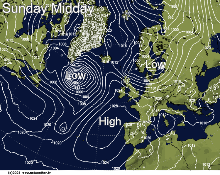
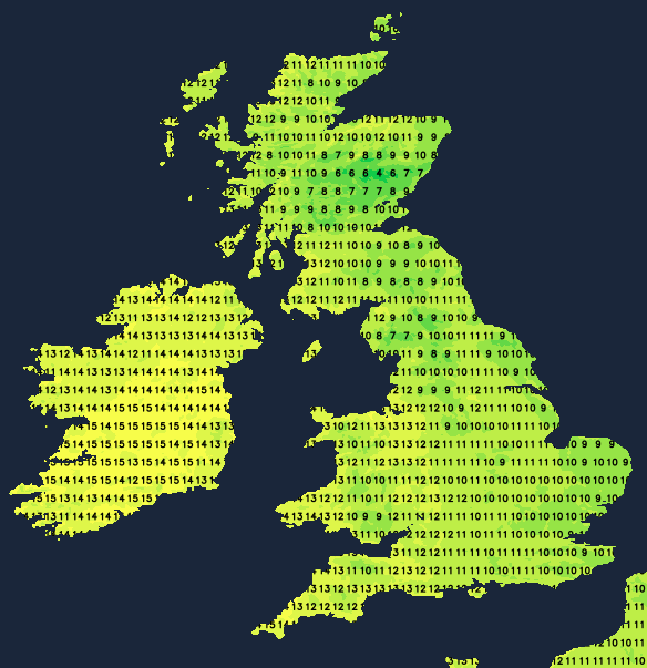
The severe North Westerly gale over northern Scotland will moderate while elsewhere, a primarily moderate or fresh West or North Westerly wind becomes light towards dusk. This'll make it feel somewhat colder than yesterday, but top temperatures of 9 to 11C in the North and 12 or 13C further South will be close to normal for early November.
In a dry evening for most, there'll be clear spells, and as winds become light, it'll turn cold enough during the night for a touch of grass frost over sheltered rural parts of East Wales and central and eastern England. In the West, cloud will be increasing, with outbreaks of rain over Northern Ireland spreading to some other western parts before morning. Here a freshening southerly wind will be introducing milder air, with lowest temperatures about 7 or 8C in the West and 2 to 4C further East.
Many eastern areas start the new working week on a bright note with a little sunshine, but it'll tend to cloud over from the West. Elsewhere expect a lot of cloud and some patchy rain, much of which should be light, with the heaviest bursts over the North and West of Scotland and Northern Ireland. East Anglia and the South East may also see a few spits of rain later, but it'll probably stay dry here. A South to South West wind will freshen, becoming strong over exposed parts of the North and West. After a chilly start in the East, temperatures reach 10 or 11C, but it'll be milder in the West, with a very mild 14 or 15C possible across Northern Ireland later.
Most parts see an overcast evening with patchy rain. This'll be heaviest over Scotland and Northern Ireland, where the North and West may see a change to clear intervals and blustery showers by morning. A South West wind will be strongest in the North and contain the remnants of ex-tropical storm Wanda so parts can expect a mild night, with temperatures generally not falling below 8 to 12C.
There'll be some rain or showers during the remainder of the week, but with pressure relatively high and winds mostly from a southerly quarter, there'll also be a fair amount of mild, dry weather. It'll be murky at times, especially later in the week with mist and patchy fog for much November is renowned.