After yesterday's heavy rain, showers and, in places, thunderstorms, today willa0be a colder and quieter day for most of the country.
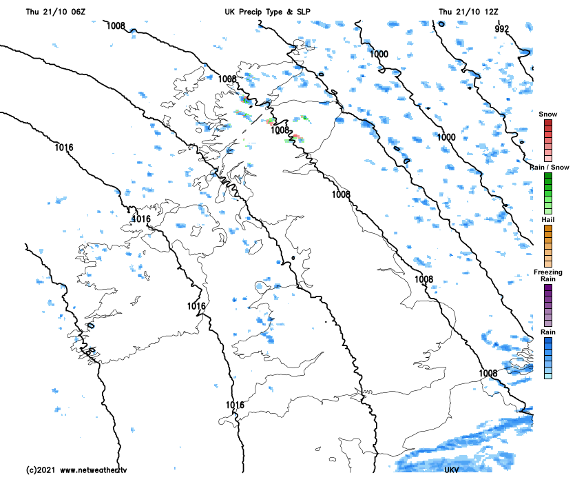
After yesterday's heavy rain, showers and, in places, thunderstorms, today will be a colder and quieter day for most of the country. There will be some showers in northern and western Scotland, Northern Ireland and north and west Wales during the morning, and rain will be quite slow to clear over East Anglia.
The showers will fall as rain at low levels, but there will be sleet and snow on high ground in Scotland. We also have some showers spreading south along the Yorkshire coast. However, most of the country will have a dry, sunny morning.
 As the winds change to a more west to north-westerly direction during the afternoon, showers will develop more widely in western parts of the country, particularly west Scotland, northwest England and the West Country. Some isolated showers will also break out elsewhere.
However, for most of the east and south-east of Scotland and the eastern half of England, it will remain dry with plenty of sunshine once early rain clears East Anglia and the south-east, and the showers over East Yorkshire will move out into the North Sea.
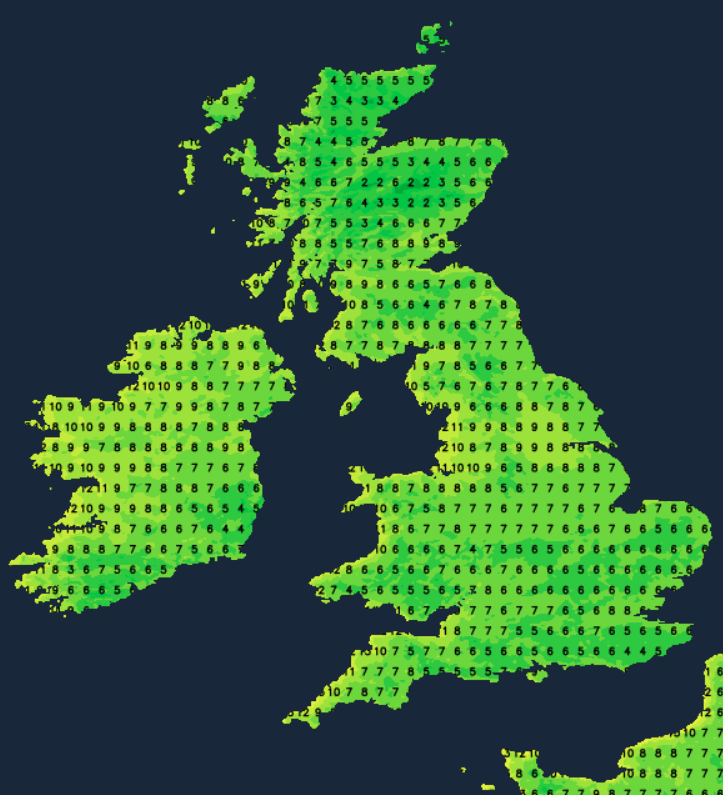
It will be a much cooler day than we have been used to recently, despite the sunshine, due to a blast of cold air from the Arctic. In low-lying parts of Scotland and Northern Ireland, highs of between 7 and 10C will be typical, with 10 to 13C in most parts of England and Wales, possibly 14C in some sheltered southern areas.
Despite the colder air mass, frost won't be very widespread tonight, as there will be a moderate west to north-westerly wind. In central and western Scotland, Northern Ireland and northwest England, there will continue to be showers. Temperatures will fall to between 5 and 8C in most central and northern parts of the UK, but in south Wales and southern England, lows of 2 to 4C will affect some sheltered locations, with potential for a slight frost in places.
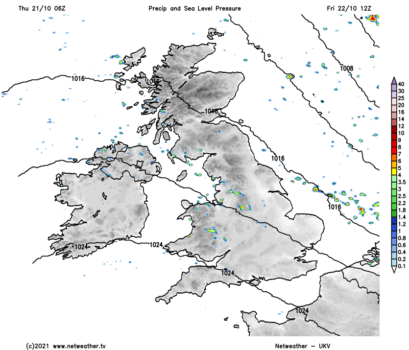
Towards dawn, showers will spread more widely across the Midlands and the north of England.
Tomorrow, the "Cheshire Gap" feed of showers will affect northwest England, the Midlands, and East Anglia. There will also be some showers in Wales, Northern Ireland, western Scotland and also the West Country, albeit generally fewer showers for north-western parts of the country (with the exception of northwest England) than we'll see today.
Elsewhere, there will be some isolated showers, but most places will stay dry, and all areas are expected to see a fair amount of sunshine again. With the winds blowing from a westerly rather than northerly direction, temperatures will be a little higher than today, reaching between 8 and 11C over most lowland parts of Scotland and 11 to 14C over England, Wales and Northern Ireland.
With winds easing off, Friday night will see quite a widespread frost in inland parts of Scotland, with minimum temperatures of between 0 and 3C. But elsewhere, lows of 4 to 6C will be typical. So again over England, Wales and Northern Ireland, there will be nothing more than a slight frost in some prone frost hollows.
The generally unsettled regime will continue, although rainfall amounts are not expected to be high for most this weekend. Saturday will start dry and sunny in eastern England. Still, it will turn cloudier and windier from the west, with rain spreading through Northern Ireland and central and western Scotland during the afternoon and evening. The rain will tend to fizzle out as it heads eastwards through the rest of the country on Sunday, with brighter weather and some showers spreading into the west. Temperatures will recover back to around or slightly above average for the time of year by Sunday.
During next week there is potential for the weather to turn somewhat warmer with southerly and south-westerly winds, particularly late in the week, but this is subject to change at this range.