Torrential thundery downpours spreading east across parts of England & Wales, Scotland and N. Ireland drier. Thursday turning much colder as winds turn northwesterly bringing arctic air.
Tuesday was an exceptionally mild day for the second half of October. Although it was cloudy for many, damp for some in the north and west, where the cloud thinned and the sun appeared – the temperature climbed to 21C in London and Norwich. It was even warmer further south across France, with foehn winds descending the Pyrenees lifting the temperature to 30C in the Basque area of SW France.
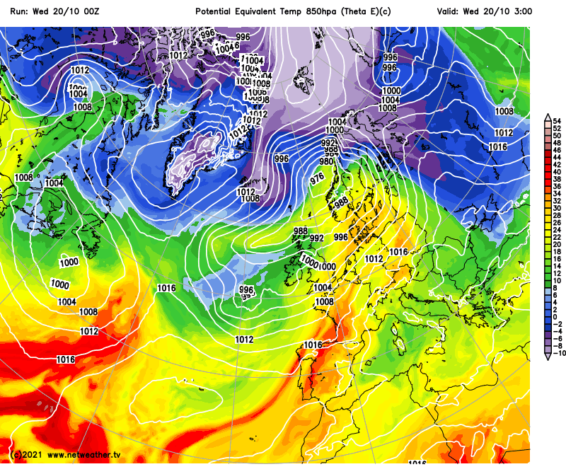
But a big change is on the way over the next 24-36 hours, with Tropical maritime air bringing the unseasonal warmth these last few days replaced by Arctic maritime air tomorrow – bringing a colder feel for everyone. Friday night may see a frost in the north.
A change of airmass: very mild Tropical maritime air will be replaced by colder Arctic maritime air on Thursday:
During the transition to colder conditions, there will be some rather lively weather. A cold front clearing east brought some heavy rain overnight in the south. But following will be further heavy downpours, even some thunderstorms, spreading from the west across southern parts of Britain.
Winds will switch from the mild southwesterly since the beginning of the week to a colder northwesterly bringing air from the arctic on Thursday. But it will be drier and sunnier for southern areas, coastal showers in north. Northwesterly wind easing on Friday, so feeling as cold, with most dry and bright too away from coastal showers.
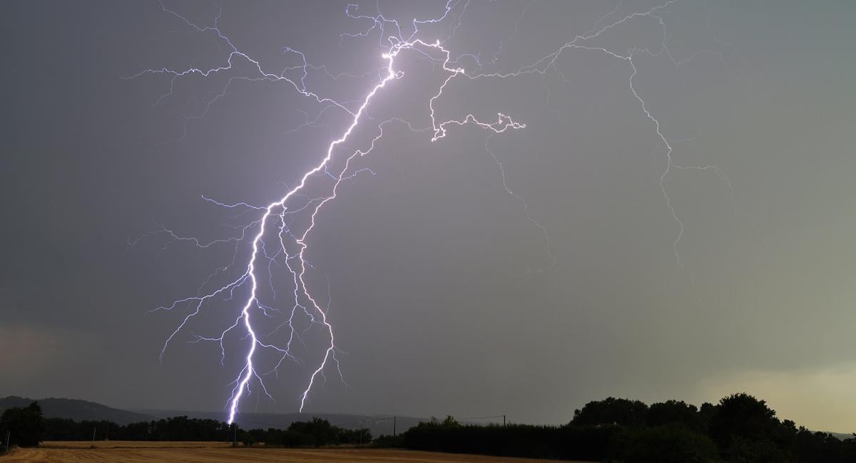
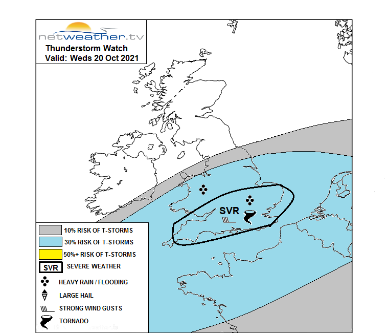
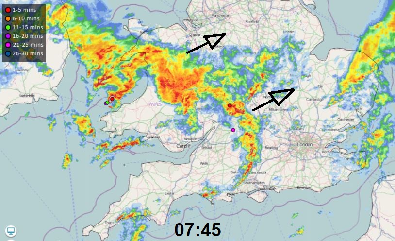
The last day of very mild weather today, but it could be rather wet in places across the southern half of Britain. There are torrential downpours with thunder and lightning from the word go moving in across SW England and south Wales before dawn, while rain, locally heavy, along a cold front continues to clear SE England further east. A Met Office Yellow Warning for Thunderstorms is in force for Wales, The Midlands, parts of southern and eastern England. While Netweather has a severe thunderstorm watch in force for southern England.
Windy with thunderstorms or heavy showers continuing to spread east across Wales, southern England and the Midlands, southern NW England and on towards eastern England through the morning. There is a risk of flash-flooding from these downpours leading to hazardous driving conditions, while strong gusty winds are possible too. The heaviest of the downpours should clear eastern England early afternoon, followed by sunny spells and the odd lighter shower. Though heavy downpours or longer spells of rain will return across SW England early evening. Mild in the south, temperatures reaching 14-17C.
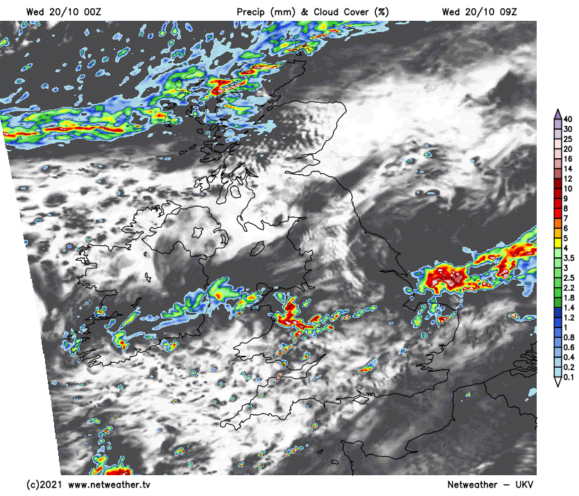
Much of Scotland and N. Ireland seeing a mostly dry and bright morning, but a band of rain along cold front will push down from the northwest across northern Scotland late morning, then the rest of Scotland through the afternoon and evening. Some snow possible over the mountain tops – as colder arctic air digs in from the north.
An area of low pressure will track across the far south of England this evening and overnight – bringing a spell of heavy rain and gusty winds mainly south of the M4, but perhaps a little further north. The rain clearing Kent in the early hours. Turning colder further north, as a brisk northwesterly wind sets in, showery rain spreading southeast in places, falling wintry over higher ground of Scotland.
Feeling much colder on Thursday for all, as a strong northwesterly wind brings air down from the arctic. Most places will remain dry with sunny spells, but there will be showers across northern Scotland and coasts of the north. Showers wintry over higher ground of Scotland. Gales down the North Sea coinciding with Spring Tides could bring some coastal flooding along North Sea coasts.
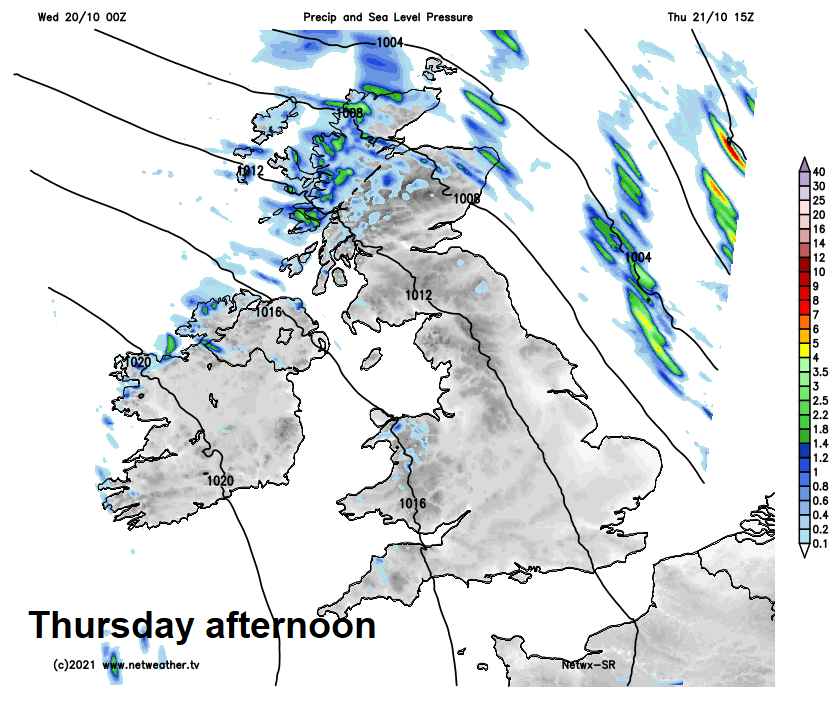
Friday will see winds ease as high pressure builds in from the west, so not feeling as cold. There will be a few showers around in the north and east, but most places will remain dry and sunny.
Saturday’s looking mostly dry and bright or sunny – as a ridge of high pressure remains in control, though it will turn cloudy, wet and windy across the far west in the evening. Sunday windier with showery rain spreading east, though SE England and East Anglia may stay dry and bright.