Lines of showers with sunshine today before a low pressure creeps over Wales and England during Tuesday. Still windy for North Sea coast midweek. Then warmer with heavy rain in NW linked to ex-Sam
This weekend’s low pressure brought wet and windy weather at times but did allow some sunshine. It is pulling away from northern Scotland this morning, but its frontal bands have brought severe weather to Spain and France.
MeteoFrance Mon Oct 4th Red warning – “Very active lines of thunderstorms. Accompanied by violent phenomena; rainfall intensities of the order of 40 to 60 mm in a short time, strong gusts of wind and hail. Bouches-du-Rhône: 80 to 120 generalized...locally up to 200 or occasionally 240 mm.” In Brittany, Nantes set a new rainfall record with 98.3 mm recorded in 24 hours at the weekend. There has been snow over the Pyrenees and warnings remain for very wet and windy weather over for Majorca and Ibiza with strong winds for Barcelona.
Parts of the UK saw 20 to 30mm of rain on Sunday with the top temperature being in London at 18.2C. As this vigorous autumn low clears western Europe, it leaves the UK in a SW flow with blustery showers and sunny spells today.
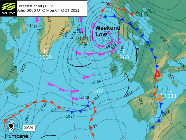
Another low pressure develops for Tuesday bringing wet and windy weather as it slows over Britain. Then we turn to Sam. Currently, a hurricane as this transitions into a post-tropical low, although the main focus heads towards Iceland its fronts will bring heavy rain over the NW of the UK later this week. It will feel warmer to the south.
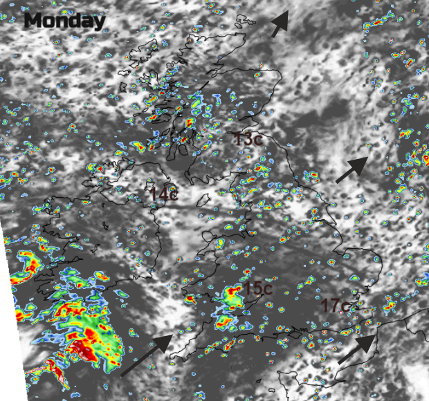
Today’s showers will move north-eastwards in lines. So, some parts will see several downpours but others miss the rain and have a fair day. Temperatures are down a bit now, 12 to 17C and cooler in the breeze. Later in the day more persistent rain arrives for SW England and SW Wales which will be heavy through Monday evening. The winds strengthen around the coasts of Cornwall and Devon and then along the English Channel from the south.
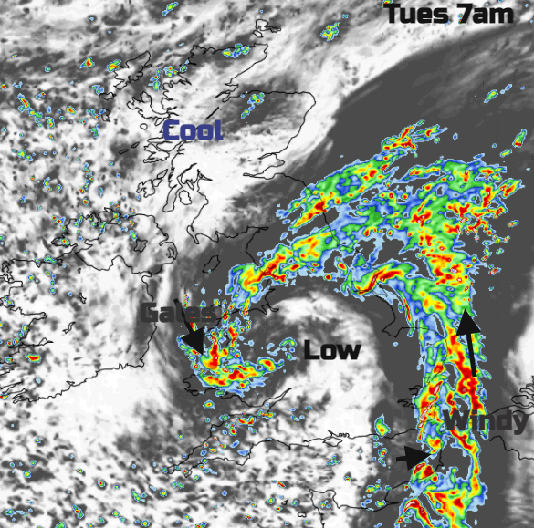
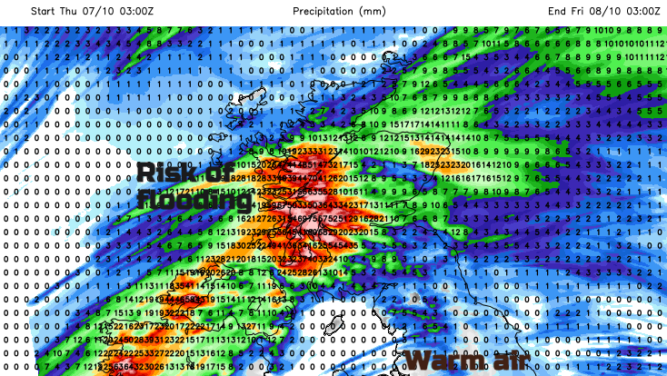
Scotland and Northern Ireland will have a cool start with sunshine and just a few showers drawn down from the north. The swirl of rain will be over Wales and sections of England (and the Scottish Borders) slowly edging eastwards away from Wales. There will be a dig of N to NW winds following on, making the day feel colder. By late afternoon it will be eastern Britain with more cloud, showery bits for eastern Scotland and still raining over eastern England. Strong winds along the A1 into NE England could cause some travel disruption on exposed stretches. Then wet and windy for eastern England as the low slowly pulls away into Tuesday night, which could cause some localised flooding. Cold and clear behind.
The chilly wind will still be a feature for east coast England on Wednesday morning, but it will be a fine sunny morning.
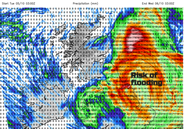
Next, we have the frontal bands associated with ex-hurricane Sam. The UKV shows heavy and persistent rain in Northern Ireland, mainland Scotland particularly the west and southern Ireland. Flooding issues are possible but to the south of this rain, it will be dry and fine and warm. Temperatures move back up to the high teens by day, even 20C with very mild nights but there could be some early morning fog to watch out for. The GFS shows the main rain further northwest with much lower totals and a fine weekend. The UKV and ECM keep the frontal band with some rain lurking longer and nudging down to Wales and northern England by the weekend.
Blustery showers for some today, a low pressure for Tuesday with wind and rain particularly for eastern England into Wednesday. Then watching out for the heavy rain from ex-Sam over NW parts of the UK later this week but fine, warm and settled away to the south of that front.