The weather remains unsettled for the foreseeable, with areas of low pressure moving through bringing spells of rain or showers across all parts. There will be some drier, sunnier interludes too. Feeling cooler than recently, but temperatures close to average.
September up until the end of the weekend has seen a prolonged period of dry weather and summer-like warmth for many. However, Monday saw quite a marked drop in temperature as a sharp cold front moved through from the west, though temperatures fell close to average reaching the high teens compared to Sunday, when temperatures were widely in the low twenties Celsius. The cold front bringing the cooler air was marked by a distinct squall line as it cleared east across England, bringing a brief spell of intense rain accompanied by strong wind gusts and even a suspected tornado in Lincolnshire – which overturned a motor home and caused some damage to buildings near it.
The cooler and fresher air is here to stay for the rest of the week, areas of low pressure moving through will bring spells of rain interspersed with brighter and showery periods, it will often be windy too, so an autumnal feel for everyone.
Overnight, showers have continued to feed in on the brisk southwesterly wind across western Scotland, N. Ireland and western areas further south. Showers across Wales and NW England merging in longer spells of rain for the morning commute and school run. Meanwhile, further east, it’s a generally dry and bright or sunny picture across eastern Scotland and eastern England, though sharp showers are pushing in across SE England. Everywhere a cool and fresh feel to start the day.
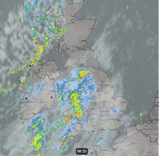
Outbreaks of rain, locally heavy, will continue to spread northeast across Wales and NW England through the morning, this area of rain and gusty winds extending east across northern England, SE Scotland, The Midlands, southwest and central southern England from late morning and through the afternoon. Turning cloudier across eastern England with showers continuing to affect SE England. Sunshine and showers for the rest of Scotland and N. Ireland. Afternoon temperatures reaching 13-16C in the north, 16-18C in the south.
Band of heavy rain and squally winds clearing eastern England and eastern Scotland this evening, clearer but showery conditions arriving in the west. Most areas becoming dry with clear spells overnight, though there will be some scattered showers continuing around some western coasts.
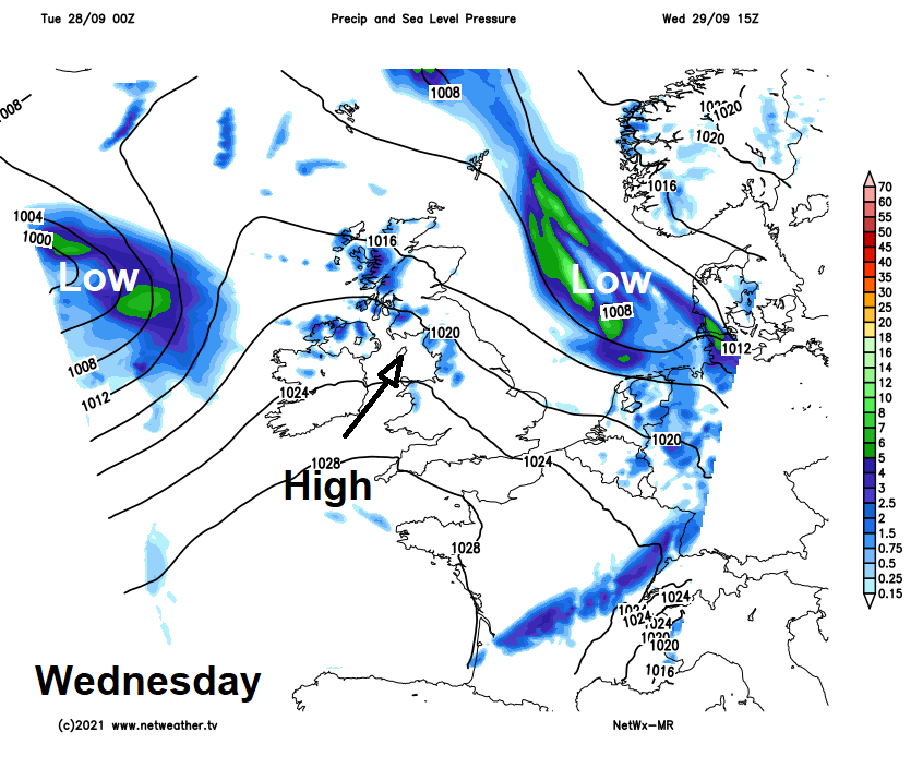
Wednesday will see a drier and calmer day, as a brief ridge of high pressure builds in, with most areas staying dry with plenty of sunshine and lighter winds, just the odd light shower possible in western areas. A cool day though in the northwesterly flow, temperatures reaching 12-14C in the north, 14-17C in the south.
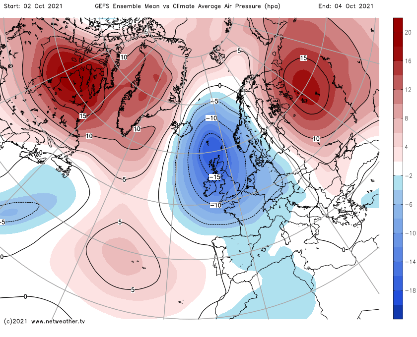
All change again on Thursday, with a return to unsettled conditions, as a deep area of low pressure towards Iceland brings strong winds and pushes bands of rain eastward across most areas, a secondary low moving in from the Atlantic to the south of the deep low bringing another batch of rain to the west in the evening.
A rather unsettled and windy day Friday looks likely, as deepening low tracks northeast over or close to Scotland, this will bring windy conditions to all areas, perhaps gales in the north, with further areas of heavy and squally rain sweeping east across most areas.
Continuing unsettled into the weekend, with low pressure close by:
The unsettled conditions look to continue through the weekend, with further low pressure systems sweeping through, bringing spells of rain and strong winds, interspersed by brighter but showery conditions.