Blustery winds continue as weak weather fronts bring areas of cloud, even patchy rain. Many parts of the UK stay fine and dry with warm sunshine which lasts into Friday, away from the damp west.
The warming trend continues with the current central England temperature compatible with the mean of 16.8C noted in 2006, which was the warmest September since at least 1659. So could we be in for another record-breaking warm month; although the latest computer models suggest cooler weather moving in into next week.
It's also the height of the hurricane season in the Caribbean, although this part of the globe has been relatively quiet over the past week or so. But with winds across Britain now largely Atlantic driven and occasionally from the South or South West, don't be surprised to see at least some embedded tropical remnants within passing Atlantic systems before the end of the month.
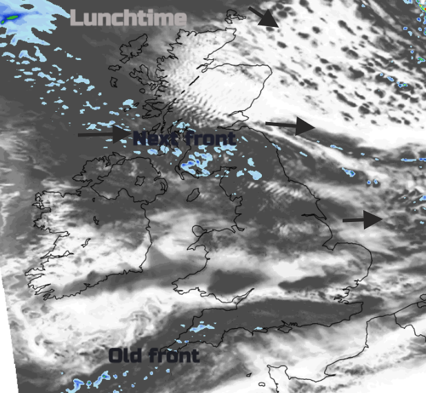
A cold front from a vigorous depression to the North is currently giving gales. heavy rain and blustery conditions over the northern half of Scotland. But as the front moves south and weakens, Scotland will clear before more cloud and rain returns to the West later. Northern Ireland and parts of northern England may also see patchy rain for a time from this front, but further South it'll continue mainly dry. A couple of very weak fronts though will give more cloud at times than yesterday, but there'll be sunny spells as well, with the finest weather over the East and South of England again.
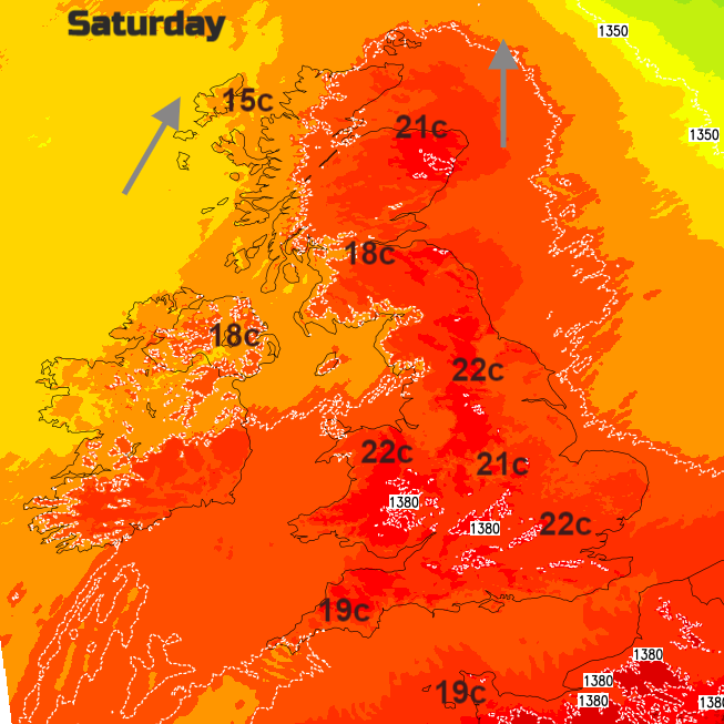
A West or South Westerly gale in the far North will soon decrease, with a mostly moderate or fresh breeze further south. It'll temporarily be colder across the Northern Isles and the far North East of Scotland and a little fresher in most parts, but it'll still become warm across some central and southern parts of England. Top temperatures 13 to 16C in the North and 18 to 22C further south.
Scotland, mostly the North and West, Northern Ireland and chiefly west facing coasts and hills see some rain or drizzle after dark but for most, it'll stay mainly dry in a mild evening and night. There'll be a lot of cloud at times but with breaks giving clear intervals, these mainly in the East and South where a few mist or fog patches could form later in the night. Winds remain from the West or South West, with temperatures across the country falling no lower than 10 to 15C.
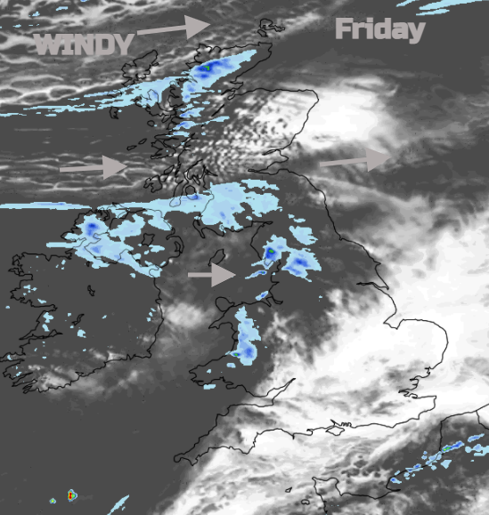
Friday continues to see the best of the weather in central southern and eastern parts, where temperatures could again reach a summery 22 or 23C in the sunny spells there'll be on offer, It continues dry here, but cloud further North will be thick enough at times to give some patchy mostly light rain or drizzle especially in the west. Across the northern half of Scotland however, it'll be clearer but colder with scattered showers these mainly towards Highland and the Northern Isles. Top temperatures away from the East and South 14 to 20C in a moderate or fresh West or South Westerly wind.
In another mild evening and night across England and Wales, it remains mostly dry, with clear spells in central and southern parts leading to mist and patchy fog once more by morning. It's also very mild over Northern Ireland but with patchy rain, while Scotland also turns milder, after a chilly clearer evening at first in the North and North East. Winds will be light in the south and South Westerly elsewhere, with temperatures generally falling no lower than 9 to 14C.