Hints of autumn are making themselves known, fog and a coolness in the morning. Leaves beginning, slowly, to turn. But there is still warm sunshine for the weekend but also rain from the west.
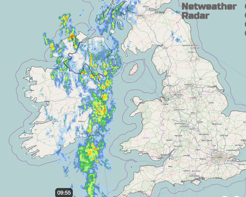
Friday will bring some September warm with temperatures tipping into the low 20sC, away from the rain in the west. High pressure clings on over Europe and near to SE Britain. This holds up a whole host of weather fronts queuing up this morning. They will bring cloud and rain over Northern Ireland, western Wales, western England and gradually more of Scotland, with heavy rain for the west coast. Ahead of that with a light southerly breeze, there will be warmth and sunny spells.
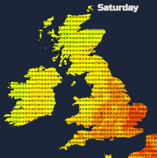
By Saturday the front will have weakened but will still be a nuisance. There will be more cloud about and damp conditions with patchy light rain for Cornwall, western Wales, up the M74 in southern Scotland and for eastern Scotland. One Met Office forecaster I used to work with always said, don’t drop an old front too quickly. Referring to drawing the synoptic charts. This front is one of those, more in a bit.
Later on Saturday another weather front, running north-south will edge towards the Western Isles and overnight reach Northern Ireland. Plenty of dilly-dallying with this rain band so don’t fixate on Weather App timings too much. In between the two rainbands on Saturday there will be sunny spells. To the southeast, for much of England and Wales, there will be fine weather, warm sunshine with just a few isolated showers centred near the West Midlands.
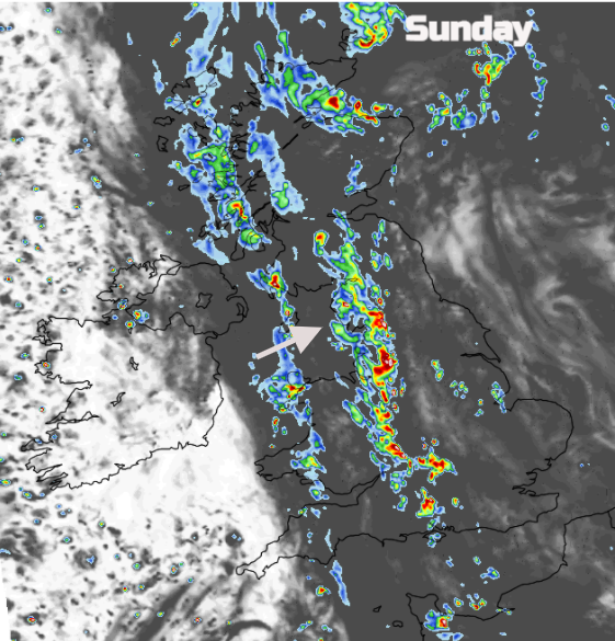
By Sunday with further destabilisation of the atmosphere as a low pressure reaches Iceland, the rain along that first front reinvigorates. There will be some heavier downpours, perhaps even the risk of thundery ones for southern Britain. Again, to across Scotland but Wales in the morning and parts of Northern Ireland. Eastern Counties looking more prone this time early in the day, but it should clear eastwards. And a band of showery downpours edging eastwards for England.
Fog
There has been some radiation fog this morning for southern and eastern England, that will soon dissolve away, there are also murky conditions nearer the frontal band in the far NW.
Fog will reform tonight, so worth bearing in mind if you are heading out early on Saturday morning. Those autumnal hints are taking hold now.
Wind
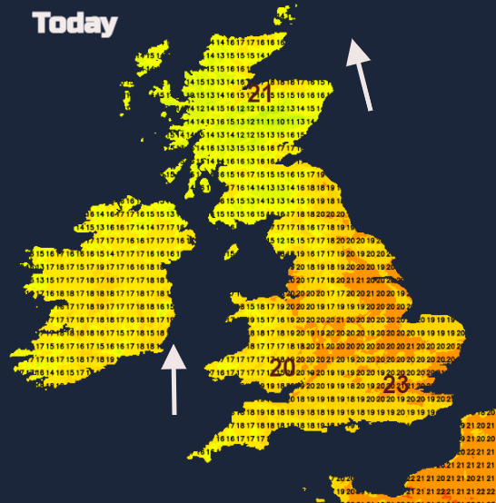
The warm southerly flow will reach right up through Britain today with temperatures of 17 to perhaps 22 or 23C. Inland SE England will do well and north of the Grampian mountains. For Northern Ireland, behind the front, the wind veers to a light westerly. This will feel a bit fresher.
The winds will be very light overnight, assisting the fog. Northern Ireland and inland western Scotland will see temperatures down into single figures, so a slight nip in the air for Saturday morning. Some warm sunshine about again but it will be the SE half of Britain that sees temperatures of 20+. London could reach 24C and with hardly any breeze it will feel pleasantly warm.
A slight shift overnight and there will be a light SE wind along North Sea coasts for Sunday morning, so that will feel fresher. A NW or W wind will follow the showery rain band over SW Britain but again SE England and East Anglia could see into the low twenties to end the weekend.