After the showery, wet weather at the end of the week, we have a bit of a breather coming up this weekend as a ridge of high pressure builds in. The overall direction of travel is still unsettled though.
After a showery, wet end to the week, we have a bit of a breather coming up this weekend as a ridge of high pressure builds in. The overall direction of travel is unsettled though. But with high pressure continuing to have an influence, we'll not be seeing a barrage of Atlantic low pressure systems, more a steady trickle.
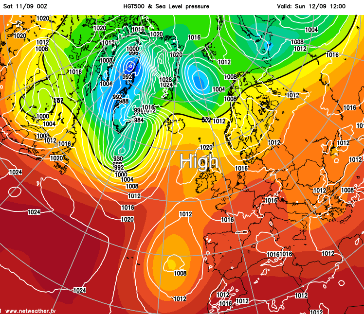
Despite that ridge, it'll not be sunshine all the way over the next couple of days. There'll be a scattering of showers across the country and some persistent rain affecting the far north and northeast of Scotland during Saturday. Then into Sunday, there'll still be the risk of showers - particularly in the northeast and also the threat of rain arriving into the southwest of England and South Wales during the day, as a front nears.
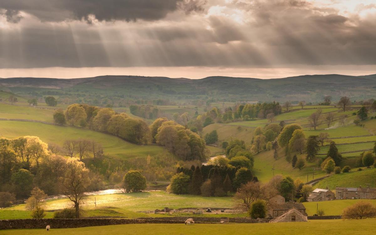
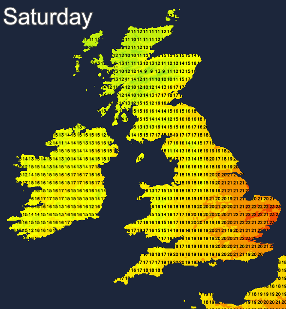
Away from all of that, Saturday looks the sunnier of the two days, with many parts seeing some reasonable spells of it. Temperatures won't be as warm as they were earlier in the week, peaking into the low twenties in southern and eastern England, the high teens in most other spots. With more cloud around, Sunday is likely to be just a touch cooler.
Overnight temperatures are worth a mention too, after some humid sweaty nights of late, as they're going to be cooling off from the north with single figures for parts of Scotland and Northern England, but still comfortably into the teens further south.
As we move into next week, the ridge which settled the weather down over the weekend will move east into the North Sea, to make landfall in Scandinavia by Tuesday. That's going to open the door to low pressures and their associated weather fronts. With that high to our east tending to block the progress of the low pressures from west to east, it's not going to be a straightforward train of lows moving in. It's going to be a messy sort of period with fronts struggling to get across the country, some showery spells, but also some drier spells.
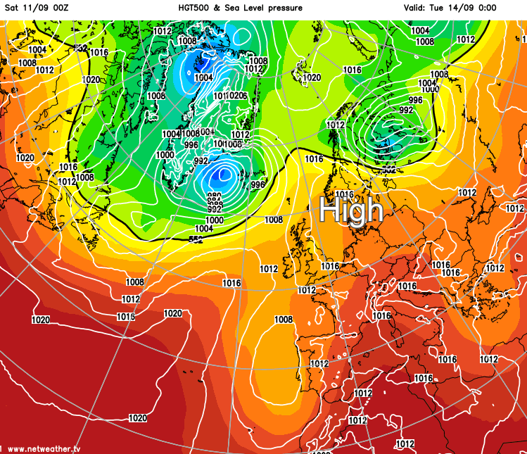
As is often the case in this type of scenario, it'll be those further south and east who tend to see the majority of the drier spells and less of the wet weather, whereas those further north and west see more in the way of rain and wind.
Monday could well buck that trend though, with a small low tracking near to the south, bringing pushing rain and showers northeast across the country through the day. The best chance of staying dry looks likely to be across the north and northeast, with high pressure still holding some sway here, as it heads east towards Scandinavia.
Once all that has cleared, Tuesday looks to be one of those drier, brighter days with a scattering of showers. Midweek looks likely to follow in a similar vein initially, but low pressure will be nearing from the Atlantic with a spell of wetter, windier weather set to arrive later Wednesday or into Thursday with those in the north and west again most likely to catch most of the action.