28.9C in Wiltshire on Monday, around 30C forecast today. This heat and sunshine will be interrupted by an Atlantic low pressure eventually, bringing showers from the west midweek onwards.
Much of England, Wales and Northern Ireland are currently free of cloud, though it is cloudy over much of central and western Scotland. This pattern looks set to continue during the day, with cloud tending to break up further in the east of Scotland. For much of the country, it will be a very warm or even hot day with hazy sunshine.
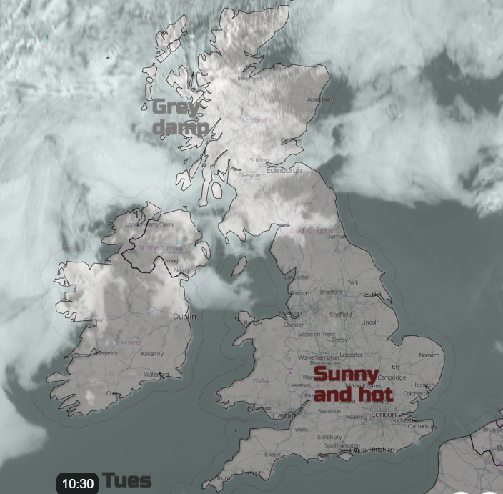
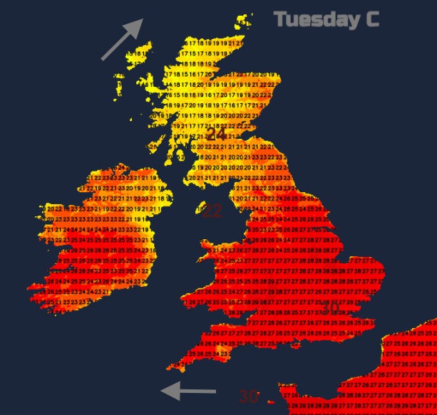
Temperatures will reach 26 to 29C widely across England, potentially hitting 30 or 31C locally. In Northern Ireland and eastern Scotland highs of 23 to 25C will be typical, but it will be cooler in the cloudier west of Scotland, with highs of 18 to 21C in most places. Due to a prolonged spell of high pressure and input of continental air, air quality will be relatively low over much of England and Wales.
Some showers, potentially thundery in places, will move into the south-west of England later this evening, but elsewhere it will generally stay dry with mainly clear skies. It will be a rather warm night for many with minimum temperatures widely between 15 and 18C, though cooler in inland parts of Scotland.
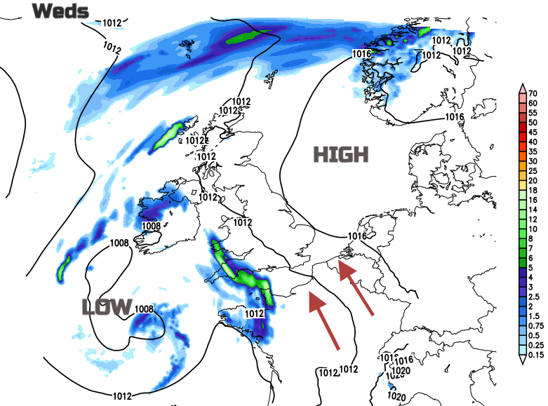
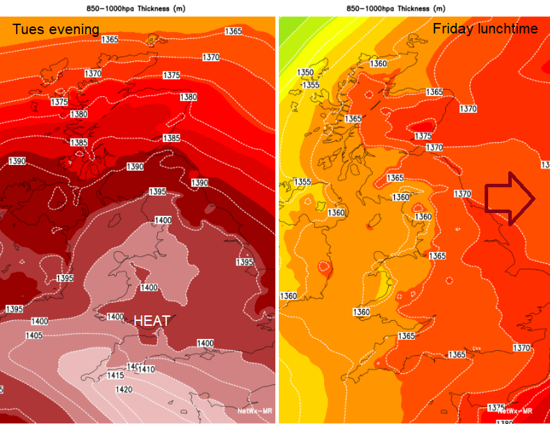
The settled high pressure spell will break down during Wednesday and Thursday, but temperatures look set to stay above the long-term average for the time of year, with no immediate sign of a return of full-blown Atlantic westerlies. Wednesday will be cooler in south-west England and south Wales, with much cloudier skies and some rain or showers, possibly thundery in places, but elsewhere it will be another hot and mainly sunny day. Temperatures will generally be similar to those of Tuesday, and it will also be hotter and sunnier in Scotland than on Tuesday, with highs of 25 to 27C in some southern and eastern parts of Scotland.
On Thursday a band of rain will move northwards, spreading through most of England and Wales overnight Wednesday/Thursday and then becoming slow-moving across northern England and southern Scotland on Thursday. There may again be some thunderstorms embedded in the rain, especially in the south. Following behind, brighter weather with scattered thundery showers will develop over the rest of England and Wales, and this will also spread into Northern Ireland. Northern Scotland is expected to stay dry for much of the day. In the brighter weather, much of England will be warm, but less so than on recent days, seeing highs of 23 to 26C, but elsewhere highs of around 20C will be typical.
Looking further ahead, Friday and Saturday look set to be mainly cloudy with fewer showers and thunderstorms around as high pressure slowly rebuilds from the west. Temperatures will generally be a little above average for the time of year, peaking at 22 to 24C in central and eastern parts of England. The longer-term outlook sees high pressure re-establish across northern Britain, promising plenty of warm dry sunny weather for north-western Britain but potentially more cloud for the south and east.
The 2021 Atlantic hurricane season is still going strong. One of the biggest concerns is currently Hurricane Larry, which has the potential to generate dangerous waves along the American east coast and is forecast to head close to Bermuda over the coming days, most likely around 200 miles to the east. It is not generally expected to pose a major direct threat to the USA other than the coastal waves but could cause rather more significant problems for some of the islands.