Finally a change to the gloomy skies and cool feel that has plagued some parts for most of August. As more go 'Back to School' the UK weather is going to get much warmer.
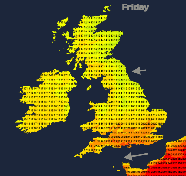
The start of next week is looking much warmer across the UK. Must be back to school. Early September has a reputation of producing glorious sunny, warm weather often as the remaining school classes return. By early next week, temperatures will more widely be in the 20sC with up to 30C on the cards for Tuesday.
Earlier in the week, there were signs that our lingering UK high pressure would begin to move away over Scandinavia at the weekend, allowing an Atlantic low to bring rain in from the SW. Caution was advised at that point that often the high takes its time to shift and there could be a delay. There are also tropical influencers that add uncertainty into the synoptic picture.
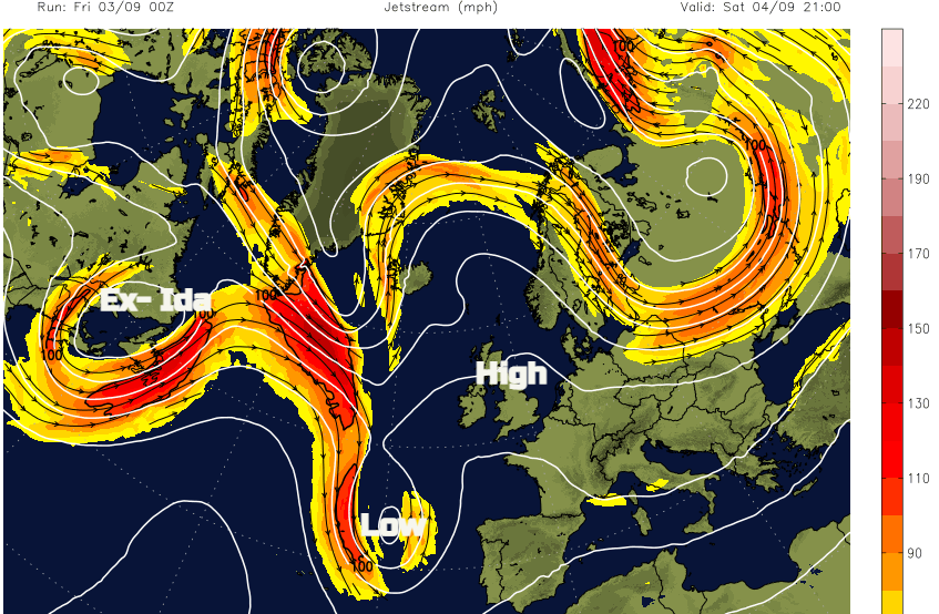
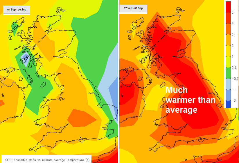
Hurricane Ida made landfall over Louisiana last weekend, flooding the coast and knocking out power in New Orleans. The resulting historic rain with thunderstorms from TD Ida/post-tropical low resulted in devasting flash flooding for the Mid- Atlantic states and New England with the streets and subway of New York being submerged. Through the weekend the remnants of Ida move over Newfoundland then up over Iceland. Our high pressure from the past two weeks will be over Europe by then but still continuing to act as a shield against the Atlantic. Low pressures deflect northeast over the top or are just kept at bay to the southwest. This means that there will still be a lot of fair, dry weather for the UK but there will be a shift in the flow. Western areas may have been seeing warm sunshine, but eastern Britain is really fed up now with the endless gloomy grey skies and cool feel.
The shift will allow warmer air to those cool areas, more breaks in the cloud and so sunshine. The wind will still be from the east. Brisk through the English Channel today. The nights are turning a little bit cooler now, especially where the cloud breaks occur. With light winds, there will be some patchy fog and a cool, damp feeling to the early mornings.
Today western Scotland and Cumbria see sunshine with southern England brightening up this afternoon and a fine evening to come. Damp and cloud overnight for eastern Britain will still be the case for Saturday morning. The brightening process takes its time on Saturday but by the evening there will be more sunny spells away from the east.
By Saturday night into Sunday, there will be some showery bits from medium layer clouds passing NW UK. A small frontal feature manages to get caught up around the side of the high on Sunday and looks to bring more cloud and rain to Northern Ireland and Scotland. Not much for SE Scotland though. This will be a dramatic change after all the warmth and sunshine. There is uncertainty in the forecast, but it could still be around early on Monday morning, encroaching into northern England even Wales. But it does fade, just leaving a lot of cloud and dampness.
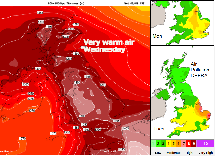
So, although the overall theme for next week is one of sunshine and real warmth, it’s not completely dry and bits of rain will move by. The winds will be very light from the east or southeast. Temperatures moving up to 26 or 27C but could go higher next week. This change in airflow will bring air quality issues.