High pressure stays with us, through the Bank Holiday weekend into next week. That brings settled conditions, dry overall but not necessarily warm sunshine for all.
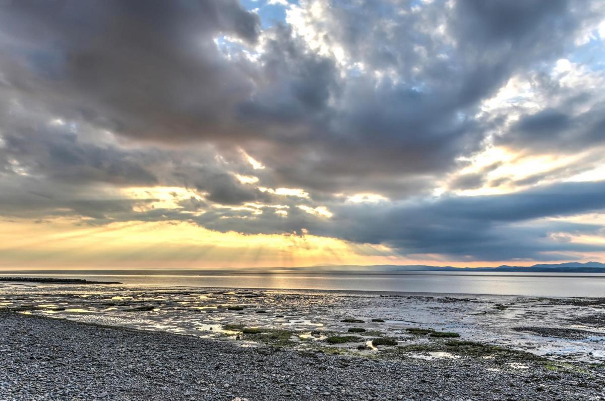
The late August high pressure over the UK has brought warm sunshine and glorious late summer weather to some but grey cloud to others with a cool flow off the North Sea. This theme continues into the weekend with temperatures being in the high teens to low twenties for most. In the sunshine with light winds that will still feel pleasantly warm but with an onshore breeze and thicker cloud it might be a bit disappointing. Especially if you have allowed media “heatwave” bombardment to pervade your thoughts.
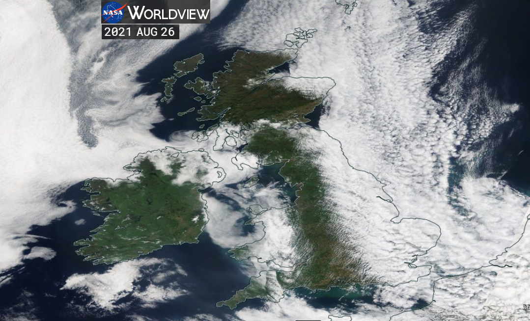
NASA image Thurs 26th August 2021 showing clear skies (and so sunshine) for some but thicker cloud for other parts of UK.
This contrast has been quite tricky to balance this week as western Scotland and Northern Ireland have experienced real warmth and sunshine. Highland Scotland did manage to score a technical heatwave at Tyndrum with 3 consecutive days in a row at 25 C or above (the Thresholds vary according to UK location). But the nights did cool off so there wasn’t the extreme heat that occurs in the height of summer when heat stress can occur. Anyone staying in these areas midweek will have commented on the stunning weather but in “the news” all eyes seem to have been on the upcoming Bank Holiday for other parts of the UK.
With a NE wind over SE Britain, a fresh direction off the North Sea there will be a fair amount of cloud about and these subdued temperatures. Western Britain, Northern Ireland, maybe London could reach 23 or 24C on Saturday which still feels warm but there won’t be those sultry evenings and any thicker cloud will make a difference. Western Britain and Northern Ireland again look to see the best of the sunshine and fine weather and inland parts of England could see more warmth if the cloud breaks up well.
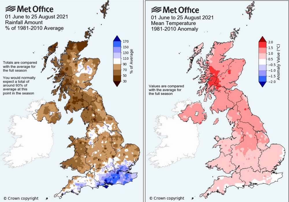
Perception of this week’s and the upcoming weekend’s weather will depend on your location. The same can be said for summer 2021. The Met Office has issued an early look at the rainfall and temperature charts for the statistical summer months of June, July and August up to the 25th. It’s easy to see how people in southern England would think that the summer hasn’t been great, there has been a lot of rain. For some locations, it has been very wet. Elsewhere though it has been very dry, there are water scarcity notices for parts of northern Scotland. It has been warm everywhere this summer, mild nights helping this month when the daytime temperatures haven’t been that special. 27.2C at Tyndrum on Wednesday was the highest August 2021 temperature.
This weekend 21C in warm sunshine may be ideal, warm enough thank you. It does look dry which will still allow a lot of outside activities to take place rather than people deciding to huddle inside.
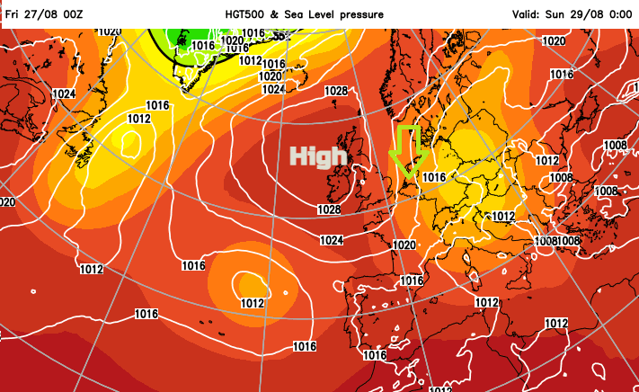
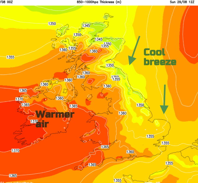
Synoptic level - High pressure centred to the north of the UK, drifts towards the NW. Settled, mostly dry weather continues through the long weekend. Western areas see the best of the sunshine, eastern/ far north of Britain more likely to see low cloud at times. The source of our air isn’t from Africa nor Spain but there is enough strength in the late August sunshine to give us some warmth. especially to the lee of high ground. A noticeable breeze around the side of the high pressure from the north or NE adding a freshness to the air along the east coast.
Today
Early morning fog for Northern Ireland and the Highlands. It has been a bit cooler overnight and that continues for the coming nights. Worth bearing in mind if you have camping plans. The cloud cover over NE England into Yorkshire is thick enough to bring a bit of drizzle in places this morning. That doesn’t fit with the overall dry theme but that’s anticyclonic gloom for you.
Saturday
There will be an occluded front over Europe which could encourage a few well-scattered showers over SE England or East Anglia on Saturday.
Sunday
Thicker cloud will move over NE Scotland and the Northern Isles with drizzle included. It will be quite grey here. That could reach right down to NE England. For those in longer sunny spells temperatures could be around 21 to 25C inland for central and western Britain
Bank Holiday Monday
The pull of low cloud off the North Sea looks to be quite a feature early on Monday. Southern Britain brightens up, but the cloud could linger further north. Again, lovely sunshine further west.