No active storms in the Atlantic but at least 3 disturbance areas are being highlighted with concerns already for developments in the Gulf of Mexico for next week.
All looks relatively quiet across the Atlantic at the moment on the National Hurricane Centre Active Storms page (NHC). However, there are 3 disturbances showing up as areas to watch. Also one off the west coast of Mexico in the eastern Pacific. So far there have been 8 named storms in the Atlantic 2021 season including 3 hurricanes.
Early in August NOAA’s Climate Prediction Centre announced that “the Atlantic hurricane season shows no signs of slowing “in their annual mid-season update.
“A mix of competing oceanic and atmospheric conditions generally favour above-average activity for the remainder of the Atlantic hurricane season, including the potential return of La Nina in the months ahead”
“Atlantic sea surface temperatures are not expected to be as warm as they were during the record-breaking 2020 season; however, reduced vertical wind shear and an enhanced west Africa monsoon all contribute to the current conditions that can increase seasonal hurricane activity”.
In 2020 there were 30 named storms including 14 hurricanes and after having to foray into the Greek Alphabet names, the World Meteorological Organisation's Hurricane Committee decided on a new naming system, if all the alphabetical names are used up.
This update (Aug 4th) included the first 5 named storms but there has now been Tropical Storm Fred, Hurricane Grace and Hurricane Henri up to 24th August. And then the current lull.
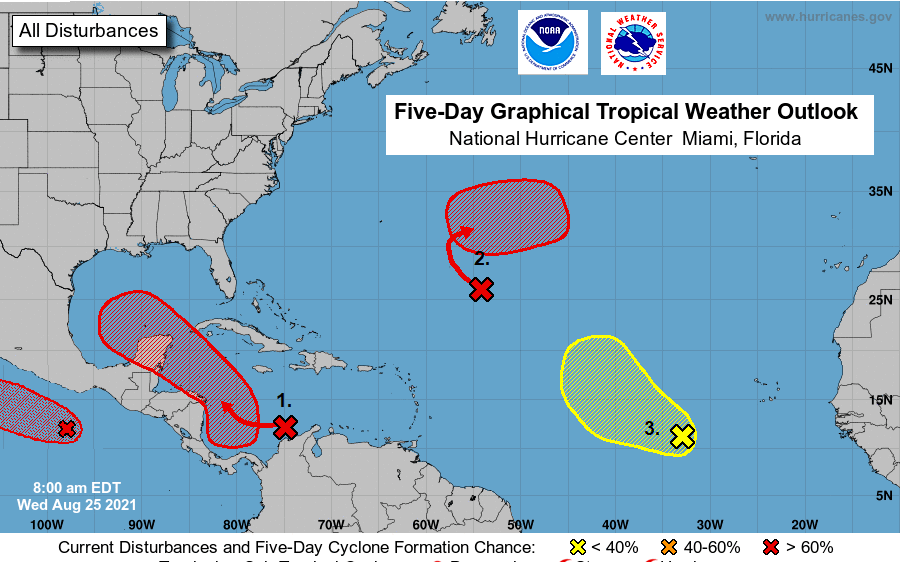
The areas of development are being highlighted and watched. The area to the west of Central America in the eastern Pacific is very likely to become a cyclone in the next 48 hours (90% 5am PDT 25th Aug). For the Atlantic, the percentages are lower for 48 hours, but the development is expected within a 5-day time frame.
Looking lively with deep convection and plenty of lightning strikes is area 1 off the north coast of Colombia and Venezuela. Forecast to head into the Gulf of Mexico, this is getting the most attention.
"a tropical depression is likely to form late this week or over the weekend while the system moves west-northwestward to northwestward over the north-western Caribbean Sea. The disturbance is expected to move near or across the Yucatan Peninsula of Mexico on Saturday and move into the western Gulf of Mexico by Sunday where conditions could be favourable for additional development to occur." NHC
Out in the mid- Atlantic, area 2 “A tropical depression is likely to form over the central Atlantic Ocean late this week or this weekend well to the east of Bermuda.” "Only slow development of this system is expected ... a tropical depression is likely to form late this week or this weekend while the system turns eastward over the central Atlantic." NHC
And in the eastern Atlantic area 3 "A tropical wave over the far eastern tropical Atlantic located several hundred miles southwest of the Cabo Verde Islands is producing a disorganized area of showers and thunderstorms. Some development of this system is possible over the next several days. "
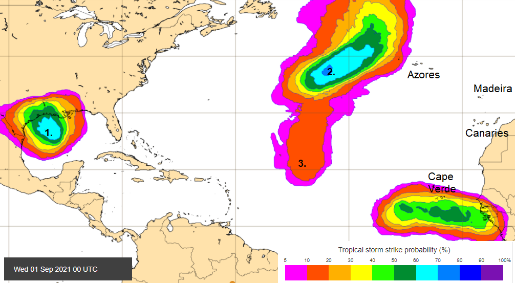
These disturbance maps give early indications of potential tropical developments which sometimes feed into our weather systems in NW Europe.
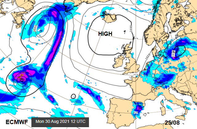
The one nearer the Caribbean and Mexico looks to head towards Texas/ Louisiana as a slow-moving system that could bring torrential rain and so flooding. This is the main one to watch. Area 3 looks to head north and get mixed up behind Area 2, whilst another disturbance appears on the ECMWF charts by this weekend off western Africa. This could trouble the Cape Verde Islands by the middle of next week but does look to continue westwards possibly across the Atlantic. Area 2 appears on the ECMWF surface pressure charts but the high pressure already over the UK looks to keep everything at bay even into next week.
Further discussion on this Atlantic season
Complete Guide to Hurricanes
Review of the 2020 Atlantic season