High pressure keeps the weather dry with mostly light winds. Early low cloud does break up and any fog lift. Temperatures in the 20s Celsius
High pressure over the UK this week will bring a lot of settled, steady weather. That doesn’t mean it is all sunshine and heat. For some, particularly Northern Ireland and NW Britain, there will be above average temperatures midweek and sunny weather. Further east, particularly for North Sea coasts of England, there will often be a fresh feeling breeze and grey cloud, even some patchy drizzle.
This makes a stark difference for the UK temperatures. Yesterday, London saw 24C, Northern Ireland 24.8C and Strathallan in Perth & Kinross reached a very warm 26.3C. The NW of the UK will continue with real warmth and sunshine, but eastern England will turn more cloudy this week and feel the effects of a north to northeast breeze.
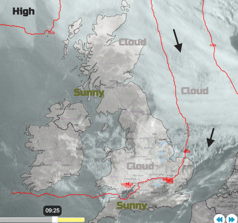
This morning there is low cloud, murk and fog in places. Also, a coolness for some that reminds us that August is coming to an end and autumn is around the corner. Most of the cloud will break up today and there will be a fine, dry, pleasantly warm day. There is a lot of low cloud over the North Sea and that will affect the UK this week as it drawn in around the eastern side of the high pressure.
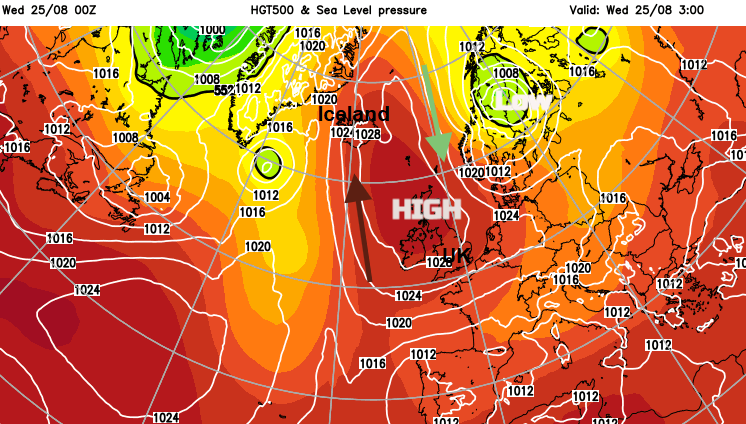
Around the western side of the high, very warm air has been reaching Iceland. In the NE, temperatures reached 29.35C on Tuesday, a provisional August record. The heat continues today, with the Iceland record being 30.5C from June 1939.
Northern Ireland and, in particular, central & western Scotland with Cumbria will see a very warm Wednesday. Temperatures will be several degrees above average with Glasgow forecast to see 27C even 28C. This is a combination of a pool of very warm air, plenty of sunshine and hardly any breeze.
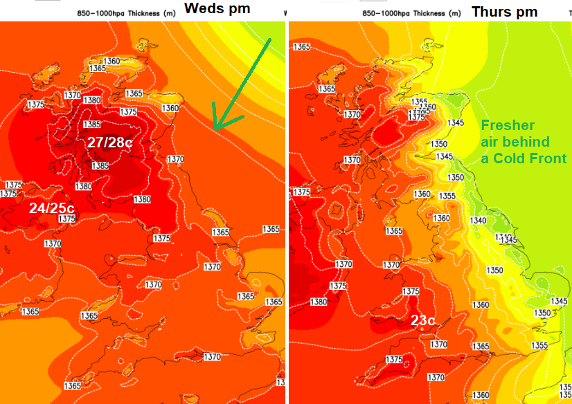
There is a shift tonight and on Thursday. The low pressure over the Baltic Sea is moving southwards and its cold front sweeps down the North Sea into eastern Britain. This brings a distinct band of low cloud, dampness and a northerly breeze. By Thursday morning there will be brighter skies behind the front, and it will still feel pleasantly warm inland. 20 to 24C with south Wales and SW England doing well. Along the east coast from the Borders down to Norfolk will feel cooler in the breeze. Further west there will be some lingering low cloud about so a more mixed picture than the sunshine of today. But still a lot of fine, dry weather.
And that is how the week continues. High pressure over the UK, a cooler flow off the North Sea. There could be one or two showers for East Anglia on Friday, maybe SE England on Saturday linked to that low pressure. There will be plenty more fine weather about, often with sunny spells and temperatures of 20 to 24C. It does look like there will be more cloud about for Monday, so not quite as sunny if you have a day off for the Bank Holiday.