Not as many showers about today. If you split the UK northwest to southeast later this week, the SE looks dry and warmer. The NW will see rain and blustery winds at times.
Not as many showers about today. For the rest of the week, if you split the UK northwest to southeast, the SE looks mostly dry and warmer but the NW will see rain and blustery winds at times.
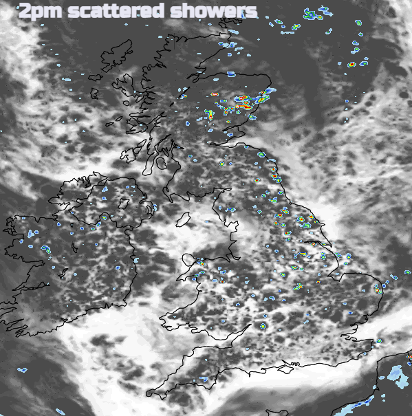
The low pressure of recent days is slackening, and thus it will be a relatively quiet day today, with light winds, variable amounts of cloud and some sunny intervals. Most places will also stay dry, but there will be some scattered, mainly light, showers breaking out from around midday onwards, mainly in the north and east of Britain, especially central and eastern Scotland and north-east England. As is often the case with showers, even in these regions some places will stay dry, but others may catch quite a few showers, and any showers are expected to be slow-moving.
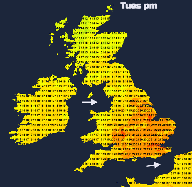
For most of the country, temperatures will be around where we'd expect at this time of the year. Much of England will see highs of 21 to 23C, with the east tending to be a little warmer than the west, and around London, they may reach 24 or 25C in some places. It will be cooler further north and west, with highs of 18 to 20C in Northern Ireland, western Scotland and west Wales.
Rest of the week
For the rest of the week, relatively high pressure will develop over the south of Britain, but low pressure systems will track to the north and north-west, bringing bands of wind and rain especially to north-western Britain, resulting in a general northwest-southeast split.
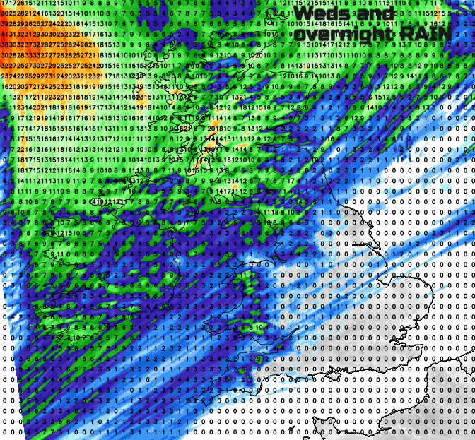
On Wednesday, frontal systems will bring a band of rain eastwards across the country, which will be quite heavy in western Scotland but will tend to fizzle as it moves further south and east, and many parts of eastern and southern England may miss the rain altogether. With some sunny spells to the east of high ground, it will be a little warmer than Tuesday in the east of England, with highs of 23 to 25C quite widespread from Yorkshire southwards, but again cooler further north and west. Under the cloud and rain, western Scotland will generally see highs of just 13 to 15C.
Another band of rain will move in from the west on Thursday but this time it will mainly just affect central and western Scotland and the northwest of Northern Ireland. There will generally be a lot of cloud, but again in eastern England, where there will be some breaks in the cloud cover, it will be warm in any sunshine, with highs of 24 to 26C in some spots.
There is more uncertainty in the outlook by Friday, but it looks like rain will be more widespread on Friday, affecting much of central and western Scotland, north-west England, Northern Ireland and central and western Wales. Again most parts of eastern and southern England will stay dry, but it will be mainly cloudy, and generally cloudier than Wednesday or Thursday. Warm, sticky nights may be an issue in central, eastern and southern England towards the end of the week, with some places staying above 15C overnight.
The weekend looks like becoming more unsettled generally, but there are signs that into next week high pressure may start to build from the south-west, promising a fine spell of weather for a rather larger proportion of the country.
While the IPCC has recently released their Summary for Policymakers, wildfires are currently posing problems. Recently the fires affecting Evia Island in Greece, have been making headlines, forcing thousands of people to evacuate their homes during a prolonged heatwave. Parts of Italy and Turkey have also recently been impacted by wildfires. Meanwhile, smoke from forest fires in Siberia has reached the North Pole for the first time in recorded history.
While assessing the contribution of climate change to individual disasters is somewhat tricky, there is growing evidence that the warming climate - the main driver of which is human activity - is making droughts and heatwaves more common and widespread in many parts of the world, making damaging wildfires like these more likely to recur more frequently.