August isn't starting off that well for the UK weather. It will still feel warm enough in the sunny spells with very light winds but heavy showers continue this week and temperatures around 20C.
It’s August and we’re not looking at the ‘height of summer’ in terms of UK weather. Temperatures this week remain in the high teens to low twenties. No repeat of the mid-July heatwave. The summer sunshine is still strong and warm, so with light winds for the next few days it will still feel fine. Just cool in the evenings or under a passing shower. The end of the week looks more unsettled as low pressure parks itself over the UK.
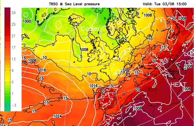
SE Europe has extreme temperature warnings, for southern Italy, Bulgaria, Greece and the islands. Here, temperatures are in the high 30sC and heading well into the 40s Celsius. There are wildfires for Turkey and other areas, warnings for people to not travel with concerns for heatstroke and water outages.
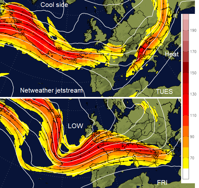
The Jetstream is still diving south, with low pressure over Iberia bringing showers to parts of Spain today. Low pressures also head towards the UK and keep the threat of showers here. One arrives from the SW on Thursday with heavy downpours that will remain a feature into the weekend.
Today there will be sharp showers over western then more inland parts of England and Wales. Also cloud with rain edging over more of Ireland. This rain will be quite patchy for Northern Ireland with light westerly winds and temperatures in the mid-teens.
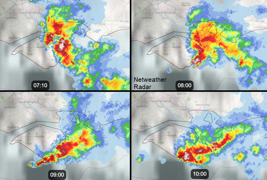
The radar signal from the Isle of Wight today looks quite bizarre. Earlier there was a line of heavy showers edging eastwards which has now resulted in stationary torrential downpours for the south and east of the island. They continue this morning as more heavy showers and thunderstorms appear over southern Britain this afternoon, with a Met Office yellow warning now in place.
“These may be quite slow-moving and last for an hour or two. Some torrential downpours are possible with a few places seeing 50 mm of rain or more within a few hours. Lightning and hail are also additional hazards.”
Wales has seen a fine start with hardly any breeze. By lunchtime, there will be a scattering of showers inland, but many areas continue to be dry with sunny spells. A fresher north wind will pickup for the west coast this afternoon so although inland Wales should see 18 or 19C, Fishguard will be 15C
https://www.netweather.tv/weather-forecasts/uk/7-day/11129~Fishguard
There will be a scattering of showers for inland northern England today but gain many places escaping them and staying bright and fine. Cambridge up to 20C. Scotland will have a fine day with sunshine and only light winds. Edinburgh up to 18C today.
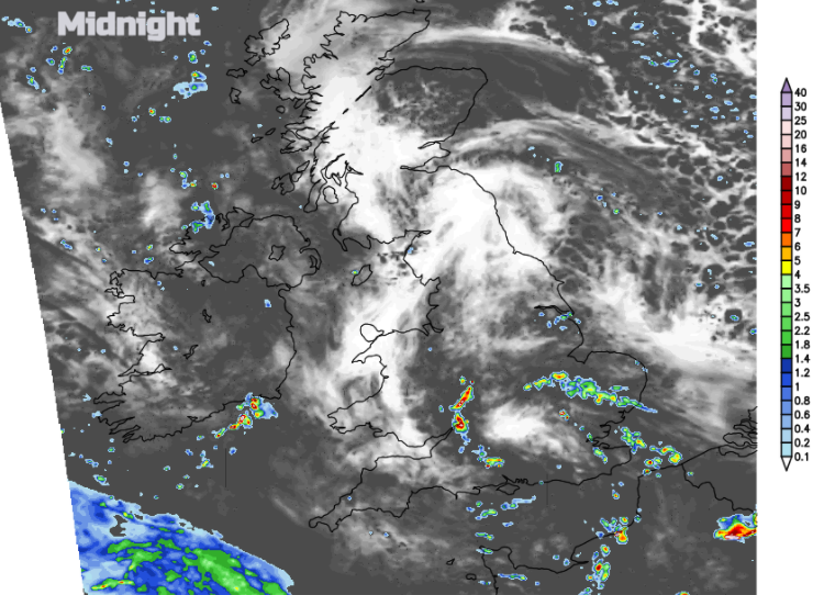
Many parts will have clear spells tonight with light winds and temperatures dipping away, down into single figures in places. A scattering of heavy showers continues overnight from central and southern England edging across to SE Britain.
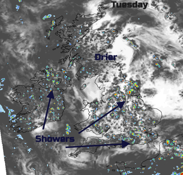
Tuesday will be fair with very light winds. Again, a scattering of showers but many places missing them. A low could throw blustery rain over Cornwall and Devon early on Wednesday, but not like Storm Evert. Scotland will see more showers midweek and then everywhere looks more windy with lots of heavy showers by Thursday.